Category:Poids public de Hauterive (Ain)
Jump to navigation
Jump to search
| Object location | | View all coordinates using: OpenStreetMap |
|---|
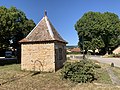
Media in category "Poids public de Hauterive (Ain)"
The following 4 files are in this category, out of 4 total.
-
 Poids Public Hauterive St Jean Vieux Ain 1.jpg 4,032 × 3,024; 6.09 MB
-
 Poids Public Hauterive St Jean Vieux Ain 2.jpg 3,024 × 4,032; 5.74 MB
-
 Poids Public Hauterive St Jean Vieux Ain 3.jpg 3,024 × 4,032; 5.84 MB
-
 Poids Public Hauterive St Jean Vieux Ain 4.jpg 4,032 × 3,024; 5.51 MB


