Category:Pod Táborem (Prague)
Jump to navigation
Jump to search
street in Prague, Czech Republic  | |||||
| Upload media | |||||
| Instance of | |||||
|---|---|---|---|---|---|
| Location | |||||
 | |||||
Subcategories
This category has the following 8 subcategories, out of 8 total.
M
P
W
Ž
Media in category "Pod Táborem (Prague)"
The following 7 files are in this category, out of 7 total.
-
 Hrdlořezy, Pod Táborem, u pomníku.jpg 3,182 × 2,217; 1.34 MB
-
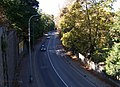
 Hrdlořezy, Pod Táborem.jpg 2,592 × 1,944; 3.05 MB
-
 Malešice, Pod Táborem 8, branka.jpg 2,488 × 1,775; 1,018 KB
-
 Malešice, Pod Táborem 8.jpg 2,428 × 1,572; 527 KB
-
 Pod Táborem, most od schodů k podchodu.jpg 3,025 × 2,180; 778 KB
-
 Pod Táborem, ze schůdků k podchodu.jpg 3,089 × 2,228; 1.14 MB
-
 Železniční most Pod Táborem 5.jpg 2,048 × 1,536; 507 KB


