Category:Plateau des Mille Etangs
Jump to navigation
Jump to search
| Object location | | View all coordinates using: OpenStreetMap |
|---|
 | |||||
| Upload media | |||||
| Instance of | |||||
|---|---|---|---|---|---|
| Location |
| ||||
 | |||||
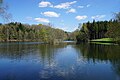
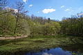
The Plateau des Mille Etangs (=highland with 1000 ponds) is a region in Haute-Saône, France.
Subcategories
This category has the following 36 subcategories, out of 36 total.
+
C
- Cigle de Ternuay (10 F)
S
T
- Tourbière des Grands Faings (5 F)
U
É
- Étang d'Arfin (5 F)
- Étang de l'Oranger (4 F)
- Étang de Platte Pierre (6 F)
- Étang des Gorgeots (4 F)
- Étang des Grands Prés (12 F)
- Étang des Noyes (9 F)
- Étang le Cure (2 F)
- Étangs d'Épée (3 F)
- Étangs de la Goutte du Tronc (5 F)
- Étangs des Grands Faings (5 F)
- Étangs du bois des Perrières (4 F)
Media in category "Plateau des Mille Etangs"
The following 50 files are in this category, out of 50 total.
-
 2016-04 - Belonchamp - 01.JPG 6,000 × 4,000; 17.32 MB
-
 2016-04 - Belonchamp - 02.JPG 6,000 × 4,000; 9.19 MB
-
 2016-04 - Belonchamp - 03.JPG 4,000 × 4,750; 10.7 MB
-
 2016-04 - Mélisey (Haute-Saône) - 24.JPG 6,000 × 4,000; 11.47 MB
-
 2016-04 - Mélisey (Haute-Saône) - 25.JPG 6,000 × 4,000; 9.84 MB
-
 2016-04 - Mélisey (Haute-Saône) - 26.JPG 6,000 × 4,000; 9.91 MB
-
 2016-04 - Mélisey (Haute-Saône) - 27.JPG 6,000 × 4,000; 11.09 MB
-
 2016-04 - Mélisey (Haute-Saône) - 28.JPG 6,000 × 4,000; 10.13 MB
-
 2016-04 - Mélisey (Haute-Saône) - 29.JPG 6,000 × 4,000; 11.35 MB
-
 2016-04 - Mélisey (Haute-Saône) - 30.JPG 6,000 × 4,000; 9.81 MB
-
 2016-04 - Mélisey (Haute-Saône) - 31.JPG 6,000 × 4,000; 10.81 MB
-
 2016-04 - Mélisey (Haute-Saône) - 33.JPG 6,000 × 4,000; 10.44 MB
-
 2016-04 - Mélisey (Haute-Saône) - 34.JPG 6,000 × 4,000; 10.25 MB
-
 2016-04 - Mélisey (Haute-Saône) - 35.JPG 6,000 × 4,000; 9.91 MB
-
 2016-04 - Mélisey (Haute-Saône) - 36.JPG 6,000 × 4,000; 9.75 MB
-
 2020 - Peugeot 308 II (B) - 73.jpg 3,832 × 2,762; 4.35 MB
-
 2020-05 - Étang d'Arfin - 01.jpg 5,472 × 3,078; 7.13 MB
-
 2020-05 - Étang des Noyes - 02.jpg 5,472 × 3,078; 6.82 MB
-
 2020-05 - Étang Mama - 01.jpg 5,472 × 3,078; 6.82 MB
-
 2020-05 - Étangs du Grand Rang - 01.jpg 5,472 × 3,078; 6.74 MB
-
 Bloc erratique apppelé pierre qui vire, lieu-dit Les Oroz.jpg 4,000 × 3,000; 5.29 MB
-
 Bloc erratique au centre du bourg.jpg 4,000 × 3,000; 5.57 MB
-
 Bloc erratique des granges Baverey. (3).jpg 4,000 × 3,000; 6.92 MB
-
 Bloc erratique des Granges Baverey.jpg 2,024 × 1,486; 1.63 MB
-
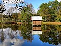
 Chalet au bord d'un étang au nord du village d'Ecromagny..JPG 4,000 × 3,000; 7.06 MB
-
 Ecromagny, cabane sur pilotis.jpg 2,960 × 2,220; 2.4 MB
-
 Ecromagny, l'île de l'étang du Pré aux Lièvres.jpg 4,553 × 2,561; 4.98 MB
-
 Ecromagny, étang avec île aménagée.jpg 4,223 × 2,375; 3.72 MB
-
 Ecromagny, étang de la Grand Peteneu.jpg 4,254 × 2,393; 2.87 MB
-
 Ecromagny, étang à la Côte Meix.jpg 4,200 × 2,363; 3.53 MB
-
 Etang au nord du village d'Ecromagny..JPG 3,912 × 2,880; 6.06 MB
-
 Etang en aval du village d'Ecromagny..JPG 4,000 × 3,000; 3.98 MB
-
 Etang entre Faing aux lièvres et Grand Chemin- proche Beulotte 70.jpg 2,592 × 1,944; 2.26 MB
-
 Etang ferme de Bambois- proche Beulotte 70.jpg 2,592 × 1,944; 2.28 MB
-
 Etang Girard in Faucogney 70 SPR.jpg 2,592 × 1,944; 2.2 MB
-
 Etang proche Conchotte- Esmoulières 70.jpg 2,592 × 1,944; 2.21 MB
-
 Explications sur le bloc erratique au centre de Mélisey.jpg 4,000 × 3,000; 4.95 MB
-
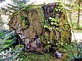 La pierre qui vire. Lieu-dit les Oroz. (2).jpg 4,000 × 3,000; 5.45 MB
-
 La pierre qui vire. Lieu-dit les Oroz. (3).jpg 4,000 × 3,000; 3.47 MB
-
 La pierre qui vire.jpg 2,012 × 1,476; 2 MB
-
 MilleEtangsHteSaone.jpg 3,072 × 2,304; 1.97 MB
-
 Plateau des Mille Etangs 1.jpg 4,416 × 3,312; 3.08 MB
-
 Plateau des Mille Etangs 2.jpg 4,416 × 3,312; 2.31 MB
-
 Plateau des Mille Etangs 3.jpg 4,416 × 3,312; 2.97 MB
-
 Plateau des Mille Etangs 4.jpg 4,416 × 3,312; 1.56 MB
-
 Plateau des Mille Etangs, étang avec île.jpg 3,771 × 2,828; 3.74 MB
-
 Pond between farm of Bambois D236- B Esmoulières and Beulotte 70.jpg 2,592 × 1,944; 2.08 MB
-
 Pond next Faing aux lièvres- between Esmoulières and Beulotte 70.jpg 2,592 × 1,944; 2.21 MB
-
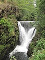 Saut de l'Ognon.jpg 3,312 × 4,416; 3.03 MB
-
Saut de l'Ognon.ogv 8.5 s, 480 × 640; 2.53 MB


_-_24.JPG)
_-_25.JPG)
_-_26.JPG)
_-_27.JPG)
_-_28.JPG)
_-_29.JPG)
_-_30.JPG)
_-_31.JPG)
_-_33.JPG)
_-_34.JPG)
_-_35.JPG)
_-_36.JPG)
_-_73.jpg)


.jpg)


.jpg)
.jpg)


