Category:Plateau de Retord
Jump to navigation
Jump to search
| Object location | | View all coordinates using: OpenStreetMap |
|---|
mountain in France  | |||||
| Upload media | |||||
| Pronunciation audio | |||||
|---|---|---|---|---|---|
| Instance of | |||||
| Part of | |||||
| Made from material | |||||
| Location | Haut-Valromey, Ain, Auvergne-Rhône-Alpes, Metropolitan France, France | ||||
| Heritage designation | |||||
| Width |
| ||||
| Length |
| ||||
| Mountain range | |||||
| Area |
| ||||
| Elevation above sea level |
| ||||
 | |||||
Media in category "Plateau de Retord"
The following 12 files are in this category, out of 12 total.
-
 Aux environs du Petit-Abergement.JPG 1,126 × 877; 478 KB
-
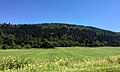
 Brénod et environs - 2016 (6).JPG 3,264 × 2,448; 3.05 MB
-
 Brénod et environs - 2016 (7).JPG 3,264 × 2,448; 2.84 MB
-
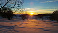 Coucher de soleil sur Retord enneigé.JPG 4,608 × 2,592; 4.36 MB
-
 Panoramique du plateau sous la neige.JPG 4,912 × 912; 1.19 MB
-
 Plan d'Hotonnes.jpg 3,264 × 2,448; 2.35 MB
-
 Plaque en hommage à Delphine Arène au plateau de Retord.png 541 × 397; 550 KB
-
LL-Q150 (fra)-Benoît Prieur-plateau de Retord.wav 1.8 s; 153 KB
-
 Plateau de Retord - 1 - 2016.JPG 3,264 × 1,631; 2.09 MB
-
 Plateau de Retord - 2 - 2016.JPG 3,264 × 1,957; 2.57 MB
-
 Plateau de Retord-1.JPG 1,024 × 768; 147 KB
-
 Plateau de Retord-2.JPG 1,024 × 768; 208 KB

.JPG)
.JPG)


