Category:Plaslaar (overstromingsgebied)
Jump to navigation
Jump to search
English: Plaslaar (overstromingsgebied), a water basin in Lier, Belgium
Nederlands: Plaslaar (overstromingsgebied), een waterbekken in Lier (België).
| Object location | | View all coordinates using: OpenStreetMap |
|---|
Media in category "Plaslaar (overstromingsgebied)"
The following 14 files are in this category, out of 14 total.
-
 Plaslaar hondenpoepzakjesbak.jpg 3,456 × 4,608; 3.58 MB
-
 Plaslaar hoofdingang.jpg 4,608 × 3,456; 3.54 MB
-
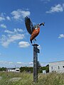 Plaslaar ijsvogel.jpg 3,456 × 4,608; 3.4 MB
-
 Plaslaar infobord vogels.jpg 4,608 × 3,456; 3.59 MB
-
 Plaslaar infobord.jpg 4,608 × 3,456; 3.33 MB
-
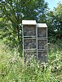 Plaslaar insectenhotel.jpg 3,456 × 4,608; 3.35 MB
-
 Plaslaar sluis met wiel.jpg 4,608 × 3,456; 3.41 MB
-
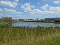
 Plaslaar zicht 1.jpg 4,608 × 3,456; 3.39 MB
-
 Plaslaar zicht 2.jpg 4,608 × 3,456; 3.47 MB
-
 Plaslaar zicht 3.jpg 4,608 × 3,456; 3.43 MB
-
 Plaslaar zicht 4.jpg 4,608 × 3,456; 3.45 MB
-
 Vogelkijkhut Plaslaar oost.jpg 4,608 × 3,456; 3.88 MB
-
 Vogelkijkhut Plaslaar zuid.jpg 4,608 × 3,456; 3.57 MB
-
 Vogelkijkhut zicht op Plaslaar.jpg 4,608 × 3,456; 3.44 MB


