Category:Plaques in Norfolk, England
Jump to navigation
Jump to search
Subcategories
This category has the following 9 subcategories, out of 9 total.
Media in category "Plaques in Norfolk, England"
The following 49 files are in this category, out of 49 total.
-
 -2022-06-18 Paston footprint waymarker, Saint Andrew's, Bacton, Norfolk.JPG 5,152 × 3,864; 5.03 MB
-
 170602 Blakeney 1 (35446300970).jpg 5,472 × 3,080; 8.58 MB
-
 Anchorite House.jpg 2,592 × 1,944; 1.71 MB
-
 Black Boys Plaque.JPG 2,304 × 1,728; 1.81 MB
-
 Boer War memorial plaque - geograph.org.uk - 1131707.jpg 640 × 482; 101 KB
-
 Bridge across nameless stream - plaque - geograph.org.uk - 756262.jpg 480 × 640; 170 KB
-
 Brittania Barracks Plaque.JPG 1,944 × 2,592; 1.28 MB
-
 Commemorative plaque on cottage front - geograph.org.uk - 1717746.jpg 562 × 600; 191 KB
-

-
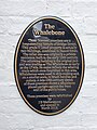 Downham Market Plaque on The Whalebone PH.jpg 3,024 × 4,032; 4.13 MB
-
 Wheel Wrights Oven Sign - geograph.org.uk - 1440935.jpg 640 × 480; 117 KB
-
 EDP Best Kept Village 1999 Plaque.jpg 5,184 × 3,888; 9.99 MB
-
 Ely, best station of 1987.jpg 3,753 × 2,329; 3.85 MB
-
 Fire Point on Hardwick House - geograph.org.uk - 1131656.jpg 480 × 640; 87 KB
-
 Fred Roy.JPG 1,728 × 2,304; 1.57 MB
-
 All Saints church Hempstead Norfolk (1567448434).jpg 1,280 × 853; 176 KB
-
 IMAG1012.jpg 2,592 × 1,728; 644 KB
-
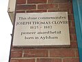 Joseph Thomas Clover.JPG 2,304 × 1,728; 1.46 MB
-

-

-
 Markshall Farm - farm sign - geograph.org.uk - 1541736.jpg 600 × 553; 100 KB
-
 Memorial plaque to the Coffey Crew - geograph.org.uk - 4143282.jpg 464 × 640; 230 KB
-
 Mile Cross Bridge Plaque.JPG 2,304 × 1,728; 1.78 MB
-

-
 North Creake 3.jpg 2,160 × 1,440; 1.62 MB
-
 Old Hall Farm - farm sign - geograph.org.uk - 1360833.jpg 640 × 499; 120 KB
-
 Paston Way Knapton Cutting 27 Jan 2008 (10).JPG 2,560 × 1,920; 1.08 MB
-
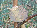 Planted 1909 - geograph.org.uk - 329049.jpg 640 × 480; 117 KB
-
 Plaque - geograph.org.uk - 448673.jpg 480 × 640; 128 KB
-

-
 Plaque on the Coastguard Lookout - geograph.org.uk - 2077324.jpg 640 × 478; 94 KB
-
 Plaque, Great Hospital.jpg 3,024 × 4,032; 1.59 MB
-
 Plaques in Rotary Hide, RSPB Snettisham - opened by Bill Oddie 01.JPG 3,008 × 2,000; 1.96 MB
-
 Plaques in Rotary Hide, RSPB Snettisham - opened by Bill Oddie 02.JPG 3,008 × 2,000; 2.12 MB
-

-
 Poet's Corner, Kenninghall.jpg 3,024 × 4,032; 3.53 MB
-
 Sewell Park.jpg 2,304 × 1,728; 1.65 MB
-
-

-
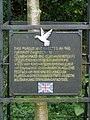
 The Heacham Declaration - geograph.org.uk - 574719.jpg 640 × 480; 105 KB
-
 The Plaque on the Monument to Coke of Holkham (geograph 1862624).jpg 640 × 481; 99 KB
-

-

-
 Thomas Paine Commemorative Plaque - geograph.org.uk - 311958.jpg 428 × 640; 78 KB
-

-
 Victorian Postbox King Street Great Yarmouth 20 July 2013 (1).JPG 4,000 × 3,000; 3.86 MB
-
 Chapel of St. Thomas a Becket, Wymondham (18133231719).jpg 4,592 × 3,056; 3.92 MB
-
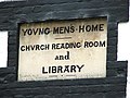 Young Men's Home (stone plaque) - geograph.org.uk - 1914729.jpg 640 × 480; 101 KB
-


.jpg)


.jpg)


.JPG)


.jpg)


.JPG)
.jpg)
_-_geograph.org.uk_-_1914729.jpg)
