Category:Pitton, Swansea
Jump to navigation
Jump to search
Media in category "Pitton, Swansea"
The following 12 files are in this category, out of 12 total.
-
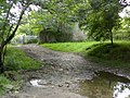
 Bridleway past Kingshall - geograph.org.uk - 493264.jpg 640 × 480; 155 KB
-
 Chapel near Pitton (geograph 5855374).jpg 3,137 × 2,352; 1.57 MB
-
 Gower coast (geograph 6786246).jpg 3,897 × 2,922; 5.53 MB
-
 Part of the Gower coast east of Mewslade (geograph 2977222).jpg 640 × 480; 80 KB
-
 Pitton Farm (geograph 5005292).jpg 6,000 × 4,000; 4.44 MB
-
 Pitton Methodist Church - geograph.org.uk - 4557098.jpg 2,424 × 1,880; 1.85 MB
-
 Ram Grove (geograph 5006875).jpg 6,000 × 4,000; 5.71 MB
-
 Ram Grove (geograph 6787117).jpg 2,048 × 1,536; 1.46 MB
-
 Ram Grove (geograph 6787132).jpg 2,930 × 3,907; 4.82 MB
-
 Approaching Kingshall - geograph.org.uk - 493265.jpg 640 × 480; 102 KB
-
 Footpath heading South, past Newton - geograph.org.uk - 493272.jpg 640 × 480; 87 KB
-
 Footpath to Newton - geograph.org.uk - 493271.jpg 640 × 480; 141 KB

.jpg)
.jpg)
.jpg)
.jpg)

.jpg)
.jpg)
.jpg)


