Category:Piste cyclable de l'Ernz Blanche (PC5)
Jump to navigation
Jump to search
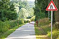
cycling route in Luxembourg _(104).jpg) D'Pist vun der Wäisser Iernz, tëscht der Supp a Kéideng  | |||||
| Upload media | |||||
| Instance of | |||||
|---|---|---|---|---|---|
| Part of | |||||
| Location |
| ||||
| Start point |
| ||||
| Length |
| ||||
| Highest point |
| ||||
| |||||
Media in category "Piste cyclable de l'Ernz Blanche (PC5)"
The following 9 files are in this category, out of 9 total.
-
 Ernzen, inauguration de la piste cyclable PC5.jpg 2,997 × 1,925; 6.9 MB
-
 Fiels Déi al Gare.jpg 2,048 × 1,317; 692 KB
-
 Luxembourg, pictogramme piste cyclable nationale PC005.svg 512 × 512; 8 KB
-
 PC5 End Kéideng.jpg 4,000 × 3,000; 3.33 MB
-
 Piste cyclable de l'Ernz Blanche (PC5) (100).jpg 3,648 × 2,736; 1.41 MB
-
 Piste cyclable de l'Ernz Blanche (PC5) (101).jpg 6,000 × 4,000; 7.53 MB
-
 Piste cyclable de l'Ernz Blanche (PC5) (102).jpg 6,000 × 4,000; 7.94 MB
-
 Piste cyclable de l'Ernz Blanche (PC5) (103).jpg 6,000 × 4,000; 7.4 MB
-
 Piste cyclable de l'Ernz Blanche (PC5) (104).jpg 3,499 × 2,625; 3.52 MB


_(100).jpg)
_(101).jpg)
_(102).jpg)
_(103).jpg)