Category:Piste cyclable de l'Attert (PC12)
Jump to navigation
Jump to search
cycling route in Luxembourg .jpg) D'PC12 an der Géigend vun Äischen  | |||||
| Upload media | |||||
| Instance of | |||||
|---|---|---|---|---|---|
| Part of | |||||
| Location |
| ||||
| Start point |
| ||||
| Length |
| ||||
| Highest point |
| ||||
| |||||
Subcategories
This category has the following 4 subcategories, out of 4 total.
- PC12 in Grass (8 F)
D
- Dräi Brécken (Atertlinn) (5 F)
H
- Habschter tunnel (2 F)
S
- Schack (Käerjeng) (3 F)
Media in category "Piste cyclable de l'Attert (PC12)"
The following 21 files are in this category, out of 21 total.
-
 Attert-01.jpg 3,264 × 2,448; 3.55 MB
-
 Gravel bike inside Hovelange tunnel.jpg 5,472 × 3,648; 5.9 MB
-
 Hovelange bikeway.jpg 7,128 × 4,727; 23.03 MB
-
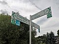 Luxembourg road sign E,7c, Useldange (101).jpg 3,130 × 2,348; 1.32 MB
-
 Luxembourg road sign E,7c, Useldange (102).jpg 3,397 × 2,547; 1.08 MB
-
 Luxembourg road signs E,7a (101) comm.jpg 5,630 × 3,753; 1.86 MB
-
 Luxembourg, pictogramme piste cyclable nationale PC012.svg 512 × 512; 8 KB
-
 Luxembourg, road sign E,7a & symbole E,21f PC12 (101).jpg 5,602 × 3,167; 1.58 MB
-
 Luxembourg, road sign E,7a & symbole E,21f PC9-PC12 (101).jpg 3,773 × 1,743; 1.02 MB
-
 PC Atert Hoen-001.jpg 3,746 × 2,488; 5.24 MB
-
 PC Atert Hoen.jpg 3,644 × 2,420; 4.8 MB
-
 Piste cyclable de l'Attert (01).jpg 5,521 × 3,438; 3.99 MB
-
 Piste cyclable de l'Attert (2).jpg 5,819 × 3,879; 6.19 MB
-
 Piste cyclable de l'Attert (3).jpg 5,847 × 3,899; 5.6 MB
-
 Piste cyclable de l'Attert (4).jpg 3,323 × 3,323; 2.08 MB
-
 Rippweiler, Bei der Laach, Bahnhäuschen 01.jpg 2,698 × 1,750; 6.45 MB
-
 Rippweiler, Bei der Laach, Bahnhäuschen 02.jpg 2,633 × 1,790; 6.34 MB
-
 Schack Bascharage 02.jpg 2,097 × 1,320; 2.78 MB
-
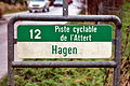
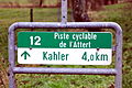
 Schëld PC12, Béiwen-Atert-101.jpg 5,183 × 4,491; 12.28 MB
-
 Sun on PC 12 (53446768733).jpg 4,000 × 2,667; 6.2 MB
-
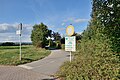
 Traditional photo point on PC 12 near Eischen (47362529722).jpg 5,444 × 3,630; 6.75 MB


.jpg)
.jpg)
_comm.jpg)
.jpg)
.jpg)


.jpg)
.jpg)
.jpg)
.jpg)


.jpg)