Category:Pirnmill
Jump to navigation
Jump to search
village on the west coast of Arran, North Ayrshire, Scotland, UK  | |||||
| Upload media | |||||
| Instance of | |||||
|---|---|---|---|---|---|
| Location |
| ||||
 | |||||
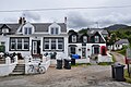
English: Pirnmill is a small village on the Isle of Arran, Scotland. Unlike many of the other villages on the island, Pirnmill's etymology is not rooted in the Gaelic or Viking heritage of Arran. Rather Pirnmill takes its name from a mill that historically stood there until 1840, which produced pirns (wooden bobbins).
Subcategories
This category has the following 4 subcategories, out of 4 total.
F
J
Media in category "Pirnmill"
The following 56 files are in this category, out of 56 total.
-
 Arran coast road south of Pirnmill - geograph.org.uk - 2749330.jpg 640 × 480; 268 KB
-

-
 Burial ground, Pirnmill, Isle of Arran, Scotland.JPG 1,287 × 855; 576 KB
-
 Coast road south of Imachar - geograph.org.uk - 214330.jpg 640 × 480; 74 KB
-
 Coire Fhionn Lochan - geograph.org.uk - 785722.jpg 640 × 480; 78 KB
-
 Heron on Rocks at Pirnmill. - geograph.org.uk - 554268.jpg 640 × 426; 267 KB
-
 Loch Tanna - geograph.org.uk - 243224.jpg 640 × 427; 52 KB
-
 Looking Towards Beinn Bharrain - geograph.org.uk - 5574389.jpg 640 × 392; 95 KB
-
 Mouth of the Allt Gobhlach - geograph.org.uk - 5798264.jpg 3,909 × 2,933; 2.13 MB
-
 Northern End of Pirnmill, Arran - geograph.org.uk - 1052282.jpg 640 × 480; 75 KB
-
 On The Path to Coire Fhionn Lochan - geograph.org.uk - 862833.jpg 640 × 426; 70 KB
-
 Pirnmill - looking south - geograph.org.uk - 1447186.jpg 640 × 479; 82 KB
-
 Pirnmill Shoreline View - geograph.org.uk - 5562098.jpg 640 × 396; 89 KB
-
 Pirnmill View - geograph.org.uk - 5562093.jpg 640 × 380; 88 KB
-
 Pirnmill, Isle of Arran, Scotland.JPG 1,501 × 997; 631 KB
-
 Power cables to the sea - geograph.org.uk - 214335.jpg 480 × 640; 107 KB
-

-
 Rocks on the shore at Pirnmill - geograph.org.uk - 5132432.jpg 640 × 360; 267 KB
-
 Sea caves at Dougarie - geograph.org.uk - 214371.jpg 640 × 480; 65 KB
-
 Shore at Dougarie Point - geograph.org.uk - 214337.jpg 640 × 470; 90 KB
-
 The Iorsa Water - geograph.org.uk - 445242.jpg 640 × 480; 106 KB
-
 The Iorsa Water - geograph.org.uk - 447073.jpg 640 × 480; 78 KB
-

-
 Undersea cable marker near Balliekine - geograph.org.uk - 214333.jpg 640 × 480; 153 KB
-
 View towards Pirnmill - geograph.org.uk - 2964303.jpg 3,456 × 4,608; 5.69 MB
-
 War Memorial at Pirnmill. - geograph.org.uk - 554210.jpg 640 × 426; 305 KB
-
 Allt Gobhlach - geograph.org.uk - 1055942.jpg 480 × 640; 89 KB
-
 Allt Gobhlach tributary - geograph.org.uk - 1055934.jpg 480 × 640; 106 KB
-
 Allt Gobhlach. - geograph.org.uk - 554201.jpg 426 × 640; 349 KB
-
 Allt na h-Airighe - geograph.org.uk - 1162128.jpg 640 × 428; 73 KB
-
 Arran coastline - geograph.org.uk - 800191.jpg 640 × 427; 114 KB
-
 Auchagallon beach - geograph.org.uk - 799927.jpg 640 × 427; 113 KB
-
 Beinn Lochain - geograph.org.uk - 447088.jpg 640 × 480; 92 KB
-
 Brook at Pirnmill - geograph.org.uk - 418919.jpg 424 × 640; 194 KB
-
 Creag a Chromain - geograph.org.uk - 447076.jpg 640 × 480; 89 KB
-
 Dougarie Point sunset - geograph.org.uk - 451671.jpg 640 × 392; 29 KB
-
 Entering Pirnmill from the South. - geograph.org.uk - 554206.jpg 640 × 426; 244 KB
-
 Entrance to Auchencar Farm - geograph.org.uk - 616862.jpg 640 × 428; 79 KB
-
 Footbridge on the Iorsa path - geograph.org.uk - 445238.jpg 640 × 480; 132 KB
-
 Ford on the Iorsa path - geograph.org.uk - 445249.jpg 480 × 640; 86 KB
-
 Foreshore south of Pirnmill - geograph.org.uk - 552632.jpg 640 × 425; 96 KB
-
 Grey day on the Arran Moors - geograph.org.uk - 589921.jpg 640 × 480; 51 KB
-
 Gulf stream influence at Immachar - geograph.org.uk - 77305.jpg 640 × 480; 103 KB
-
 Iorsa Water - geograph.org.uk - 77281.jpg 640 × 480; 140 KB
-
 Jetty at Pirnmill. - geograph.org.uk - 554208.jpg 640 × 426; 230 KB
-
 Pirnmill - geograph.org.uk - 77302.jpg 640 × 480; 109 KB
-
 Pirnmill from the sea - geograph.org.uk - 20650.jpg 640 × 397; 58 KB
-
 Raised beach at Dougarie - geograph.org.uk - 77307.jpg 640 × 480; 122 KB
-
 Roadside garden at Whitefarland - geograph.org.uk - 214327.jpg 480 × 640; 110 KB
-
 Seafield - geograph.org.uk - 214324.jpg 640 × 480; 64 KB
-
 Sheep Bridge. - geograph.org.uk - 554205.jpg 640 × 426; 331 KB
-
 Standing stone at Auchencar - geograph.org.uk - 418925.jpg 415 × 640; 111 KB
-

-
 Swans and Cygnet at Pirnmill. - geograph.org.uk - 554265.jpg 640 × 426; 272 KB
-
 Swings at Whitefarland Point - geograph.org.uk - 214326.jpg 640 × 480; 103 KB
-
 The Dougarie Lodge bypass - geograph.org.uk - 445230.jpg 480 × 640; 95 KB


