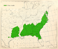
Category:Pinus taeda range maps
Jump to navigation
Jump to search
Media in category "Pinus taeda range maps"
The following 6 files are in this category, out of 6 total.
-
CL-41 Pinus taeda range map.png 3,341 × 2,798; 11.39 MB
-
Loblolly-pine-range-map.jpg 376 × 263; 34 KB
-
Munns (1938) 018 Pinus taeda.jpg 3,244 × 2,484; 2.79 MB
-
Pinus taeda distribution map.png 1,920 × 1,920; 100 KB
-
Pinus taeda range map.jpg 367 × 301; 35 KB
-
Pinus taeda USGS range map.png 4,812 × 6,253; 473 KB


