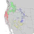
Category:Pinus ponderosa range maps
Jump to navigation
Jump to search
Media in category "Pinus ponderosa range maps"
The following 22 files are in this category, out of 22 total.
-
Pinus ponderosa levila02.png 900 × 801; 122 KB
-
Braunrindige Gelb-Kiefer.jpg 4,235 × 2,876; 2.62 MB
-
CL-47 Pinus ponderosa range map.png 2,471 × 3,556; 9.22 MB
-
CL-48 Pinus jeffreyi & Pinus washoensis range map.png 2,286 × 3,580; 5.41 MB
-
Munns (1938) 013 Pinus ponderosa.jpg 2,482 × 3,172; 3.61 MB
-
Pinus ponderosa & arizonica range map 0.png 4,534 × 6,009; 575 KB
-
Pinus ponderosa & arizonica range map 1.png 2,560 × 2,560; 194 KB
-
Pinus ponderosa & arizonica subspecies range map 0.png 9,069 × 12,018; 1.14 MB
-
Pinus ponderosa & arizonica subspecies range map 1.png 5,101 × 5,101; 347 KB
-
Pinus ponderosa range map 2.gif 3,014 × 3,707; 214 KB
-
Pinus ponderosa range map.svg 2,000 × 2,000; 601 KB
-
Pinus ponderosa subspecies range map 0.png 9,069 × 12,018; 1.11 MB
-
Pinus ponderosa subspecies range map 1.gif 1,200 × 1,200; 70 KB
-
Pinus ponderosa subspecies range map 1.png 3,937 × 3,937; 411 KB
-
Pinus ponderosa subspecies range map 2.png 3,688 × 3,687; 383 KB
-
Pinus ponderosa subspecies range map.png 609 × 746; 77 KB
-
Pinus ponderosa washoensis range map 0.png 9,624 × 12,505; 974 KB
-
Pinus washoensis range map 1.png 1,684 × 1,684; 27 KB
-
Pinus washoensis range map 2.png 777 × 777; 9 KB
-
PonderosaRangeMap.png 2,083 × 2,777; 636 KB


