Category:Pinus elliottii range maps
Jump to navigation
Jump to search
Media in category "Pinus elliottii range maps"
The following 7 files are in this category, out of 7 total.
-
Pinus elliotii map.png 860 × 549; 88 KB
-
CL-45 Pinus elliottii range map detail.png 1,465 × 1,234; 2.59 MB
-
CL-45 Pinus elliottii range map.png 3,340 × 2,780; 13.36 MB
-
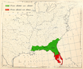
Munns (1938) 026 Pinus elliottii & Pinus caribaea.jpg 2,470 × 2,856; 2.47 MB
-
Pinus elliottii range map.jpg 556 × 720; 60 KB
-
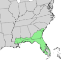
Pinus elliottii range map.png 1,281 × 1,281; 50 KB
-
Pinus elliottii USGS range map.png 4,812 × 6,253; 469 KB


