Category:Pintesfeld
Jump to navigation
Jump to search
;_Panoramablick_c.jpg)
municipality of Germany ;_Panoramablick_a.jpg)  | |||||
| Upload media | |||||
| Instance of |
| ||||
|---|---|---|---|---|---|
| Location | Arzfeld, Eifelkreis Bitburg-Prüm, Rhineland-Palatinate, Germany | ||||
| Population |
| ||||
| Area |
| ||||
| Elevation above sea level |
| ||||
| official website | |||||
 | |||||
Media in category "Pintesfeld"
The following 5 files are in this category, out of 5 total.
-
 Arzfeld-pintesfeld.png 1,498 × 956; 57 KB
-
 Pintesfeld (Eifel); Panoramablick a.jpg 5,184 × 3,456; 7.85 MB
-
 Pintesfeld (Eifel); Panoramablick b.jpg 5,184 × 3,456; 8.33 MB
-
 Pintesfeld (Eifel); Panoramablick c.jpg 5,000 × 1,815; 1.08 MB
-
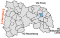
 Pintesfeld in BIT.svg 354 × 369; 268 KB

;_Panoramablick_b.jpg)