Category:Pietzpuhl
Jump to navigation
Jump to search
| Object location | | View all coordinates using: OpenStreetMap |
|---|
human settlement in Germany   | |||||
| Upload media | |||||
| Instance of |
| ||||
|---|---|---|---|---|---|
| Location | Möser, Jerichower Land, Saxony-Anhalt, Germany | ||||
| Area |
| ||||
| Elevation above sea level |
| ||||
| official website | |||||
 | |||||
Media in category "Pietzpuhl"
The following 7 files are in this category, out of 7 total.
-
 DE-ST 15-0-86-145 Pietzpuhl COA.png 591 × 664; 71 KB
-
 Pietzpuhl in JL.png 299 × 299; 6 KB
-
 PietzpuhlSchloss.jpg 640 × 480; 278 KB
-
 Siegelmarke Amt Pietzpuhl - Kreis Jerichow I W0214004.jpg 265 × 270; 18 KB
-
 Siegelmarke Amtsbezirk Pietzpuhl W0328007.jpg 269 × 270; 13 KB
-
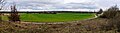 Views from Kapaunberg 02.jpg 3,672 × 1,000; 792 KB
-
 Views from Kapaunberg 03.jpg 4,000 × 1,000; 529 KB


