Category:Piethorne Reservoir
Jump to navigation
Jump to search
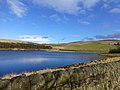
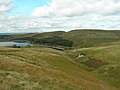
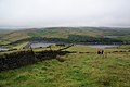
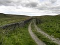
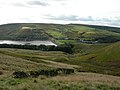
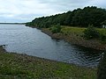
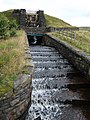
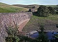
English: Piethorne Reservoir is the largest of several reservoirs in the Piethorne Valley above Newhey, by Milnrow, in the Metropolitan Borough of Rochdale, Greater Manchester, England. It was built between 1858 and 1868.
Media in category "Piethorne Reservoir"
The following 69 files are in this category, out of 69 total.
-
-
 Bluebell Wood - geograph.org.uk - 2969523.jpg 640 × 481; 748 KB
-
 Bluebells at Old House Ground - geograph.org.uk - 427824.jpg 640 × 480; 187 KB
-
 Catchment drain - geograph.org.uk - 4182056.jpg 2,000 × 1,500; 995 KB
-
 Cold Greave - geograph.org.uk - 3488460.jpg 2,375 × 3,739; 1.95 MB
-
 Cold Greave - geograph.org.uk - 4703280.jpg 5,471 × 3,345; 1.96 MB
-
 Cold Greave Clough - geograph.org.uk - 1736131.jpg 640 × 480; 164 KB
-
 Cold Greave Clough - geograph.org.uk - 3149129.jpg 800 × 600; 93 KB
-
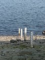 Depth gauges, Piethorne Reservoir - geograph.org.uk - 2370047.jpg 1,500 × 2,000; 869 KB
-
 Descent to Piethorne Reservoir - geograph.org.uk - 2509878.jpg 3,872 × 2,592; 3.79 MB
-
 Hacking in the Piethorne Valley - geograph.org.uk - 2602838.jpg 640 × 472; 132 KB
-
 Hillside by the bridleway - geograph.org.uk - 1773665.jpg 3,718 × 2,466; 4.25 MB
-
 Locked gate, Piethorne Valley - geograph.org.uk - 3323631.jpg 2,000 × 1,282; 2.67 MB
-
 Moorland Path - geograph.org.uk - 2525920.jpg 1,280 × 960; 557 KB
-
 Moorland Wall, Turf Hill Clough - geograph.org.uk - 3147018.jpg 800 × 600; 105 KB
-

-
 Pennine Bridleway approaching Piethorne Reservoir - geograph.org.uk - 3088922.jpg 2,048 × 1,536; 595 KB
-
 Piethorn Reservoir - geograph.org.uk - 2264471.jpg 1,600 × 1,200; 425 KB
-
 Piethorn reservoir, eastern end - geograph.org.uk - 2565728.jpg 2,592 × 1,944; 1.42 MB
-
 Piethorne Brook - geograph.org.uk - 2587620.jpg 480 × 640; 144 KB
-
 Piethorne Brook - geograph.org.uk - 2602822.jpg 640 × 461; 157 KB
-
 Piethorne Reservoir (51107297422).jpg 3,648 × 2,736; 2.45 MB
-
 Piethorne Reservoir - geograph.org.uk - 1657850.jpg 640 × 461; 122 KB
-
 Piethorne Reservoir - geograph.org.uk - 1657857.jpg 640 × 480; 129 KB
-
 Piethorne Reservoir - geograph.org.uk - 1774941.jpg 3,807 × 2,499; 4.37 MB
-
 Piethorne Reservoir - geograph.org.uk - 1917730.jpg 1,365 × 1,024; 433 KB
-
 Piethorne Reservoir - geograph.org.uk - 1917738.jpg 1,365 × 1,024; 500 KB
-
 Piethorne Reservoir - geograph.org.uk - 2250671.jpg 640 × 436; 83 KB
-
 Piethorne Reservoir - geograph.org.uk - 24518.jpg 640 × 480; 91 KB
-
 Piethorne Reservoir - geograph.org.uk - 2525902.jpg 1,280 × 960; 554 KB
-
 Piethorne Reservoir - geograph.org.uk - 2525910.jpg 1,280 × 953; 487 KB
-
 Piethorne Reservoir - geograph.org.uk - 2579635.jpg 640 × 467; 109 KB
-
 Piethorne Reservoir - geograph.org.uk - 2969545.jpg 640 × 480; 465 KB
-
 Piethorne Reservoir - geograph.org.uk - 2969558.jpg 640 × 481; 538 KB
-
 Piethorne Reservoir - geograph.org.uk - 2969562.jpg 640 × 481; 536 KB
-
 Piethorne Reservoir - geograph.org.uk - 3323632.jpg 2,000 × 1,305; 2.24 MB
-
 Piethorne Reservoir - geograph.org.uk - 3488464.jpg 3,658 × 2,155; 1.15 MB
-
 Piethorne Reservoir - geograph.org.uk - 3535323.jpg 4,000 × 3,000; 1.74 MB
-
 Piethorne Reservoir - geograph.org.uk - 371991.jpg 640 × 483; 162 KB
-
 Piethorne Reservoir - geograph.org.uk - 4658679.jpg 5,472 × 2,870; 1.71 MB
-
 Piethorne Reservoir - geograph.org.uk - 5122496.jpg 640 × 480; 125 KB
-
 Piethorne Reservoir 1.jpg 640 × 480; 63 KB
-
 Piethorne Reservoir and Ogden Lane - geograph.org.uk - 782366.jpg 640 × 431; 79 KB
-
 Piethorne Reservoir at Cold Greave - geograph.org.uk - 1736104.jpg 640 × 480; 160 KB
-
 Piethorne Reservoir near Milnrow - geograph.org.uk - 3904140.jpg 4,265 × 2,112; 1.94 MB
-
 Piethorne Reservoir near Milnrow - geograph.org.uk - 3904164.jpg 4,567 × 2,502; 2.92 MB
-
 Piethorne Reservoir Overflow - geograph.org.uk - 2525933.jpg 1,280 × 960; 730 KB
-
 Piethorne Reservoir, Milnrow, from the air - geograph.org.uk - 5904774.jpg 1,600 × 1,065; 441 KB
-
 Piethorne Reservoir, Wall and Lime House - geograph.org.uk - 2969556.jpg 640 × 479; 546 KB
-
 Piethorne Reservoir.jpg 1,600 × 1,200; 220 KB
-
 Piethorne Water Treatment Works - geograph.org.uk - 2525952.jpg 1,280 × 960; 774 KB
-
 Reservoir track and shelter - geograph.org.uk - 2370083.jpg 2,000 × 1,500; 840 KB
-

-
 Slaking Piethorne's thirst - geograph.org.uk - 1939630.jpg 640 × 430; 95 KB
-
 South Pennine landscape - geograph.org.uk - 3904179.jpg 4,525 × 1,550; 1.4 MB
-
 The edge of the access land - geograph.org.uk - 1774918.jpg 3,872 × 2,592; 4.77 MB
-
 The Lime House - geograph.org.uk - 2969538.jpg 640 × 480; 550 KB
-
 The Pennine Bridleway crossing Piethorne Clough - geograph.org.uk - 4182015.jpg 2,000 × 1,483; 919 KB
-

-
 The Pennine Bridleway near Piethorne Reservoir - geograph.org.uk - 6322645.jpg 4,000 × 3,000; 4.83 MB
-
 The Pennine Bridleway near Piethorne Reservoir - geograph.org.uk - 6322647.jpg 4,000 × 3,000; 4.69 MB
-
 The Pennine Bridleway near Piethorne Reservoir - geograph.org.uk - 6322649.jpg 4,000 × 3,000; 4.57 MB
-
 The Pennine Bridleway near Piethorne Reservoir - geograph.org.uk - 6322651.jpg 4,000 × 3,000; 4.52 MB
-

-
 The Rochdale Way passing Piethorne Reservoir - geograph.org.uk - 2369903.jpg 2,000 × 1,393; 749 KB
-
 Tunshill Lane, Pennine Bridleway - geograph.org.uk - 6597410.jpg 4,727 × 3,545; 3.55 MB
-
 Valve House, Piethorne Reservoir - geograph.org.uk - 2250661.jpg 640 × 461; 118 KB
-
 Valve house, Piethorne Reservoir - geograph.org.uk - 2370035.jpg 2,000 × 1,500; 817 KB
-
 Waterfall - geograph.org.uk - 2969528.jpg 640 × 481; 620 KB


_-_geograph.org.uk_-_2969520.jpg)


.jpg)


