Category:Pictorial maps of the United States
Jump to navigation
Jump to search
Subcategories
This category has the following 3 subcategories, out of 3 total.
Media in category "Pictorial maps of the United States"
The following 25 files are in this category, out of 25 total.
-
 "To Natural and Civic Wonders" pictorial map, 1928.jpg 7,205 × 5,073; 5.85 MB
-

-

-

-

-
 A hysterical map of Rocky Mountain National Park scenery - chockfull of ohs & ahs LOC 2008625104.tif 6,733 × 8,796; 169.44 MB
-
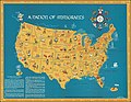 A Nation of Immigrants.jpg 12,887 × 9,957; 33.43 MB
-
 Alaska pictorial.jpg 1,354 × 647; 493 KB
-
 American connection.jpg 738 × 446; 56 KB
-
 Armour's Food Source Map - The Greatness of the United States is Founded on Agriculture.jpg 23,306 × 14,870; 61.65 MB
-
 Being a cartograph of Ohio (35179323305).jpg 1,567 × 2,000; 4.04 MB
-

-

-
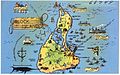 Map of Block Island (68749).jpg 3,298 × 2,049; 2.37 MB
-
 Nicknames of the states, 1884.jpg 9,334 × 5,232; 17.57 MB
-
 Paul Sample's America, its soil LOC 2012588336.jpg 13,606 × 9,364; 21.47 MB
-
 Pictorial United States, 1943.jpg 5,893 × 4,620; 4.51 MB
-
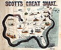 Scott-anaconda.jpg 5,248 × 4,382; 4.16 MB
-
 The Commonwealth of Connecticut (20112486154).jpg 2,000 × 1,578; 3.64 MB
-
 The pictorial map, United States stamps (35048884061) (2).jpg 2,000 × 1,185; 2.59 MB
-
 The pictorial map, United States stamps (35048884061).jpg 8,696 × 5,152; 11.65 MB
-
 The United States, The land and the people (1958).jpg 4,097 × 2,898; 3.51 MB
-

-
 USA (lower 48) pictorial.jpg 3,024 × 1,965; 3.39 MB
-
 Virginia 1861.jpg 8,634 × 6,743; 7.77 MB


.jpg)
.jpg)


.jpg)

.jpg)
.jpg)


.jpg)
_(2).jpg)
.jpg)
.jpg)
.jpg)
_pictorial.jpg)
