Category:Photos of the Neckartalradweg by Panoramio ID 596286
Jump to navigation
Jump to search
Media in category "Photos of the Neckartalradweg by Panoramio ID 596286"
The following 200 files are in this category, out of 468 total.
(previous page) (next page)-

-
 Ausblick vom 366 km langen Neckartalradweg - panoramio (1).jpg 4,592 × 3,436; 5.45 MB
-
 Ausblick vom 366 km langen Neckartalradweg - panoramio (10).jpg 4,504 × 3,314; 6.39 MB
-
 Ausblick vom 366 km langen Neckartalradweg - panoramio (11).jpg 4,604 × 2,304; 4.3 MB
-
 Ausblick vom 366 km langen Neckartalradweg - panoramio (12).jpg 4,608 × 3,456; 9.17 MB
-
 Ausblick vom 366 km langen Neckartalradweg - panoramio (2).jpg 4,604 × 3,452; 7.95 MB
-
 Ausblick vom 366 km langen Neckartalradweg - panoramio (3).jpg 4,600 × 3,446; 4.66 MB
-
 Ausblick vom 366 km langen Neckartalradweg - panoramio (4).jpg 4,598 × 2,304; 4.17 MB
-
 Ausblick vom 366 km langen Neckartalradweg - panoramio (5).jpg 4,600 × 2,304; 4.16 MB
-
 Ausblick vom 366 km langen Neckartalradweg - panoramio (6).jpg 4,608 × 2,304; 5.52 MB
-
 Ausblick vom 366 km langen Neckartalradweg - panoramio (7).jpg 4,604 × 2,304; 3.94 MB
-
 Ausblick vom 366 km langen Neckartalradweg - panoramio (8).jpg 4,582 × 2,304; 4.77 MB
-
 Ausblick vom 366 km langen Neckartalradweg - panoramio (9).jpg 4,572 × 3,408; 7.11 MB
-
 Ausblick vom 366 km langen Neckartalradweg - panoramio.jpg 3,206 × 2,368; 3.9 MB
-
-

-

-

-

-

-

-
 Ausblick vom 366 km langen Neckartalradweg auf das Schloß Neuburg - panoramio (1).jpg 3,021 × 2,234; 2.79 MB
-
 Ausblick vom 366 km langen Neckartalradweg auf das Schloß Neuburg - panoramio.jpg 4,594 × 3,436; 7.1 MB
-
 Ausblick vom 366 km langen Neckartalradweg auf den Neckar - panoramio.jpg 3,264 × 2,448; 4.25 MB
-
 Ausblick vom 366 km langen Neckartalradweg auf den Neckar bei Gemmrigheim - panoramio.jpg 3,264 × 2,448; 2.79 MB
-
 Ausblick vom 366 km langen Neckartalradweg auf den Neckar bei Gemmrigheim 2 - panoramio.jpg 3,264 × 2,448; 3.03 MB
-

-
 Ausblick vom 366 km langen Neckartalradweg auf die Alte Brücke - panoramio.jpg 4,524 × 2,258; 3.99 MB
-
-

-
 Ausblick vom 366 km langen Neckartalradweg auf die Brücke der B38a - panoramio.jpg 4,570 × 2,304; 3.9 MB
-
 Ausblick vom 366 km langen Neckartalradweg auf die Brücke der BAB A6 - panoramio (1).jpg 4,608 × 3,456; 6.82 MB
-
 Ausblick vom 366 km langen Neckartalradweg auf die Brücke der BAB A6 - panoramio.jpg 4,586 × 2,304; 4.26 MB
-
 Ausblick vom 366 km langen Neckartalradweg auf die Burg Dilsberg - panoramio.jpg 3,070 × 2,304; 2.96 MB
-
 Ausblick vom 366 km langen Neckartalradweg auf die Burg Guttenberg - panoramio.jpg 4,606 × 3,454; 7.92 MB
-
 Ausblick vom 366 km langen Neckartalradweg auf die Burg Hornberg - panoramio.jpg 4,572 × 3,408; 6.45 MB
-

-
 Ausblick vom 366 km langen Neckartalradweg auf die Schleuse bei Heidelberg - panoramio.jpg 4,582 × 3,422; 5.44 MB
-
 Ausblick vom 366 km langen Neckartalradweg auf die Schleuse Neckarsteinach - panoramio.jpg 4,579 × 2,278; 3.65 MB
-
 Ausblick vom 366 km langen Neckartalradweg auf die Staustufe, Schleuse - panoramio.jpg 4,524 × 3,342; 6.25 MB
-
 Ausblick vom 366 km langen Neckartalradweg auf die Ziegelhäuser Landstraße - panoramio.jpg 3,070 × 2,304; 3.11 MB
-
 Ausblick vom 366 km langen Neckartalradweg auf Fortuna Camping - panoramio (1).jpg 4,562 × 3,394; 6.9 MB
-
 Ausblick vom 366 km langen Neckartalradweg auf Fortuna Camping - panoramio.jpg 4,582 × 3,422; 6.53 MB
-
 Ausblick vom 366 km langen Neckartalradweg auf Neckargemünd - panoramio.jpg 4,608 × 2,304; 3.78 MB
-
 Ausblick vom 366 km langen Neckartalradweg auf Seckenheim - panoramio.jpg 4,602 × 3,448; 8.08 MB
-
 Ausblick vom 366 km langen Neckartalradweg auf Zwingenberg - panoramio.jpg 4,604 × 3,452; 7.73 MB
-

-
 Ausblick vom 366 km langen Neckartalradweg bei Obrigheim - panoramio.jpg 4,604 × 3,450; 4.54 MB
-
 Ausblick vom 366 km langen Neckartalradweg bei Offenau - panoramio.jpg 4,590 × 3,432; 5.21 MB
-

-
 Ausblick vom 366 km langen Neckartalradweg, Blick Richtung Uferstraße - panoramio.jpg 3,072 × 2,304; 2.99 MB
-

-
 Ausblick vom 366 km langen Neckartalradweg, Die Enz mündet in den Neckar - panoramio.jpg 3,072 × 1,679; 2.55 MB
-
 Ausblick vom 366 km langen Neckartalradweg, Ehemaliges Bahnwärterhäuschen - panoramio.jpg 4,590 × 3,432; 5.55 MB
-

-
 Ausblick vom 366 km langen Neckartalradweg, Gierfähre "Hbg 034" bei Neckarhausen - panoramio.jpg 4,542 × 3,366; 10.29 MB
-
 Ausblick vom 366 km langen Neckartalradweg, Hessigheimer Felsengarten - panoramio (1).jpg 3,072 × 1,536; 2.53 MB
-
 Ausblick vom 366 km langen Neckartalradweg, Hessigheimer Felsengarten - panoramio.jpg 3,072 × 1,536; 2.61 MB
-
 Ausblick vom 366 km langen Neckartalradweg, Kleiningersheim - panoramio.jpg 3,072 × 1,536; 2.26 MB
-
 Ausblick vom 366 km langen Neckartalradweg, Neckar in Heidelberg - panoramio.jpg 3,002 × 2,210; 2.84 MB
-
 Ausblick vom 366 km langen Neckartalradweg, Neckarschleuse Besigheim - panoramio.jpg 3,072 × 1,825; 2.69 MB
-
 Ausblick vom 366 km langen Neckartalradweg, Neckarufer-Nord-Bebauung - panoramio.jpg 4,604 × 3,452; 6.11 MB
-

-
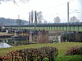
 Bahnbrücke über den Salinenkanal.jpg 4,530 × 3,350; 7.11 MB
-
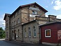 Bahnhof Bad Friedrichshall-Kochendorf,.jpg 2,177 × 1,632; 1.39 MB
-

-
 Beim 366 km langen Neckartalradweg - panoramio (1).jpg 4,598 × 2,304; 3.98 MB
-
 Beim 366 km langen Neckartalradweg - panoramio.jpg 4,576 × 3,414; 6.95 MB
-

-

-
 Beim 366 km langen Neckartalradweg, A81 (Neckarbrücke) - panoramio.jpg 3,072 × 2,304; 1.18 MB
-
 Beim 366 km langen Neckartalradweg, A81 Autobahnbrücke über den Neckar - panoramio.jpg 2,134 × 1,024; 1.08 MB
-
 Beim 366 km langen Neckartalradweg, A81 Brücke über den Neckar - panoramio.jpg 4,608 × 3,456; 5.86 MB
-
 Beim 366 km langen Neckartalradweg, Aileswasensee - panoramio.jpg 4,596 × 3,440; 8.82 MB
-

-
 Beim 366 km langen Neckartalradweg, Am Neckar bei Oberboihingen - panoramio.jpg 4,572 × 3,408; 7.65 MB
-
 Beim 366 km langen Neckartalradweg, Am Neckar bei Oberndorf - panoramio.jpg 4,608 × 3,456; 9.39 MB
-

-

-

-

-

-

-
 Beim 366 km langen Neckartalradweg, Aussichtsplattform "Neckar erleben" - panoramio.jpg 4,608 × 2,304; 7.06 MB
-

-
 Beim 366 km langen Neckartalradweg, Baggersee Kirchentellinsfurt - panoramio (1).jpg 4,600 × 2,304; 3.99 MB
-
 Beim 366 km langen Neckartalradweg, Baggersee Kirchentellinsfurt - panoramio.jpg 4,598 × 3,442; 7.08 MB
-
 Beim 366 km langen Neckartalradweg, Bahnbrücke über den Neckar - panoramio.jpg 4,608 × 3,456; 7.29 MB
-
 Beim 366 km langen Neckartalradweg, Bahnhof Bad Niedernau - panoramio.jpg 4,608 × 3,456; 7.79 MB
-
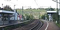 Beim 366 km langen Neckartalradweg, Bahnhof bei Kirchheim - panoramio.jpg 3,264 × 1,632; 2.35 MB
-
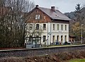
 Beim 366 km langen Neckartalradweg, Bahnhof Bieringen - panoramio.jpg 4,600 × 3,446; 6.93 MB
-
 Beim 366 km langen Neckartalradweg, Bahnhof Eyach - panoramio (1).jpg 4,540 × 3,364; 5.87 MB
-
 Beim 366 km langen Neckartalradweg, Bahnhof Eyach - panoramio (2).jpg 4,592 × 3,436; 7.38 MB
-
 Beim 366 km langen Neckartalradweg, Bahnhof Eyach - panoramio.jpg 4,606 × 3,454; 6.13 MB
-
 Beim 366 km langen Neckartalradweg, Bahnhof in Neckarsulm - panoramio.jpg 3,264 × 2,448; 2.85 MB
-
 Beim 366 km langen Neckartalradweg, Bahnhof in Rottweil - panoramio.jpg 2,272 × 1,136; 2.38 MB
-
 Beim 366 km langen Neckartalradweg, Bahnhof in Schwenningen - panoramio.jpg 4,586 × 2,304; 3.92 MB
-
 Beim 366 km langen Neckartalradweg, Bahnhof Lauffen am Neckar - panoramio.jpg 3,264 × 1,632; 2.87 MB
-
 Beim 366 km langen Neckartalradweg, Bahnhof Mühlen (b Horb) - panoramio.jpg 4,516 × 3,330; 7.18 MB
-
 Beim 366 km langen Neckartalradweg, Bahnhof Nürtingen - panoramio (1).jpg 4,582 × 2,304; 4.64 MB
-
 Beim 366 km langen Neckartalradweg, Bahnhof Nürtingen - panoramio (2).jpg 4,528 × 2,304; 3.8 MB
-
 Beim 366 km langen Neckartalradweg, Bahnhof Nürtingen - panoramio.jpg 4,597 × 2,299; 4.03 MB
-
 Beim 366 km langen Neckartalradweg, Bahnhof Rottweil - panoramio.jpg 4,432 × 3,206; 4.62 MB
-
 Beim 366 km langen Neckartalradweg, Bahnhof Sulz am Neckar - panoramio (1).jpg 4,586 × 3,426; 4.16 MB
-
 Beim 366 km langen Neckartalradweg, Bahnhof Sulz am Neckar - panoramio.jpg 4,608 × 3,456; 5.62 MB
-
 Beim 366 km langen Neckartalradweg, Bahnstrecke der Kulturbahn Tübingen - Horb - panoramio.jpg 4,608 × 3,456; 10.58 MB
-
 Beim 366 km langen Neckartalradweg, Bahnstrecke Zürich - Stuttgart - panoramio.jpg 4,582 × 2,304; 4.66 MB
-
 Beim 366 km langen Neckartalradweg, Bank am Neckar - panoramio.jpg 4,608 × 3,456; 9.04 MB
-
 Beim 366 km langen Neckartalradweg, Beim Bahnhof Bad Niedernau - panoramio.jpg 4,500 × 3,306; 9.06 MB
-

-
 Beim 366 km langen Neckartalradweg, Bieringen (^) - panoramio.jpg 4,604 × 3,450; 6.64 MB
-
 Beim 366 km langen Neckartalradweg, Bieringen - panoramio.jpg 4,608 × 3,456; 5.7 MB
-
 Beim 366 km langen Neckartalradweg, Blick auf Bad Wmpfen - panoramio.jpg 4,532 × 3,354; 5.75 MB
-

-
 Beim 366 km langen Neckartalradweg, Blick auf das Wasserwerk Neckarburg - panoramio.jpg 4,566 × 3,398; 8.81 MB
-

-
 Beim 366 km langen Neckartalradweg, Blick auf die Burg Ehrenberg - panoramio.jpg 4,608 × 3,454; 7.2 MB
-
 Beim 366 km langen Neckartalradweg, Blick auf die Clemenskirche - panoramio.jpg 4,590 × 3,432; 7.37 MB
-

-

-

-
 Beim 366 km langen Neckartalradweg, Blick auf Schloss Horneck - panoramio (1).jpg 4,530 × 3,350; 7.99 MB
-
 Beim 366 km langen Neckartalradweg, Blick auf Schloss Horneck - panoramio.jpg 4,586 × 3,426; 6.18 MB
-
 Beim 366 km langen Neckartalradweg, Blick in das Neckartal bei Rottweil - panoramio.jpg 4,608 × 3,456; 5.8 MB
-

-
 Beim 366 km langen Neckartalradweg, Blick Richtung Bronnmühle mit Kulturbahn - panoramio.jpg 4,582 × 3,422; 7.16 MB
-

-
 Beim 366 km langen Neckartalradweg, Blick vom Max-Eyth-See nach Freiberg - panoramio.jpg 2,304 × 3,072; 4.09 MB
-

-

-

-

-

-
 Beim 366 km langen Neckartalradweg, Blick zum Dom St. Martin - panoramio.jpg 4,606 × 3,452; 5.93 MB
-
 Beim 366 km langen Neckartalradweg, Blick zum Hotel-Restaurant Klostermühle - panoramio.jpg 4,588 × 3,428; 9.51 MB
-

-
 Beim 366 km langen Neckartalradweg, Blick über den Neckar - panoramio.jpg 3,264 × 1,632; 3.19 MB
-

-
 Beim 366 km langen Neckartalradweg, Bogenbrücke über den Neckar - panoramio.jpg 4,600 × 2,304; 4.03 MB
-
 Beim 366 km langen Neckartalradweg, Brauereigasthof zum Pflug - panoramio (1).jpg 4,558 × 3,388; 5.71 MB
-
 Beim 366 km langen Neckartalradweg, Brauereigasthof zum Pflug - panoramio.jpg 2,272 × 1,136; 1.46 MB
-
 Beim 366 km langen Neckartalradweg, Bronnmühle - panoramio.jpg 4,600 × 3,444; 10.08 MB
-
 Beim 366 km langen Neckartalradweg, Brunnen in Eberbach - panoramio.jpg 3,072 × 2,304; 3.1 MB
-
 Beim 366 km langen Neckartalradweg, Brücke bei Neckargröningen - panoramio (1).jpg 3,072 × 1,916; 2.66 MB
-
 Beim 366 km langen Neckartalradweg, Brücke bei Neckargröningen - panoramio.jpg 3,072 × 2,304; 3.28 MB
-
 Beim 366 km langen Neckartalradweg, Brücke der BAB A6 über den Neckar - panoramio.jpg 4,554 × 3,382; 5.32 MB
-

-
 Beim 366 km langen Neckartalradweg, Brücke der BAB A81 über den Neckar - panoramio (2).jpg 4,580 × 3,418; 8.82 MB
-
 Beim 366 km langen Neckartalradweg, Brücke der BAB A81 über den Neckar - panoramio (3).jpg 4,510 × 3,322; 6.46 MB
-
 Beim 366 km langen Neckartalradweg, Brücke der BAB A81 über den Neckar - panoramio (4).jpg 4,544 × 3,370; 7.13 MB
-
 Beim 366 km langen Neckartalradweg, Brücke der BAB A81 über den Neckar - panoramio (5).jpg 4,554 × 3,382; 7.11 MB
-
 Beim 366 km langen Neckartalradweg, Brücke der BAB A81 über den Neckar - panoramio.jpg 4,558 × 3,388; 6.69 MB
-
 Beim 366 km langen Neckartalradweg, Brücke über den Neckar - panoramio (1).jpg 4,592 × 3,436; 8.84 MB
-
 Beim 366 km langen Neckartalradweg, Brücke über den Neckar - panoramio.jpg 3,206 × 2,368; 2.97 MB
-

-

-
 Beim 366 km langen Neckartalradweg, Brücke über den Neckar in Sulz am Neckar - panoramio.jpg 4,608 × 2,783; 4.41 MB
-
 Beim 366 km langen Neckartalradweg, Brücke über die B27 - panoramio.jpg 4,608 × 3,456; 8.41 MB
-

-

-
 Beim 366 km langen Neckartalradweg, Bürogebäude - panoramio.jpg 4,516 × 3,330; 8.47 MB
-

-

-
 Beim 366 km langen Neckartalradweg, Das Audi-Werk in Neckarsulm - panoramio.jpg 3,070 × 2,304; 2.34 MB
-
-
 Beim 366 km langen Neckartalradweg, Das Salzbergwerk in Bad Friedrichshall - panoramio.jpg 4,608 × 3,456; 8.18 MB
-
 Beim 366 km langen Neckartalradweg, Der Bahnhof in Horb am Neckar - panoramio.jpg 3,072 × 1,536; 2.23 MB
-
 Beim 366 km langen Neckartalradweg, Der Bahnhof in Oberndorf am Neckar - panoramio.jpg 4,600 × 3,446; 6.54 MB
-
-
 Beim 366 km langen Neckartalradweg, Der Hafen in Heilbronn - panoramio.jpg 3,070 × 2,304; 3.15 MB
-
 Beim 366 km langen Neckartalradweg, Der Hafen von Stuttgart am Neckar - panoramio.jpg 1,639 × 1,059; 882 KB
-

-

-
 Beim 366 km langen Neckartalradweg, Der Neckar bei Neckartenzlingen - panoramio.jpg 3,264 × 2,448; 3.27 MB
-
 Beim 366 km langen Neckartalradweg, Der Neckar beim Wasserwerk - panoramio.jpg 4,532 × 3,352; 9.07 MB
-
 Beim 366 km langen Neckartalradweg, Der Salinenkanal in Bad Friedichshall - panoramio.jpg 4,608 × 3,456; 10.54 MB
-

-

-

-

-

-

-
 Beim 366 km langen Neckartalradweg, Ehemaliger Bahnhof - panoramio.jpg 4,570 × 3,404; 7.51 MB
-
-
 Beim 366 km langen Neckartalradweg, Ein EnBW Kraftwerk - panoramio.jpg 3,264 × 2,448; 3.22 MB
-
 Beim 366 km langen Neckartalradweg, Eisenbahnbrücke über den Neckar - panoramio (1).jpg 4,580 × 2,304; 6.27 MB
-
 Beim 366 km langen Neckartalradweg, Eisenbahnbrücke über den Neckar - panoramio (2).jpg 4,562 × 3,394; 8.59 MB
-
 Beim 366 km langen Neckartalradweg, Eisenbahnbrücke über den Neckar - panoramio.jpg 4,592 × 3,436; 6.17 MB
-

-
 Beim 366 km langen Neckartalradweg, Eisenbahnbrücke über die Eyach - panoramio.jpg 4,590 × 3,432; 8.55 MB
-

-
 Beim 366 km langen Neckartalradweg, Eisenbahnstrecke Stuttgart - Zürich - panoramio.jpg 4,602 × 3,448; 10.34 MB
-
 Beim 366 km langen Neckartalradweg, EnBW Kraftwerk am Neckar - panoramio.jpg 4,598 × 3,442; 4.76 MB
-
 Beim 366 km langen Neckartalradweg, EnBW Kraftwerk Heilbronn - panoramio.jpg 4,608 × 2,304; 2.46 MB
-
 Beim 366 km langen Neckartalradweg, EnBW Kraftwerk in Heilbronn - panoramio.jpg 2,178 × 1,632; 1.07 MB
-
 Beim 366 km langen Neckartalradweg, EnBW Waserkraftwerk am Neckar - panoramio.jpg 4,572 × 3,408; 8.55 MB
-
 Beim 366 km langen Neckartalradweg, Ersheimer Kapelle - panoramio.jpg 4,600 × 3,444; 7.49 MB
-

-

-

_-_panoramio.jpg)
.jpg)
.jpg)
.jpg)
.jpg)
.jpg)
.jpg)
.jpg)
.jpg)
.jpg)
.jpg)
.jpg)
.jpg)


.jpg)


.jpg)


.jpg)


.jpg)


.jpg)

.jpg)


_1939_-_panoramio.jpg)
.jpg)


_-_panoramio.jpg)


,_auch_Schwalbennest_-_panoramio.jpg)


.jpg)


.jpg)
.jpg)


_-_panoramio.jpg)
.jpg)
.jpg)


.jpg)


,_Horb_am_Neckar_-_panoramio.jpg)
_-_panoramio.jpg)


.jpg)


_auf_den_Aufzugstestturm_in_Rottweil_der_Fa._ThyssenKrupp_Elevator_-_panoramio.jpg)


.jpg)

_-_panoramio.jpg)


.jpg)


.jpg)


.jpg)
.jpg)
.jpg)
.jpg)
.jpg)

.jpg)


,_auch_Schwalbennest_-_panoramio_(1).jpg)
,_auch_Schwalbennest_-_panoramio.jpg)


.jpg)


.jpg)

_-_panoramio.jpg)


.jpg)
.jpg)


.jpg)
.jpg)