Category:Photos from Panoramio ID 6075601
Jump to navigation
Jump to search

Media in category "Photos from Panoramio ID 6075601"
The following 36 files are in this category, out of 36 total.
-
 Approaching I-215 - panoramio.jpg 1,600 × 1,200; 552 KB
-
 Begin North UT-148 to Cedar Breaks, Brian Head - panoramio.jpg 1,600 × 1,200; 801 KB
-
 END UT-48 Shield - panoramio.jpg 1,600 × 1,200; 530 KB
-
 Error "US-143" Shield near Mammoth Creek - panoramio.jpg 1,600 × 1,200; 501 KB
-
 Error "US-190" Shield at the West end of UT-210 - panoramio.jpg 1,600 × 1,200; 520 KB
-
 First NB US-189 Shield - panoramio.jpg 1,600 × 1,200; 520 KB
-
 Hidden UT-73-145 Junction Shields - panoramio.jpg 1,600 × 1,200; 808 KB
-
 JCT UT-21 on BL-15-UT-160 in Beaver - panoramio.jpg 1,600 × 1,200; 501 KB
-
 Junction UT-129 on EB UT-92 - panoramio.jpg 1,600 × 1,200; 672 KB
-
 Junction UT-198 in Payson - panoramio.jpg 1,600 × 1,200; 603 KB
-
 Last UT-48 Shield West of Bangerter Hwy (UT-154) - panoramio.jpg 1,600 × 1,200; 563 KB
-
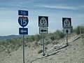
 Misplaced I-215 Shields - panoramio.jpg 1,600 × 1,200; 647 KB
-
 North US-189 (University Ave) with a Covered Shield - panoramio.jpg 1,600 × 1,200; 527 KB
-
 North US-189 With a Yet-to-be-Numbered Route Shield - panoramio.jpg 1,600 × 1,200; 668 KB
-
 North UT-147 Beginning where UT-141 Ends - panoramio.jpg 1,600 × 1,200; 538 KB
-
 Old Hidden I-215 Shield - panoramio.jpg 1,600 × 1,200; 1.09 MB
-
 Old UT-209 Milepost 6 - panoramio.jpg 1,600 × 1,200; 597 KB
-
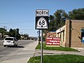 Solo UT-68 Shield, N from 7800 S - panoramio.jpg 1,600 × 1,200; 621 KB
-
 South UT-148 near Cedar Breaks - panoramio.jpg 1,600 × 1,200; 744 KB
-
 Updated UT-209 Milepost 10 - panoramio.jpg 1,600 × 1,200; 527 KB
-
 UT-111 at WB Old UT-48 (now UT-209) Shield - panoramio.jpg 1,600 × 1,200; 507 KB
-
 UT-111-EB Old UT-48 (New UT-209) Junction - panoramio.jpg 1,600 × 1,200; 617 KB
-
 UT-143 East near Mammoth Creek - panoramio.jpg 1,600 × 1,200; 654 KB
-
 UT-160-BL-15 North in Beaver - panoramio.jpg 1,600 × 1,200; 545 KB
-
 UT-198 at the South (or West) end of UT-115 in Payson - panoramio.jpg 1,600 × 1,200; 1.04 MB
-
 UT-209-210 Junction - panoramio.jpg 1,600 × 1,200; 504 KB
-
 UT-266 in Taylorsville - panoramio.jpg 1,600 × 1,200; 510 KB
-
 UT-68 Crossways at 14600 S (UT-140) - panoramio.jpg 1,600 × 1,200; 536 KB
-
 UT-68 Junction, UT-140 End - panoramio.jpg 1,600 × 1,200; 612 KB
-
 UT-68-140 Junction Assembly, Looking South - panoramio.jpg 1,600 × 1,200; 535 KB
-
 UT-68-171 Junction - panoramio.jpg 1,600 × 1,200; 556 KB
-
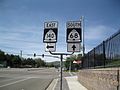
 UT-68-209 Junction, Looking South - panoramio.jpg 1,600 × 1,200; 769 KB
-
 UT-68-48 Implicit Duplex 1 - panoramio.jpg 1,600 × 1,200; 557 KB
-
 UT-68-48 Implicit Duplex 3 - panoramio.jpg 1,600 × 1,200; 558 KB
-
 UT-85 (Lehi's 2100 N) at Redwood Rd - panoramio.jpg 1,600 × 1,200; 660 KB
-
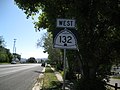 West UT-132 in Nephi - panoramio.jpg 1,600 × 1,200; 618 KB


_-_panoramio.jpg)

_with_a_Covered_Shield_-_panoramio.jpg)


_Shield_-_panoramio.jpg)
_Junction_-_panoramio.jpg)


_end_of_UT-115_in_Payson_-_panoramio.jpg)


_-_panoramio.jpg)


_at_Redwood_Rd_-_panoramio.jpg)
