Category:Photos from Panoramio ID 4805004
Jump to navigation
Jump to search

Pictures by Panoramio member JF Hobbs
Media in category "Photos from Panoramio ID 4805004"
The following 172 files are in this category, out of 172 total.
-
 A Bridge on the River Portneuf - panoramio.jpg 3,488 × 2,616; 3.71 MB
-
 A Deer - panoramio.jpg 2,312 × 1,400; 2.31 MB
-
 A High Meadow - panoramio.jpg 1,600 × 1,200; 1.96 MB
-
 A Hole in the Old Kraft Plant to Remove Equiptment - panoramio.jpg 1,600 × 1,200; 1.16 MB
-
 A Pool on the Portneuf - panoramio.jpg 3,444 × 2,523; 4.39 MB
-
 A Popular Climbing Place - panoramio.jpg 3,488 × 2,616; 2.84 MB
-
 A Very Old Cabin - panoramio.jpg 2,172 × 1,504; 2.58 MB
-
 Acoss Arbon Valley to the Deep Creek Range - panoramio.jpg 800 × 529; 346 KB
-
 Across Arbon Basin - panoramio (1).jpg 3,364 × 2,539; 4.85 MB
-
 Across Arbon Basin - panoramio.jpg 3,488 × 2,616; 3.93 MB
-
 Across the Bottoms - panoramio.jpg 3,420 × 1,532; 1.71 MB
-
 American Falls Reservoir - panoramio.jpg 3,488 × 2,616; 4.43 MB
-
 An Old Aggregate Mine - panoramio.jpg 3,432 × 2,455; 5.19 MB
-
 An Old Farm - panoramio.jpg 1,600 × 1,200; 1.45 MB
-
 Antiaircraft Gun - panoramio.jpg 3,488 × 2,616; 3.74 MB
-
 Approaching the Wapi - panoramio.jpg 3,488 × 2,616; 4.9 MB
-
 Aspen Grove - panoramio.jpg 1,600 × 1,200; 1.8 MB
-
 Bannock Creek - panoramio (1).jpg 3,488 × 2,616; 3.96 MB
-
 Bannock Creek - panoramio.jpg 3,376 × 2,495; 3.97 MB
-
 Bannock Creek in Flood - panoramio.jpg 3,488 × 2,616; 4.56 MB
-
 Basalt Wall - panoramio.jpg 3,488 × 2,616; 3.2 MB
-
 Batiste Spring - panoramio.jpg 3,488 × 2,616; 3.83 MB
-
 Birds - panoramio (1).jpg 1,600 × 1,200; 1.59 MB
-
 Birds on the Beach - panoramio.jpg 3,488 × 2,616; 4.77 MB
-
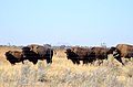 Bison - panoramio.jpg 3,013 × 1,977; 2.95 MB
-
 Blackrock Canyon - panoramio.jpg 3,488 × 2,616; 4.68 MB
-
 Blackrock Slopes - panoramio.jpg 3,488 × 2,616; 5.1 MB
-
 Bottomland - panoramio.jpg 2,482 × 1,578; 2.51 MB
-
 Bridge Over the Creek - panoramio.jpg 3,488 × 2,616; 3.89 MB
-
 Canal - panoramio (1).jpg 3,364 × 2,371; 3.65 MB
-
 Canal Passes Under the Interstate Here - panoramio.jpg 3,388 × 2,443; 4.01 MB
-
 Canyon Maples - panoramio.jpg 1,600 × 1,200; 1.78 MB
-
 Chesterfield - panoramio (1).jpg 1,600 × 1,200; 1.36 MB
-
 Chesterfield - panoramio.jpg 800 × 600; 474 KB
-
 Cliffs of Howard Mountain - panoramio.jpg 800 × 600; 414 KB
-
 Cove - panoramio.jpg 3,488 × 2,616; 5.47 MB
-
 Creek - panoramio (1).jpg 3,488 × 2,616; 3.58 MB
-
 Creek Crossing - panoramio.jpg 3,488 × 2,616; 6.51 MB
-
 Desert Elk - panoramio.jpg 1,600 × 1,200; 1.26 MB
-
 Desert Grasslands - panoramio.jpg 3,488 × 2,616; 3.84 MB
-
 Early Springtime Fields - panoramio.jpg 3,404 × 2,087; 4.84 MB
-
 East Fork Mink Creek - panoramio.jpg 800 × 600; 462 KB
-
 East to North Putnam Mountain - panoramio.jpg 3,488 × 2,616; 3.68 MB
-
 Edge of the Flow - panoramio.jpg 3,488 × 2,616; 6.09 MB
-
 Fallow Fields - panoramio.jpg 1,600 × 1,200; 1.22 MB
-
 Field - panoramio (1).jpg 3,488 × 2,616; 6 MB
-
 Field of Sunflowers - panoramio.jpg 1,600 × 1,200; 1.64 MB
-
 Fishing Hole - panoramio.jpg 1,600 × 1,200; 1.19 MB
-
 Flat River Bottoms - panoramio.jpg 2,484 × 1,818; 2.69 MB
-
 Flat Top - panoramio.jpg 3,488 × 2,616; 5.31 MB
-
 Fort Hall Monument - panoramio.jpg 3,488 × 2,616; 4.6 MB
-
 From the Oregon Trail Travelers Springs are Called Drinks - panoramio.jpg 3,488 × 2,616; 2.25 MB
-
 Frozen River - panoramio (1).jpg 1,600 × 1,200; 1.47 MB
-
 Full River - panoramio.jpg 3,488 × 2,616; 3.47 MB
-
 Garden Creek Gap - panoramio.jpg 3,352 × 2,524; 5.54 MB
-
 Gas Pipeline - panoramio (1).jpg 1,600 × 1,200; 1.6 MB
-
 Grasslands - panoramio.jpg 2,592 × 1,944; 1.96 MB
-
 Gravel Pit Pond - panoramio.jpg 3,488 × 2,616; 2.87 MB
-
 Great Southern Butte from Rainbow Beach - panoramio.jpg 822 × 617; 430 KB
-
 High Meadow - panoramio.jpg 800 × 600; 430 KB
-
 Hillside - panoramio.jpg 3,488 × 2,616; 4.31 MB
-
 Horseshoes Area - panoramio.jpg 3,488 × 2,616; 5.16 MB
-
 Howard Mountain - panoramio.jpg 1,600 × 1,200; 1.3 MB
-
 In the Brush - panoramio.jpg 3,488 × 2,616; 5.35 MB
-
 In the Distance is Ferry Butte - panoramio.jpg 2,592 × 1,944; 2.17 MB
-
 In the Junipers - panoramio.jpg 3,488 × 2,616; 6.75 MB
-
 Indian Graves - panoramio.jpg 3,488 × 2,616; 4.47 MB
-
 Inkom - panoramio.jpg 800 × 600; 485 KB
-
 Interstate 15 - panoramio.jpg 3,488 × 2,616; 4.47 MB
-
 ITD Salt Shed - panoramio.jpg 3,488 × 2,616; 1.92 MB
-
 Kinport from City Creek Road - panoramio.jpg 3,488 × 2,616; 4.75 MB
-
 Lagoon - panoramio.jpg 3,436 × 2,483; 4.05 MB
-
 Land of Carcasses - panoramio.jpg 1,696 × 1,332; 1.47 MB
-
 Lone Waterfowl - panoramio.jpg 2,460 × 1,788; 4.04 MB
-
 Looking over Wildhorse Mountain to Mink Creek - panoramio.jpg 3,488 × 2,616; 4.29 MB
-
 Looking South to Wildhorse Mountain - panoramio.jpg 800 × 600; 503 KB
-
 Looking West to Michaud Creek - panoramio.jpg 800 × 600; 513 KB
-
 Low Water - panoramio.jpg 2,592 × 1,944; 2.45 MB
-
 Meadow - panoramio (1).jpg 1,600 × 1,200; 1.54 MB
-
 Michaud Creek - panoramio.jpg 1,600 × 1,200; 2.05 MB
-
 Mist in the Hills - panoramio.jpg 3,488 × 2,616; 4.33 MB
-
 Molly's Nipple - panoramio (1).jpg 3,156 × 2,072; 2.57 MB
-
 Molly's Nipple - panoramio.jpg 3,000 × 2,004; 1.91 MB
-
 Moss on Lava - panoramio.jpg 3,488 × 2,616; 7.07 MB
-
 Nature Trail - panoramio.jpg 3,488 × 2,616; 5.99 MB
-
 North Fork - panoramio.jpg 3,000 × 2,172; 4.56 MB
-
 North Putnam Mountain - panoramio.jpg 1,600 × 1,200; 1.63 MB
-
 North to Pillar Butte - panoramio.jpg 3,363 × 2,469; 4.86 MB
-
 On a Gore - panoramio.jpg 3,488 × 2,616; 2.99 MB
-
 On Fish Creek Pass - panoramio.jpg 3,488 × 2,616; 3.51 MB
-
 On the Flow - panoramio.jpg 3,445 × 2,541; 5.71 MB
-
 On the Frozen Lake - panoramio.jpg 3,449 × 2,537; 4.4 MB
-
 On the Old Road - panoramio.jpg 3,488 × 2,616; 3.65 MB
-
 On the Overlook Above the River - panoramio.jpg 3,488 × 2,616; 3.61 MB
-
 On the Pedestrian Bridge - panoramio.jpg 3,488 × 2,616; 3.73 MB
-
 On Wildhorse Mountain above Michaud Creek - panoramio.jpg 3,488 × 2,616; 3.4 MB
-
 Passing through Rockland - panoramio.jpg 3,420 × 2,031; 3.56 MB
-
 Peak in the Deep Creek Range - panoramio.jpg 3,488 × 2,616; 3.81 MB
-
 Pillar Butte - panoramio.jpg 1,600 × 1,200; 1.25 MB
-
 Pillar Butte at the Heart of the Wapi - panoramio.jpg 3,488 × 2,616; 3.26 MB
-
 Pocatello - panoramio.jpg 800 × 600; 397 KB
-
 Portneuf Bottoms - panoramio.jpg 3,352 × 2,468; 5.42 MB
-
 Portneuf River - panoramio (1).jpg 1,557 × 1,116; 1.37 MB
-
 Portneuf River - panoramio (2).jpg 1,600 × 1,200; 1.55 MB
-
 Portneuf River - panoramio - JF Hobbs.jpg 3,488 × 2,616; 3.76 MB
-
 Portneuf River - panoramio.jpg 3,488 × 2,616; 3.46 MB
-
 Railroad - panoramio (2).jpg 1,600 × 1,200; 1.12 MB
-
 Rainbow Beach - panoramio (1).jpg 2,592 × 1,944; 2.57 MB
-
 Reflected in a Beautiful Spring is Simplot, Our Only Major Polluter - panoramio.jpg 3,488 × 2,616; 4.39 MB
-
 Riverbank - panoramio.jpg 3,316 × 2,312; 3.72 MB
-
 Rock Pile - panoramio.jpg 3,488 × 2,616; 4.48 MB
-
 Ross Fork - panoramio.jpg 3,380 × 2,435; 4.4 MB
-
 Sage in Arbon Valley - panoramio.jpg 3,488 × 2,616; 4.92 MB
-
 Sagebrush - panoramio.jpg 3,408 × 2,467; 6.65 MB
-
 Scout Mountain - panoramio (1).jpg 1,600 × 1,200; 1.47 MB
-
 Scout Mountain - panoramio.jpg 800 × 600; 463 KB
-
 Scout Mountain from the Last Gate - panoramio.jpg 3,488 × 2,616; 2.79 MB
-
 Scout Mountain from the Performing Arts Center - panoramio.jpg 3,360 × 2,312; 2.6 MB
-
 Scout Mountain Scenic Overlook - panoramio.jpg 800 × 600; 374 KB
-
 Shore - panoramio.jpg 2,592 × 1,944; 2.36 MB
-
 Sign - panoramio (1).jpg 1,590 × 1,060; 1.07 MB
-
 South Grotto Spatter Cone - panoramio.jpg 3,352 × 2,479; 4.02 MB
-
 South Shore - panoramio.jpg 3,408 × 2,439; 3.68 MB
-
 South to Howard Mountain - panoramio.jpg 3,484 × 1,420; 1.67 MB
-
 South to Marsh Valley - panoramio.jpg 1,600 × 1,200; 1.41 MB
-
 South to Pocatelloland - panoramio.jpg 3,436 × 1,615; 2.78 MB
-
 South to the Mountains above Pocatello - panoramio.jpg 3,000 × 1,460; 1.78 MB
-
 Spring Wildflowers - panoramio.jpg 1,600 × 1,200; 1.6 MB
-
 Steam From the Warmer Spring Water - panoramio.jpg 3,488 × 2,616; 3.19 MB
-
 Still Water - panoramio.jpg 2,448 × 1,507; 2.01 MB
-
 Stone Structure - panoramio (1).jpg 3,488 × 2,616; 4.4 MB
-
 Sulphur Springs - panoramio.jpg 800 × 600; 467 KB
-

-
 The Bridge Over Clear Creek - panoramio.jpg 3,388 × 1,904; 2.23 MB
-
 The Bubbling Pond at Sulphur Springs - panoramio.jpg 3,488 × 2,616; 5.02 MB
-
 The Centicone - panoramio.jpg 3,336 × 2,328; 5.23 MB
-
 The Gap - panoramio (1).jpg 2,748 × 1,376; 1.64 MB
-
 The Great Southern Butte 1 - panoramio.jpg 1,600 × 1,200; 977 KB
-
 The Great Southern Butte 2 - panoramio.jpg 1,600 × 1,200; 1.04 MB
-
 The Great Southern Butte 3 - panoramio.jpg 1,600 × 1,200; 997 KB
-
 The Horses that Once Lived Here - panoramio.jpg 1,600 × 1,200; 1.09 MB
-
 The Lake - panoramio (1).jpg 3,465 × 2,569; 4.4 MB
-
 The Mounted F101 Voodoo - panoramio.jpg 2,153 × 1,179; 1.24 MB
-
 The Old Emerson School - panoramio.jpg 1,600 × 1,200; 1.46 MB
-
 The Old Mine - panoramio.jpg 1,600 × 1,200; 1.37 MB
-
 The Peak - panoramio (1).jpg 3,488 × 2,616; 3.89 MB
-
 The Pond at Elk Meadows - panoramio.jpg 800 × 553; 543 KB
-
 The Pond on the Old Stagecoach Road - panoramio.jpg 3,420 × 2,483; 4.73 MB
-
 The Portneuf Drinks - panoramio.jpg 3,488 × 2,616; 2.76 MB
-
 The Portneuf River - panoramio.jpg 3,392 × 2,423; 2.97 MB
-
 The Road Up Howard Mountain - panoramio.jpg 800 × 600; 352 KB
-
 The Road up the Butte - panoramio.jpg 1,600 × 1,200; 1.19 MB
-
 The Wapi Lava Flow - panoramio.jpg 3,433 × 2,457; 5.55 MB
-
 The West Fork of Michaud Creek - panoramio.jpg 1,600 × 1,200; 1.77 MB
-
 Three Trains - panoramio.jpg 3,392 × 2,119; 3.23 MB
-
 Trail Creek - panoramio.jpg 800 × 520; 302 KB
-
 Turn Left to Lariat Cave - panoramio.jpg 800 × 600; 441 KB
-
 Underpass - panoramio - JF Hobbs.jpg 3,275 × 2,257; 2.03 MB
-
 Up Blackrock - panoramio.jpg 1,600 × 1,200; 1.26 MB
-
 Water in the Desert, at the Bottom of King's Bowl is the Crystal Pool - panoramio.jpg 3,227 × 2,441; 6.22 MB
-
 Waterfall on the Portneuf - panoramio.jpg 3,488 × 2,616; 4.97 MB
-
 Waterhole - panoramio.jpg 1,600 × 1,200; 1.27 MB
-
 West from Wildhorse Mountain to the Wheatgrass Hills - panoramio.jpg 800 × 600; 356 KB
-
 Wetland - panoramio.jpg 3,006 × 2,172; 4.37 MB
-
 Wetland Paradise - panoramio.jpg 2,556 × 1,839; 2.72 MB
-
 Wheatgrass Hills - panoramio.jpg 1,600 × 1,200; 1.6 MB
-
 Where this Creek Meets the Portneuf is Where the Old Indian Camp Was - panoramio.jpg 3,488 × 2,616; 3.58 MB
-
 Wier - panoramio.jpg 1,600 × 1,200; 1.38 MB
-
 Wild Iris Grows Along the Portneuf River - panoramio.jpg 3,488 × 2,616; 4.61 MB
-
 Wildflowers in the Desert - panoramio.jpg 1,600 × 1,200; 1.4 MB
-
 Wildflowers on the Montain - panoramio.jpg 3,488 × 2,616; 5.58 MB
-
 Wildflowers on the Mountain - panoramio.jpg 800 × 600; 418 KB


.jpg)


.jpg)


.jpg)


.jpg)


.jpg)


.jpg)


.jpg)


.jpg)


.jpg)


.jpg)


.jpg)


.jpg)
.jpg)


.jpg)
.jpg)


.jpg)


.jpg)


.jpg)


.jpg)


.jpg)


.jpg)


