Category:Photos from Panoramio ID 4259470
Jump to navigation
Jump to search

Media in category "Photos from Panoramio ID 4259470"
The following 48 files are in this category, out of 48 total.
-
 360 degrees vista from Kaka Hill trig (annotated) - panoramio.jpg 7,239 × 684; 1.68 MB
-
 Awapoto Hut and Moa Park Inland Track intersection - panoramio.jpg 1,024 × 768; 723 KB
-
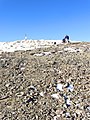
 Beach erosion at Ngaroma - panoramio.jpg 1,024 × 768; 214 KB
-
 Ben Nevis - north and east faces - panoramio.jpg 768 × 1,024; 470 KB
-
 Ben Nevis summit - north face - panoramio.jpg 768 × 1,024; 485 KB
-
 Ben Nevis summit - west face - panoramio.jpg 768 × 1,024; 559 KB
-
 Buller River stop bank near Murchison - panoramio.jpg 1,024 × 768; 490 KB
-
 Buller River, Kawatiri - panoramio.jpg 961 × 657; 432 KB
-
 Buxton Camp at Gore Bay - panoramio.jpg 1,024 × 768; 326 KB
-
 Buxton Creek, Gore Bay - panoramio - nut.in.a.hut.jpg 1,024 × 768; 430 KB
-
 Buxton Creek, Gore Bay - panoramio.jpg 768 × 1,024; 439 KB
-
 Cape Farewell - northern most tip of South Island - panoramio.jpg 1,024 × 768; 387 KB
-
 Cape Farewell - panoramio.jpg 1,024 × 768; 512 KB
-
 Cape Farewell - tourist viewing platform - panoramio.jpg 1,024 × 768; 479 KB
-
 Cape Farewell from Pillar Point - panoramio.jpg 1,024 × 768; 378 KB
-
 DOC sign on track to the historic Chromite Mine - panoramio.jpg 1,024 × 768; 447 KB
-
 DOC sign with walking times in several directions - panoramio.jpg 1,024 × 768; 621 KB
-
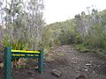
 DOC sign with walking times into the Hacket area - panoramio.jpg 1,024 × 768; 681 KB
-
 Druggans Dam reservoir - panoramio.jpg 1,024 × 766; 214 KB
-
 Dry River at start of Rawhiti Cave track climb - panoramio.jpg 1,024 × 768; 651 KB
-
 Failing seawall erosion protection - panoramio.jpg 1,024 × 768; 463 KB
-
 Farewell Spit from Knuckle Hill - panoramio.jpg 1,024 × 768; 264 KB
-
 Farewell Spit from Pillar Point - panoramio.jpg 1,024 × 768; 401 KB
-
 Haumuri Bluffs on Claverley Beach - panoramio.jpg 1,024 × 768; 377 KB
-
 Johnson Creek, Murchison - panoramio.jpg 768 × 1,024; 648 KB
-
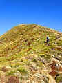
 Kaka Hill as seen from Supplejack Lookout - panoramio.jpg 1,024 × 768; 369 KB
-
 Kayaks on Matakitaki river, Murchison - panoramio.jpg 1,024 × 768; 482 KB
-
 Knuckle Hill trig - panoramio.jpg 1,024 × 768; 398 KB
-
 Lake Chalice at sunrise - panoramio.jpg 768 × 1,024; 227 KB
-
 Lake Chalice Hut - panoramio - nut.in.a.hut.jpg 1,024 × 768; 450 KB
-
 Lake Chalice Hut - panoramio.jpg 1,024 × 768; 497 KB
-
 Mt Patriarch from SH63 - panoramio.jpg 1,024 × 768; 340 KB
-
 Mts Rintoul, Richmond, Fell and Fishtail from Gibbs Spur - panoramio.jpg 1,024 × 768; 338 KB
-
 Nelson City - panoramio.jpg 1,024 × 768; 338 KB
-
 Pillar Point lighthouse - panoramio.jpg 1,024 × 793; 393 KB
-

-
 Railway Tunnel near Claverley - panoramio.jpg 1,024 × 768; 503 KB
-
 Rawhiti Cave interior - panoramio.jpg 1,024 × 768; 404 KB
-
 Rawhiti Cave mouth as seen from inside - panoramio.jpg 1,024 × 768; 261 KB
-
 Rawhiti Cave stalagtites in the entrance - panoramio.jpg 1,024 × 768; 356 KB
-
 Restored waterrace at Pupu Valley Historic Power Station - panoramio.jpg 768 × 1,024; 640 KB
-
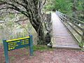
 Salisbury Bridge over Aorere River - panoramio.jpg 768 × 1,024; 419 KB
-
 Sign at Rawhiti Cave parking area - panoramio.jpg 768 × 1,024; 505 KB
-
 Titirangi Bay, Marlborough - panoramio.jpg 1,024 × 768; 279 KB
-
 View of Nelson City from Kaka Hill trig - panoramio.jpg 1,024 × 556; 362 KB
-
 Wairau Wash bridge - panoramio.jpg 1,024 × 768; 523 KB
-
 Wairoa River in Wairoa Gorge - panoramio.jpg 1,024 × 768; 588 KB
-
 Whanganui Inlet from Knuckle Hill - panoramio.jpg 1,024 × 768; 326 KB


_-_historic_but_active_after_restoration_-_panoramio.jpg)


_-_panoramio.jpg)