Category:Photos from Panoramio ID 3144111
Jump to navigation
Jump to search

Media in category "Photos from Panoramio ID 3144111"
The following 174 files are in this category, out of 174 total.
-
 Acantilados - panoramio (1).jpg 2,652 × 1,604; 747 KB
-
 Adobe - panoramio.jpg 5,448 × 3,252; 4.37 MB
-
 Agua brilla en la noche - panoramio.jpg 3,648 × 2,736; 971 KB
-
 Agua clara - panoramio.jpg 5,812 × 3,216; 3.01 MB
-
 Aguada - panoramio.jpg 3,727 × 8,531; 6.06 MB
-
 Al atardecer - panoramio.jpg 2,848 × 2,144; 1.54 MB
-
 Alfredo Mémoli - panoramio.jpg 2,736 × 3,648; 2.85 MB
-
 Algo fresco despues del cerro - panoramio.jpg 2,848 × 2,144; 1.51 MB
-
 Amanece en la pampa de los ñangos - panoramio.jpg 8,710 × 3,176; 2.66 MB
-
 Amanecer en la pampa - panoramio.jpg 3,319 × 5,083; 2.58 MB
-
 Antigua parada de trenes - panoramio.jpg 2,144 × 2,848; 1.52 MB
-
 Arbol - panoramio (4).jpg 3,000 × 1,751; 932 KB
-
 Arbolada - panoramio (1).jpg 3,631 × 2,929; 1.99 MB
-
 Arbolada qda Agua de la Falda - panoramio.jpg 7,151 × 3,500; 5.72 MB
-
 Arcilllas multicolores - panoramio.jpg 5,480 × 2,992; 2.92 MB
-
 Arena - panoramio (10).jpg 3,648 × 2,736; 1.68 MB
-
 Arriba de la qda guamparito - panoramio.jpg 6,310 × 3,199; 3.19 MB
-
 Arroyo - panoramio (4).jpg 2,542 × 4,418; 2.24 MB
-
 Atahualpa - panoramio.jpg 3,648 × 2,736; 3.65 MB
-
 Baipass hacia pto tres quebradas - panoramio.jpg 3,648 × 2,736; 3.71 MB
-
 Bajada al sendero medio - panoramio.jpg 6,370 × 3,497; 3.91 MB
-
 Bosque de álamos - panoramio.jpg 3,648 × 2,736; 3.2 MB
-
 Brown - panoramio (1).jpg 3,648 × 2,736; 3.07 MB
-
 C alfalfa - panoramio.jpg 5,670 × 3,152; 5.05 MB
-
 Cabras - panoramio (1).jpg 3,648 × 2,736; 3.54 MB
-
 Camino desde el pajarito - panoramio.jpg 2,736 × 3,648; 3.53 MB
-
 Camino hacia el puesto - panoramio.jpg 3,648 × 2,736; 3.38 MB
-
 Capilla santa teresa de los andes - panoramio.jpg 2,144 × 2,848; 1.51 MB
-
 Cara este - panoramio.jpg 3,304 × 1,268; 727 KB
-
 Cara sur cerro de la gloria - panoramio.jpg 9,662 × 3,677; 4.62 MB
-
 Cascadas - panoramio (1).jpg 5,315 × 2,991; 4.84 MB
-
 Cazador de sueños - panoramio.jpg 2,736 × 3,648; 2.51 MB
-
 Cerro Del Fierro, estación Parametrica - panoramio.jpg 2,736 × 3,648; 2.38 MB
-
 Challao pedemonte - panoramio.jpg 1,629 × 484; 631 KB
-
 Chimeneas - panoramio (1).jpg 2,736 × 3,648; 2.15 MB
-
 Churrasquera de vila - panoramio.jpg 4,345 × 2,795; 1.4 MB
-
 Clavos para rapel - panoramio.jpg 3,421 × 1,838; 2.06 MB
-
 Colinas doradas - panoramio.jpg 5,000 × 1,910; 3.69 MB
-
 Contraste - panoramio (5).jpg 4,000 × 3,000; 4.79 MB
-
 Cornelio - panoramio.jpg 2,144 × 2,848; 1.33 MB
-
 Corral - panoramio (5).jpg 3,648 × 2,736; 2.06 MB
-
 Corral techado - panoramio.jpg 7,705 × 3,579; 5.16 MB
-
 Cortaderas - panoramio.jpg 2,736 × 3,648; 4.59 MB
-
 Cortaderas y cajones - panoramio.jpg 6,693 × 3,109; 5 MB
-
 Cosas que pasan al ras del piso - panoramio.jpg 3,648 × 2,736; 3.62 MB
-
 Cuchas en las chacritas - panoramio.jpg 6,615 × 2,205; 5.47 MB
-
 Cumbre del C° de las Aguilas - panoramio.jpg 4,000 × 3,000; 4.59 MB
-
 C° de las Águilas - panoramio.jpg 6,292 × 2,545; 2.75 MB
-
 C° Pelado y el Diablo desde R52 - panoramio.jpg 4,900 × 2,495; 1.3 MB
-
 Denmoza rhodacantha - panoramio.jpg 1,417 × 941; 786 KB
-
 Desierto - panoramio (1).jpg 4,000 × 3,000; 4.7 MB
-
 Division del camino - panoramio.jpg 5,000 × 2,621; 5.51 MB
-
 Donde se posan los jotes - panoramio.jpg 11,493 × 4,218; 8.14 MB
-
 Dunas - panoramio (8).jpg 3,000 × 1,128; 275 KB
-
 El salto - panoramio.jpg 3,648 × 2,736; 4.92 MB
-
 El sauro tirano - panoramio.jpg 5,224 × 1,944; 5.62 MB
-
 Emiliano y pablo - panoramio.jpg 3,648 × 2,736; 3.33 MB
-
 En el puente - panoramio (1).jpg 2,736 × 3,648; 3.51 MB
-
 Entrada a la mina de cobre - panoramio.jpg 2,000 × 1,500; 421 KB
-
 Entrando a la pampa de los ñangos - panoramio.jpg 7,967 × 3,539; 3.56 MB
-
 Escala humana del tanque - panoramio.jpg 3,648 × 2,736; 3.72 MB
-
 Escudo de la ciudad de Mendoza - panoramio.jpg 2,848 × 2,144; 1.36 MB
-
 Esquivando rocas - panoramio.jpg 2,736 × 3,648; 2.76 MB
-
 Estación abandonada - panoramio.jpg 2,848 × 2,144; 1.52 MB
-
 Estereotipo de indio - panoramio.jpg 2,736 × 3,648; 2.92 MB
-
 Exposición La Brujula - panoramio.jpg 3,000 × 964; 930 KB
-
 Fabrica minetti desde el cerro arco - panoramio.jpg 3,648 × 2,736; 1.9 MB
-
 Falla - panoramio (1).jpg 5,011 × 3,421; 2.73 MB
-
 Falla - panoramio.jpg 5,147 × 2,868; 4.53 MB
-
 Falla geologica con betuminosa - panoramio.jpg 5,775 × 3,455; 3.78 MB
-
 Ferro - panoramio.jpg 3,000 × 2,731; 1.98 MB
-
 Filo molesto - panoramio.jpg 4,653 × 3,215; 1.94 MB
-
 Filos podridos - panoramio.jpg 5,843 × 3,480; 3.02 MB
-
 Fin qda de los gateados - panoramio.jpg 2,736 × 3,648; 3.19 MB
-
 Formaciones - panoramio.jpg 4,000 × 3,000; 4.82 MB
-
 Formaciones rocosas - panoramio (1).jpg 5,695 × 2,657; 4.14 MB
-
 Formaciones rocosas - panoramio (2).jpg 4,322 × 2,646; 2.48 MB
-
 Formación cacheuta - panoramio.jpg 6,231 × 3,559; 4.15 MB
-
 Fuente de los Continentes - panoramio - Pablo Nazareno Alvar….jpg 2,848 × 2,144; 1.5 MB
-
 Gordini - panoramio.jpg 4,000 × 3,000; 4.69 MB
-
 Gordini abandonado - panoramio.jpg 4,000 × 3,000; 5.09 MB
-
 Grupo ecosenderismo de lujan - panoramio.jpg 4,191 × 4,962; 2.07 MB
-
 Grutas - panoramio (1).jpg 3,507 × 4,458; 4.37 MB
-
 Hornero - panoramio.jpg 3,000 × 870; 394 KB
-
 Horno - panoramio (2).jpg 2,632 × 6,308; 2.08 MB
-
 Hotelería del Los Penitentes - panoramio.jpg 2,848 × 2,144; 1.51 MB
-
 Huellas de motocroos - panoramio.jpg 4,000 × 3,000; 4.95 MB
-
 Inca - panoramio.jpg 2,848 × 2,144; 1.55 MB
-
 Inicio de la qda - panoramio.jpg 2,736 × 3,648; 2.71 MB
-
 Inicio qda del salto - panoramio.jpg 6,927 × 3,525; 5.18 MB
-
 Invernadero - panoramio.jpg 5,550 × 2,964; 2.75 MB
-
 Lago no tan seco - panoramio.jpg 7,246 × 2,677; 2.59 MB
-
 Lago temporal - panoramio.jpg 3,000 × 4,000; 1.37 MB
-
 Limpieza del lago - panoramio.jpg 3,648 × 2,736; 2.97 MB
-
 Luján de Cuyo, Mendoza, Argentina - panoramio.jpg 2,144 × 2,848; 1.52 MB
-
 Manada de guanacos - panoramio.jpg 2,736 × 3,648; 2.76 MB
-
 Mapa devisadero largo - panoramio.jpg 3,648 × 2,736; 2.65 MB
-
 Mara pastando - panoramio.jpg 3,648 × 2,736; 3.98 MB
-
 Mendoza, Capital Department, Mendoza Province, Argentina - panoramio.jpg 2,144 × 2,848; 1.5 MB
-
 Mini Cristo Redentor - panoramio.jpg 2,144 × 2,848; 1.5 MB
-
 Mini siete colores - panoramio.jpg 3,648 × 2,736; 3.23 MB
-
 Mira la atala - panoramio.jpg 2,736 × 3,648; 3.57 MB
-
 Mirador geologico - panoramio.jpg 3,648 × 2,736; 3.19 MB
-
 Mirador geológico preco - panoramio.jpg 3,648 × 2,736; 3.17 MB
-
 Mirador La Atala - panoramio.jpg 3,433 × 2,618; 2.02 MB
-
 Mogote de la guanaca - panoramio.jpg 2,736 × 3,648; 2.89 MB
-
 Monumento en el parque aborigen - panoramio.jpg 2,144 × 2,848; 1.52 MB
-
 Noche en el lago del parque General San Martín - panoramio.jpg 1,759 × 1,261; 423 KB
-
 Nocturna plaza San Martin - panoramio.jpg 2,848 × 2,144; 1.51 MB
-
 Olas de Potrerillos - panoramio.jpg 2,848 × 2,144; 1.52 MB
-
 OVNI en panorámica de cacheuta - panoramio.jpg 4,944 × 1,328; 1.48 MB
-
 Paisaje - panoramio (12).jpg 3,000 × 4,000; 4.14 MB
-
 Panorama rugoso - panoramio.jpg 9,848 × 2,524; 2.94 MB
-
 Panoramica desde el pajarito - panoramio.jpg 9,550 × 3,628; 3.7 MB
-
 Panorámica hacia el oeste - panoramio.jpg 8,112 × 4,587; 5.8 MB
-
 Panorámica Norte de Los Penitentes - panoramio.jpg 5,120 × 1,328; 1.71 MB
-
 Panorámica Sur de Los Penitentes - panoramio.jpg 5,104 × 1,328; 1.57 MB
-
 Para escalada - panoramio.jpg 5,039 × 3,785; 2.76 MB
-
 Pared natural - panoramio.jpg 2,736 × 3,648; 3.99 MB
-
 Paredes de rocas - panoramio.jpg 2,604 × 3,495; 2.75 MB
-
 Paredón de practica - panoramio.jpg 2,736 × 3,648; 3.42 MB
-
 Parque aborigen 1 - panoramio.jpg 2,579 × 462; 1.2 MB
-
 Parque aborigen 2 - panoramio.jpg 669 × 1,422; 1 MB
-
 Pequeñacascada - panoramio.jpg 6,526 × 2,452; 2.67 MB
-
 Pichiciego - panoramio.jpg 3,648 × 2,736; 2.2 MB
-
 Playa san agustin - panoramio.jpg 4,607 × 2,392; 1.4 MB
-
 Plaza Independencia en invierno - panoramio.jpg 2,144 × 2,848; 1.52 MB
-
 Pto Rincon de guamparito - panoramio.jpg 6,104 × 3,315; 2.32 MB
-
 Puente de madera - panoramio (2).jpg 2,736 × 3,648; 4.2 MB
-
 Puente ferro - panoramio.jpg 6,569 × 2,474; 3.78 MB
-
 Puma en las rocas - panoramio.jpg 2,736 × 3,648; 1.57 MB
-
 Puma entre los cactus - panoramio.jpg 3,648 × 2,736; 4.01 MB
-
 Qda. Agua de la Falda - panoramio.jpg 2,736 × 3,648; 4.24 MB
-
 Quebrada - panoramio (1).jpg 3,000 × 1,808; 2.04 MB
-
 Quebrada al yaretas - panoramio.jpg 6,843 × 2,407; 3.77 MB
-
 Quebrada del Durazno - panoramio.jpg 2,848 × 2,144; 1.53 MB
-
 Reconstrucción del Puente Picheuta - panoramio.jpg 2,848 × 2,144; 1.52 MB
-
 Recordatorio - panoramio.jpg 3,648 × 2,736; 2.19 MB
-
 Refugio - panoramio (2).jpg 2,736 × 3,648; 3.65 MB
-
 Refugio - panoramio (3).jpg 5,081 × 3,294; 4.45 MB
-
 Relincho - panoramio.jpg 1,170 × 1,560; 691 KB
-
 Representación del histórico tajamar - panoramio.jpg 2,144 × 2,848; 1.5 MB
-
 Rinas 2 - panoramio.jpg 3,648 × 2,736; 3.42 MB
-
 Rio blanco y puente - panoramio.jpg 2,736 × 3,648; 3.92 MB
-
 Rio Seco - panoramio.jpg 4,000 × 3,000; 4.8 MB
-
 Rio seco C° Arco - panoramio.jpg 4,058 × 3,409; 2.15 MB
-
 Romantico paisaje del Parque Central - panoramio.jpg 2,848 × 2,144; 1.5 MB
-
 Ruinas - panoramio (17).jpg 3,648 × 2,736; 3.17 MB
-
 Ruinas 3 - panoramio.jpg 2,736 × 3,648; 3.08 MB
-
 Ruinas ferro - panoramio.jpg 3,648 × 2,736; 3.96 MB
-
 Ruinas La Atala - panoramio.jpg 3,493 × 5,654; 4.08 MB
-
 Ruinas mineras - panoramio.jpg 4,780 × 2,462; 2.48 MB
-
 Ruptura del paisaje con agua - panoramio.jpg 2,848 × 2,144; 1.52 MB
-
 Ruta vieja - panoramio.jpg 4,000 × 3,000; 4.91 MB
-
 Salida nocturna - panoramio.jpg 2,337 × 3,396; 819 KB
-
 Salitre - panoramio (1).jpg 2,736 × 3,648; 2.44 MB
-
 San Rafael Department, Mendoza Province, Argentina - panoramio - Pablo Nazareno Alvar….jpg 2,848 × 2,144; 1.51 MB
-
 San Rafael Department, Mendoza Province, Argentina - panoramio.jpg 2,144 × 2,848; 1.5 MB
-
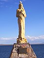 Stella maris - panoramio.jpg 2,144 × 2,848; 1.52 MB
-
 Surtiente - panoramio.jpg 4,800 × 3,388; 2.66 MB
-
 Tanque de agua - panoramio (4).jpg 6,205 × 6,004; 5.28 MB
-
 Todo Mendoza de noche - panoramio.jpg 1,529 × 474; 315 KB
-
 Trail a R13 - panoramio.jpg 3,648 × 2,736; 2.71 MB
-
 Valle Uspallata - panoramio.jpg 4,000 × 3,000; 4.73 MB
-
 Vendimia01 - panoramio.jpg 3,664 × 2,748; 2.52 MB
-
 Ventilación de la mina - panoramio.jpg 2,736 × 3,648; 3.54 MB
-
 Vista de la pampa de los ñangos - panoramio.jpg 6,795 × 3,472; 4.01 MB
-
 Vista desde la otra costa - panoramio.jpg 2,736 × 3,648; 2.06 MB
-
 Vizcacha - panoramio.jpg 2,736 × 3,648; 2.29 MB
-
 Viñedo frente al C Bayo - panoramio.jpg 5,135 × 2,361; 3.1 MB
-
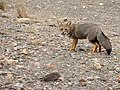
 Zorro gris cruzando canota - panoramio.jpg 1,587 × 2,115; 1.87 MB
-
 Zorro gris en Canota - panoramio.jpg 2,532 × 1,602; 3.25 MB
-
 Zorro gris en el monumento Canota - panoramio.jpg 2,688 × 2,016; 3.69 MB
-
 Zorro Rojo - panoramio.jpg 6,094 × 2,632; 5.62 MB
.jpg)


.jpg)
.jpg)


.jpg)

.jpg)


.jpg)

.jpg)


.jpg)


.jpg)


.jpg)

.jpg)


.jpg)


.jpg)


.jpg)


.jpg)
.jpg)


.jpg)
.jpg)


.jpg)


.jpg)


.jpg)


.jpg)
.jpg)


.jpg)


.jpg)


.jpg)


.jpg)