Category:Photographs taken on 1959-06-01
Jump to navigation
Jump to search
| Photographs of the previous week | · | Photographs of the previous day | ← | 1959-06-01 | → | Photographs of the next day | · | Photographs of the next week |
| 25 | · | 26 | · | 27 | · | 28 | · | 29 | · | 30 | · | 31 | · | 1 | · | 2 | · | 3 | · | 4 | · | 5 | · | 6 | · | 7 | · | 8 |

Photographs taken on June 1, 1959.
Files or subcategories can be added here using a direct categorization tag. Image files can be categorized here also automatically using {{Taken on}} template.
Subcategories
This category has the following 3 subcategories, out of 3 total.
Media in category "Photographs taken on 1959-06-01"
The following 61 files are in this category, out of 61 total.
-
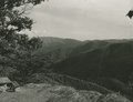 20 Minute Cliff Overlook (f286394c87e649b09c60de8f823298e6) (cropped).tif 1,397 × 1,076; 4.3 MB
-
 20 Minute Cliff Overlook (f286394c87e649b09c60de8f823298e6).tif 2,448 × 1,557; 10.91 MB
-
 8 miles to Rocky Knob sign (0f00c5717c574807a7580653137d1837).tif 2,448 × 1,557; 10.91 MB
-
 Adney Gap from Parkway (0bec101096144469a03244c72f858e12) (cropped).tif 1,399 × 1,119; 4.48 MB
-
 Adney Gap from Parkway (0bec101096144469a03244c72f858e12).tif 2,470 × 1,567; 11.08 MB
-
 Adney Gap from Parkway (9152c421b11a4359a3613011dd623ad6).tif 2,470 × 1,567; 11.08 MB
-

-
 Along the Blue Ridge from the Bald Mountain Area (9bce21f2a43a4161a165705d88e2a099).tif 2,448 × 1,567; 10.98 MB
-
 Approach from north towards Mabry Mill (2576ef86dcfe45e1886ebea49f248dbd).tif 2,461 × 1,560; 11.41 MB
-

-

-
 Bluff Mountain Tunnel (bed0954058234b1cb4c00e7221ac2cdb) (cropped).tif 1,406 × 1,128; 4.54 MB
-
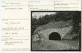 Bluff Mountain Tunnel (bed0954058234b1cb4c00e7221ac2cdb).tif 2,448 × 1,567; 10.98 MB
-
 Car driving down Parkway near Milepost 100 (5976b9ade33443578ef9617e3641a4ee) (cropped).tif 1,408 × 1,100; 4.43 MB
-
 Car driving down Parkway near Milepost 100 (5976b9ade33443578ef9617e3641a4ee).tif 2,474 × 1,571; 11.13 MB
-
 Car on Parkway near Lancaster Farm (3b3ee7d3a4f4408bad5d36e803c5ed02) (cropped).tif 1,410 × 1,129; 4.56 MB
-
 Car on Parkway near Lancaster Farm (3b3ee7d3a4f4408bad5d36e803c5ed02).tif 2,470 × 1,567; 11.08 MB
-

-

-

-

-

-

-

-
 Deck reinforcement - bridge south of Roanoke (43f7e87b94f445d28bff0411d05a7837).tif 2,474 × 1,567; 11.1 MB
-
 Five-car road accident in Caernarfon (17214730909).jpg 600 × 468; 180 KB
-
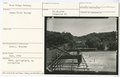
 James River Bridge during construction (5b1000edac0f47849225079e8f55cb9e).tif 2,448 × 1,567; 10.98 MB
-
 James River Bridge during construction (608734f5ae86430d921cd8558ae80ea3).tif 2,448 × 1,567; 10.98 MB
-
 James River Bridge with "Mission 66" sign (b8e9cd53d02c47b29ab0e689bf8d4513).tif 2,448 × 1,567; 10.98 MB
-
 James River Bridge with "Mission 66" sign (ef024d7a7aa74aafa0410e5bbf328f11).tif 2,448 × 1,567; 10.98 MB
-

-
 Looking north near Milepost 90 (d3760239720e413f903fb8a1e2f65ff0).tif 2,474 × 1,571; 11.13 MB
-
 Looking north near Peaks of Otter Lodge (2a4edfae2bcb4f99b69b629dddafd949).tif 2,474 × 1,571; 11.13 MB
-
 Mabry Mill Restaurant and Parking Area (a73b53aad4db49b89a77e0a9c12929a9).tif 2,448 × 1,557; 10.91 MB
-
 Mabry Mill, Milepost 176, Blue Ridge Parkway (2ee4365e38e9476a811b1491d95f0697).tif 2,461 × 1,560; 11.41 MB
-
 Mabry Mill, Milepost 176.2, Blue Ridge Parkway (63c0e05c4e8f4fd785404bee7c8aab49).tif 2,448 × 1,557; 10.91 MB
-
 Men on deck reinforcement of Roanoke River Bridge (593c8495d2424aa28d1ffedb69e423d2).tif 2,474 × 1,567; 11.1 MB
-
 Milepost 62. From the NPS, Springfield, VA Collection (4358d001d6424d14b65b6c6df6686ff7).tif 2,448 × 1,567; 10.98 MB
-
 Milepost 62. From the NPS, Springfield, VA Collection (babd1085c90d43eeb760d889a47a30e9).tif 2,448 × 1,567; 10.98 MB
-
 Near Milepost 170, from NPS, Springfield, VA Collection (b72cd54288b24e18bea5c403c47d77d3).tif 2,448 × 1,557; 10.91 MB
-
 NPS Director Conrad Wirth (b4b808ddedcc4a6c8efb05a5a02ca0dd).jpg 7,859 × 5,219; 1.83 MB
-
 Parking near Mabry Mill (03ba8e3efd9a428f90813eacbb00c9b3).tif 2,461 × 1,560; 11.41 MB
-
 Parkway near Milepost 100 (b503c43e754e4e1b83398ed6668cc290).tif 2,474 × 1,571; 11.13 MB
-
 Parkway near Puckett Cabin (58d3ab96976e45cbb0176bc60daa3580).tif 2,448 × 1,557; 10.91 MB
-
 Parkway near Rock Castle Gorge Parking Overlook (01b7101ee4fe4cb9916e3026a2d2f766).tif 2,448 × 1,557; 10.91 MB
-
 Parkway not yet opened near James River (2a2ecb70ffc04cf99cdc5947d73d330d).tif 2,448 × 1,567; 10.98 MB
-
 Parkway sign near Milepost 90 (4b4f59c4329e45728242fbe184526f96).tif 2,474 × 1,571; 11.13 MB
-
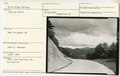
 Parkway south of Peaks of Otter (312ec560673c4365a180e497692bfa10).tif 2,448 × 1,557; 10.91 MB
-
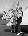 Pat and Shirley Boone and children at airport, 1959.jpg 3,507 × 4,393; 8.45 MB
-
 Peaks of Otter Visitor Center (0c7a77e998f7434c9d6dec322b2eff10).tif 2,474 × 1,571; 11.13 MB
-
 Pond just North of James River (9ac2eaabd41b44e1906f99dbcb75c2d2).tif 2,448 × 1,567; 10.98 MB
-
 Porch, VD hospital (3595196925).jpg 750 × 959; 188 KB
-
 Sharp Top Mountain from Peaks of Otter (096857dacf204a4c811a374bbd7f560f).tif 2,470 × 1,545; 10.93 MB
-
 Sign showing 5 Miles to Peaks of Otter (451e5666858f4be39d99552b9cb8f2ff).tif 2,474 × 1,571; 11.13 MB
-
 Site of visitor area before construction (d2054fd8664a4783944e55b7c0b2998e).tif 2,448 × 1,567; 10.98 MB
-

-
 View near Sharp Top Mountain sign (7b48f08f724c4eb08007bb6959071fa7).tif 2,474 × 1,571; 11.13 MB
-
 View of Parkway near Chestnut Cove Parking Overlook (09c0b03f2e3c430c8611c84b02ea9c07).tif 2,410 × 1,502; 10.36 MB
-
 Visitors at Peaks of Otter area (6b5f6c0b5ddf4eaaae823a2337f52afa).tif 2,474 × 1,571; 11.13 MB
-
 Visitors on Smart View Trail Loop looking at sign (52b5b0fc1e3141f394fc53942c46ba24).tif 2,448 × 1,557; 10.91 MB
-
 Vista near Bobblet's Gap (83de2b058ce14d0cb3babf1d84dbca1a).tif 2,474 × 1,571; 11.13 MB
.jpg)
.jpg)

.jpg)
.jpg)