
Category:Photographs of maps in Taiwan
Media in category "Photographs of maps in Taiwan"
The following 65 files are in this category, out of 65 total.
-
 20220501臺灣鐵路管理局類火車0964車次.jpg 2,048 × 1,457; 451 KB
-
 315, Taiwan, 新竹縣峨眉鄉七星村 - panoramio (6).jpg 3,872 × 2,592; 4.62 MB
-
 315, Taiwan, 新竹縣峨眉鄉湖光村 - panoramio (22).jpg 3,872 × 2,592; 4.12 MB
-
 A neighborhood evacuation plan in Hsinchu City.jpg 4,032 × 3,024; 4.49 MB
-
 Alishan Forest Recreation Area Map.jpg 1,024 × 768; 155 KB
-
 Beinan Creek06.jpg 5,248 × 3,936; 8.05 MB
-
 Beinan Creek26.jpg 5,248 × 3,936; 5.55 MB
-
 CTS Media Park satellite picture map.jpg 1,440 × 1,080; 218 KB
-
 Daan Park Map (20230512 144542).jpg 4,000 × 1,800; 2.24 MB
-
 Dihua Sewage Treatment Plant's Recreational Sports Park map 20080320.jpg 2,592 × 1,944; 895 KB
-
 Dihua Street MiNe-5DII 103-2737UG (8409441991).jpg 3,240 × 2,160; 4.21 MB
-
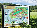
 Dongshih Forest Garden Map.jpg 4,160 × 3,120; 4.11 MB
-
 Folk Arts World map, Taipei Children's Recreation Center 20140717.jpg 3,264 × 2,448; 2.87 MB
-
 Guanyinshan Trail map 20080427.jpg 3,249 × 2,064; 318 KB
-
 Hengshan Hiking Trail Map.JPG 640 × 480; 52 KB
-
 Keelung Maritime Plaza map 20111124.jpg 3,240 × 2,160; 4.46 MB
-
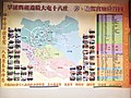
 Kinmen Military Headquarters of Qing Dynasty 04.JPG 4,928 × 3,264; 7.41 MB
-
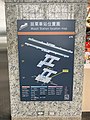 Location map on pillar in THSR Miaoli Station.jpg 3,024 × 4,032; 3.04 MB
-
 Map of Taipei Astronomical Museum and Meilun Science Park 20080806.jpg 2,592 × 1,944; 681 KB
-
 NMMST map board 20180717.jpg 4,000 × 2,250; 744 KB
-
 Old Trees Map of Nanfu Village, Taipei 20130427.jpg 4,000 × 3,000; 4.83 MB
-
 PD-2006-08-05-Description of anti-aircraft water tank, Dadaocheng Circle.jpg 1,600 × 1,200; 732 KB
-
 President Intl Tower and Eslite Xinyi Store location map 20130212.jpg 2,048 × 1,536; 864 KB
-
 Taiwan-South-Cross-Highway-Map.jpg 600 × 450; 45 KB
-
 Taoyuan International Airport 20230508 061141.jpg 1,800 × 4,000; 1.4 MB
-
 The map of Hsinchu Industrial Park 1.jpg 2,368 × 4,208; 2.94 MB
-
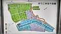 The map of Hsinchu Industrial Park 2.jpg 4,208 × 2,368; 3.57 MB
-
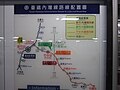 TRA Neiwan Line and Liujia Line route map 20160616.jpg 4,608 × 3,456; 3.27 MB
-
 TW YingGe CCV map.jpg 1,280 × 960; 681 KB
-
 七堵鐵道公園附近地圖.jpg 1,080 × 1,620; 1.16 MB
-
 中橫路線圖.jpg 4,000 × 3,000; 4.66 MB
-
 八二三戰史館 13.jpg 4,608 × 3,456; 3.03 MB
-
 北投區觀光農園導覽圖 - panoramio.jpg 2,592 × 1,944; 854 KB
-
 台北市古蹟識別系統導覽地圖 中山站 20080301.jpg 2,592 × 1,944; 845 KB
-
 台北市文山區興隆公園旁之指示牌.jpg 4,032 × 3,024; 1.62 MB
-
 台鐵香山車站前的朝山社區導覽地圖.jpg 1,620 × 1,080; 1.34 MB
-
 嘉義公園植物園都會森林公園導覽路線圖.jpg 4,160 × 3,120; 5.12 MB
-
 嘉義市文化路觀光夜市導覽地圖.jpg 3,264 × 1,840; 694 KB
-
 圓山公園平面配置圖 - panoramio.jpg 2,592 × 1,944; 725 KB
-
 士商路 - panoramio - Tianmu peter (19).jpg 1,944 × 2,592; 722 KB
-
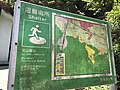
 士林官邸參觀攝影 - panoramio - Tianmu peter (10).jpg 2,592 × 1,944; 769 KB
-
 小門地質館 (5).jpg 4,000 × 3,000; 2.49 MB
-
 忠孝東路商圈觀光導覽地圖 20080201.jpg 2,592 × 1,944; 801 KB
-
 文山景美運動公園園內地圖.jpg 4,032 × 3,024; 3.66 MB
-
 文山景美運動公園園內地圖2.jpg 3,946 × 2,869; 3.1 MB
-
 新埔鎮文山國小避難指示牌.jpg 4,032 × 3,024; 3.68 MB
-
 東豐綠色走廊.jpg 3,656 × 2,701; 1.22 MB
-
 沙鹿保安宮繞境路線.jpg 4,032 × 3,024; 2.48 MB
-
 泰雅遷徙地圖.jpg 4,000 × 3,000; 3.47 MB
-
 澎湖海洋地質公園中心 08.jpg 4,000 × 3,000; 2.52 MB
-
 臺中樂成宮遶境大屯十八庄停、駐駕宫廟位置圖.jpg 3,219 × 2,414; 2.1 MB
-
 臺北市都市更新處 西門徒步區擴大試辦計畫示意圖 20080805.jpg 2,592 × 1,944; 726 KB
-
 臺北市都市更新處 西門徒步區擴大試辦計畫通知 20080805.jpg 2,592 × 1,944; 765 KB
-
 花糖文物館 (31).jpg 2,448 × 3,264; 1.73 MB
-
 花糖文物館 (5).jpg 3,264 × 2,448; 1.72 MB
-
 苗栗市苗栗火車站Miaoli City, Miaoli Station - panoramio (3).jpg 4,000 × 2,248; 1.61 MB
-
 苗栗市苗栗火車站Miaoli City, Miaoli Station - panoramio (5).jpg 2,248 × 4,000; 1.56 MB
-
 苗栗市苗栗火車站Miaoli City, Miaoli Station - panoramio (8).jpg 4,000 × 2,248; 1.94 MB
-
 蕃茄聯合國現場觀賞 - panoramio - Tianmu peter (35).jpg 2,592 × 1,944; 835 KB
-
 豐原火車站新站-周邊導覽圖.jpg 4,160 × 3,120; 3.12 MB
-
 象山步道導引路線圖 20171026.jpg 3,840 × 2,160; 2.55 MB
-
 颱風搭捷運到淡水看看 - panoramio - Tianmu peter (62).jpg 2,592 × 1,944; 972 KB
-
 颱風搭捷運到淡水看看 - panoramio - Tianmu peter (93).jpg 2,592 × 1,944; 942 KB
-
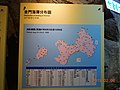
 龍門閉鎖陣地 14.jpg 4,032 × 3,024; 2.16 MB
-
 龍門閉鎖陣地 16.jpg 4,032 × 3,024; 2.42 MB

.jpg)
.jpg)


.jpg)

.jpg)


.jpg)
.jpg)
.jpg)


.jpg)
.jpg)
.jpg)
.jpg)
.jpg)
.jpg)


.jpg)
.jpg)

