Category:Photographs of Canada by Ymblanter
Jump to navigation
Jump to search
Media in category "Photographs of Canada by Ymblanter"
The following 200 files are in this category, out of 874 total.
(previous page) (next page)-
 66 Rue Saint Louis Quebec City.jpg 2,736 × 3,648; 4.98 MB
-
 74 Rue Saint Louis Quebec City.jpg 2,736 × 3,648; 4.94 MB
-
 Active Pass and Galiano Island 1.jpg 6,000 × 4,000; 13.87 MB
-
 Active Pass and Galiano Island 2.jpg 6,000 × 4,000; 14.69 MB
-
 Air Nootka floatplane in Muchalat Inlet 1.jpg 5,824 × 3,648; 14.49 MB
-
 Air Nootka floatplane in Muchalat Inlet 2.jpg 5,736 × 4,000; 15.79 MB
-
 Air Nootka floatplane in Muchalat Inlet 3.jpg 5,704 × 3,760; 12.91 MB
-
 Air Nootka floatplane parked.jpg 5,680 × 3,768; 14.96 MB
-
 Airport Road Mississauga.jpg 3,648 × 2,736; 4.77 MB
-
 Alberni Valley Regional Airport 1.jpg 5,712 × 3,800; 13.45 MB
-
 Alberni Valley Regional Airport 2.jpg 6,000 × 4,000; 12.52 MB
-
 Alexandra Falls 1.jpg 4,000 × 6,000; 11.71 MB
-
 Alexandra Falls 2.jpg 4,000 × 6,000; 12.65 MB
-
 Alexandra Falls 3.jpg 6,000 × 4,000; 12.51 MB
-
 Alexandra Falls 4.jpg 3,641 × 5,712; 9.45 MB
-
 Alexandra Falls 5.jpg 4,000 × 6,000; 14.27 MB
-
 All-terrain continuous track vehicle in Hay River Museum.jpg 6,000 × 4,000; 17.52 MB
-
 All-terrain sled vehicle in Hay River Museum.jpg 6,000 × 4,000; 18.69 MB
-
 Alley east of Carrall Street.jpg 4,000 × 6,000; 13.49 MB
-
 Amphitrite Point light 1.jpg 5,664 × 3,592; 9.42 MB
-
 Amphitrite Point light 2.jpg 6,000 × 4,000; 12.48 MB
-
 Anglican Church in Hay River.jpg 6,000 × 4,000; 16.5 MB
-
 Anse Théophile from the embankment.jpg 3,648 × 2,736; 4.26 MB
-
 Arsenal Foundry Quebec City.jpg 3,648 × 2,736; 5.36 MB
-
 Artillery gun at Fort Rodd Hill.jpg 6,000 × 4,000; 17.8 MB
-
 Assumption Cathedral Trois Rivieres.jpg 2,736 × 3,648; 3.83 MB
-
 Badland west of Drumheller 1.jpg 6,000 × 4,000; 13.33 MB
-
 Badland west of Drumheller 2.jpg 6,000 × 4,000; 14.05 MB
-
 Badland west of Drumheller 3.jpg 6,000 × 4,000; 12.58 MB
-
 Badlands above the Royal Tyrrell Museum.jpg 6,000 × 4,000; 13.39 MB
-
 Baie-Sainte-Marguerite (1).jpg 3,648 × 2,736; 4.08 MB
-
 Baie-Sainte-Marguerite (2).jpg 3,648 × 2,736; 4.73 MB
-
 Baie-Sainte-Marguerite Saguenay Fjord seen from the observation platform to the east.jpg 3,516 × 2,586; 4.36 MB
-
 Baie-Sainte-Marguerite Saguenay Fjord seen from the observation platform to the west.jpg 3,546 × 2,616; 4.16 MB
-
 Barkley Sound from the Wild Pacific Trail 1.jpg 6,000 × 4,000; 12.52 MB
-
 Barkley Sound from the Wild Pacific Trail 2.jpg 6,000 × 4,000; 12.2 MB
-
 Barkley Sound from the Wild Pacific Trail 3.jpg 6,000 × 4,000; 11.54 MB
-
 Barkley Sound from the Wild Pacific Trail 4.jpg 6,000 × 4,000; 11.39 MB
-
 Barkley Sound from the Wild Pacific Trail 5.jpg 6,000 × 4,000; 12.14 MB
-
 Barkley Sound from the Wild Pacific Trail 6.jpg 6,000 × 4,000; 12.17 MB
-
 Barkley Sound from the Wild Pacific Trail 7.jpg 6,000 × 4,000; 11.55 MB
-
 Basilica Notre-Dame-du-Cap from the south.jpg 2,736 × 3,648; 5.05 MB
-
 BC Rail locomotive at Jasper railway station.jpg 6,000 × 4,000; 12.96 MB
-
 Birds on the False Creek.jpg 6,000 × 4,000; 16.09 MB
-
 Blood Alley Gastown.jpg 4,000 × 6,000; 14.19 MB
-
 Bracket fungi Pinery Provincial Park.jpg 2,736 × 3,648; 6.65 MB
-
 Bridge in NP Hautes-Gorges-de-la-Rivière-Malbaie 01.jpg 3,648 × 2,736; 6.45 MB
-
 Brighton and SkyTrain Vancouver.jpg 5,528 × 3,736; 11.82 MB
-
 British Columbia Parliament Buildings across the harbor.jpg 6,000 × 4,000; 11.28 MB
-
 Brockton Point Lighthouse and North Vancouver.jpg 6,000 × 4,000; 12.99 MB
-
 Burrard Bridge from the east.jpg 6,000 × 4,000; 13.86 MB
-
 Burrard Landing from the Canadian Trail.jpg 6,000 × 4,000; 16.42 MB
-
 Burrard Station platforms.jpg 6,000 × 4,000; 18.75 MB
-
 Buttle Lake from below the Lupin Falls trail 1.jpg 6,000 × 4,000; 16.22 MB
-
 Buttle Lake from below the Lupin Falls trail 2.jpg 6,000 × 4,000; 13.06 MB
-
 Buttle Lake from below the Lupin Falls trail 3.jpg 4,000 × 6,000; 14.57 MB
-
 Buttle Lake from below the Lupin Falls trail 4.jpg 6,000 × 4,000; 16.52 MB
-
 Campbell River Fisherman's Wharf 1.jpg 6,000 × 4,000; 12.04 MB
-
 Campbell River Fisherman's Wharf 2.jpg 6,000 × 4,000; 13.18 MB
-
 Campbell River houses next to the ferry terminal.jpg 6,000 × 4,000; 11.24 MB
-
 Canada Place from Stanley Park.jpg 6,000 × 4,000; 11.56 MB
-
 Canadian National 6015 at Jasper railway station.jpg 6,000 × 4,000; 11.2 MB
-
 Cap Chat Church rear view.jpg 2,628 × 3,420; 3.79 MB
-
 Cap Chat Church side view.jpg 2,736 × 3,648; 3.56 MB
-
 Cap de Bon Desir (1).jpg 3,648 × 2,736; 4.35 MB
-
 Cap de Bon Desir (2).jpg 3,648 × 2,736; 4.97 MB
-
 Cap de Bon Desir (3).jpg 3,516 × 2,604; 4.48 MB
-
 Cap de Bon Desir lighthouse buildings.jpg 3,648 × 2,736; 4.32 MB
-
 Cap de Bon Desir lighthouse.jpg 2,736 × 3,648; 4.46 MB
-
 Cap de la Madeleine Lighthouse panorama.jpg 3,648 × 2,736; 5.47 MB
-
 Cap-Chat Baie de Cap-Chat seen from the west bank 1.jpg 3,522 × 2,610; 3.21 MB
-
 Cap-Chat Baie de Cap-Chat seen from the west bank 2.jpg 3,648 × 2,736; 3.74 MB
-
 Cap-Chat Rue du Rivage 20-22 in the evening.jpg 3,522 × 2,460; 4 MB
-
 Cap-Chat Rue du Rivage 20-22 in the morning.jpg 3,144 × 2,262; 2.89 MB
-
 Cap-Chat Saint Lawrence River seen from Capucins 1.jpg 3,516 × 2,616; 5.09 MB
-
 Cap-Chat Saint Lawrence River seen from Capucins 2.jpg 3,510 × 2,610; 4.79 MB
-
 Cap-Chat Saint Lawrence River seen from Capucins 3.jpg 3,648 × 2,736; 4.82 MB
-
 Cap-Chat Saint Lawrence River seen from Capucins 4.jpg 3,648 × 2,736; 5.63 MB
-
 Cap-des-Rosiers Lighthouse seen from the west.jpg 2,736 × 3,648; 4.43 MB
-
 Cap-des-Rosiers lighthouse.jpg 2,736 × 3,648; 4.28 MB
-
 Cap-des-Rosiers View of Cape Gaspé from the lighthouse 1.jpg 3,498 × 2,610; 4.19 MB
-
 Cap-des-Rosiers View of Cape Gaspé from the lighthouse 2.jpg 3,648 × 2,736; 4.27 MB
-
 Captain Passage from the ferry 1.jpg 6,000 × 4,000; 12.57 MB
-
 Captain Passage from the ferry 2.jpg 6,000 × 4,000; 13.99 MB
-
 Captain Passage from the ferry 3.jpg 6,000 × 4,000; 13.33 MB
-
 Carrall Street sign.jpg 5,624 × 3,688; 8.77 MB
-
 Cedar Nature Trail Pinery Provincial Park.jpg 2,736 × 3,648; 6.96 MB
-
 Celtic Cross at the Artillery Park.jpg 2,736 × 3,648; 6.45 MB
-
 Chapel of the Ursuline convent, Quebec City.jpg 2,736 × 3,648; 4.46 MB
-
 Chateau Lake Louise from the viewpoint.jpg 3,648 × 2,736; 4.58 MB
-
 Chicoutimi 316 Rue du Seminaire.jpg 3,648 × 2,736; 5.88 MB
-
 Chicoutimi 469 rue Drean.jpg 2,736 × 3,648; 5.13 MB
-
 Chicoutimi Pulperie de Chicoutimi Steam locomotive 106.jpg 2,736 × 3,648; 6.22 MB
-
 Chicoutimi Rivière Chicoutimi seen from Rue Dubuc downstream.jpg 3,648 × 2,736; 4.7 MB
-
 Chinese Times Building.jpg 6,000 × 4,000; 15.34 MB
-
 Church of Couvent du Bon-Pasteur-Maison Marie-Fitzbach.jpg 2,736 × 3,648; 4.95 MB
-
 Church of Sainte-Anne-des-Monts exterior.jpg 2,736 × 3,648; 4.05 MB
-
 Church Sainte-Anne-des-Monts Interior.jpg 3,648 × 2,736; 6.45 MB
-
 Church Sainte-Flavie front.jpg 2,628 × 3,336; 4.36 MB
-
 Church Sainte-Flavie rear.jpg 3,558 × 2,634; 4.1 MB
-
 Church Tower Ursuline Convent.jpg 2,736 × 3,648; 4.11 MB
-
 Chute du Diable Parc national de la Gaspésie 1.jpg 2,736 × 3,648; 7.14 MB
-
 Chute du Diable Parc national de la Gaspésie 2.jpg 2,736 × 3,648; 6.24 MB
-
 Chute du Diable Parc national de la Gaspésie 3.jpg 2,736 × 3,648; 6.25 MB
-
 Chute Montmorency with red umbrella.jpg 2,736 × 3,648; 5.8 MB
-
 Château Landry.jpg 3,510 × 2,532; 4 MB
-
 Citadelle from Plains of Abraham.jpg 3,648 × 2,736; 6.62 MB
-
 Clachnacudainn Range from Heather Lake 1.jpg 6,000 × 4,000; 15.28 MB
-
 Clachnacudainn Range from Heather Lake 2.jpg 6,000 × 4,000; 15.11 MB
-
 Clachnacudainn Range from Heather Lake 3.jpg 6,000 × 4,000; 16.45 MB
-
 Clearwater river valley.jpg 3,665 × 5,448; 12.1 MB
-
 Closed road in Wayne.jpg 6,000 × 4,000; 16.73 MB
-
 Coal Harbor and Canada Place from Stanley Park.jpg 4,000 × 6,000; 12.18 MB
-
 Coal Harbour from Stanley Park.jpg 6,000 × 4,000; 12.31 MB
-
 Coast from Fisgard Lighthouse.jpg 6,000 × 4,000; 12.85 MB
-
 Coast in Stanley Park.jpg 3,845 × 5,868; 14.57 MB
-
 Commissariat Building from Mayor's Hill Park.jpg 3,648 × 2,736; 5.86 MB
-
 Cote de la Canoterie.jpg 2,544 × 3,498; 4.36 MB
-
 Courtenay River from the bridge.jpg 6,000 × 4,000; 13.06 MB
-
 Courtenay River side course.jpg 4,000 × 6,000; 17.86 MB
-
 Cowichan Bay from Cowichan Bay 1.jpg 6,000 × 4,000; 13.01 MB
-
 Cowichan Bay from Cowichan Bay 2.jpg 6,000 × 4,000; 11.9 MB
-
 Cowichan Bay from Cowichan Bay 3.jpg 6,000 × 4,000; 12.47 MB
-
 Cowichan Bay from Cowichan Bay 4.jpg 6,000 × 4,000; 15.5 MB
-
 Cowichan Bay from Cowichan Bay 5.jpg 6,000 × 4,000; 14.06 MB
-
 David Lam Park Terminal False Creek.jpg 4,000 × 6,000; 14.19 MB
-
 Dawson Falls 1.jpg 6,000 × 4,000; 15.22 MB
-
 Dawson Falls 2.jpg 6,000 × 4,000; 14.86 MB
-
 Deh Cho Bridge from the north.jpg 4,000 × 6,000; 13.5 MB
-
 Deh Cho Bridge from the right bank.jpg 5,800 × 3,832; 13.89 MB
-
 Denman Island across Baynes Sound 1.jpg 6,000 × 4,000; 13.51 MB
-
 Denman Island across Baynes Sound 2.jpg 6,000 × 4,000; 12.33 MB
-
 Dinosaur head across the Red Deer River Drumheller.jpg 6,000 × 4,000; 15.66 MB
-
 Discovery Passage from Campbell River.jpg 6,000 × 4,000; 11.98 MB
-
 Dog Beach Pinery Provincial Park.jpg 2,736 × 3,648; 5.95 MB
-
 Downtown Buffalo from Fort Erie.jpg 3,648 × 2,736; 4.89 MB
-
 Dry spruce on a rock Jasper NP.jpg 4,000 × 6,000; 11.34 MB
-
 Dunes Beach Pinery Provincial Park.jpg 3,534 × 2,652; 4.98 MB
-
 Dunn Block and Alexander Street.jpg 5,824 × 3,776; 13.93 MB
-
 Eagleson-Buyers House.jpg 3,648 × 2,736; 5.67 MB
-
 East side of Steveston Harbor.jpg 5,112 × 3,856; 10.87 MB
-
 Ecole Saint-Francois-Xavier.jpg 3,648 × 2,736; 4.46 MB
-
 Edifice Thomas-Zozyme-Cloutier.jpg 3,648 × 2,736; 6.12 MB
-
 Elk River Strathcona Provincial Park.jpg 6,000 × 4,000; 19.92 MB
-
 Entrance Sun Yat-Sen Classical Chinese Garden Vancouver.jpg 5,848 × 3,824; 12.57 MB
-
 Esquimalt Harbor from Fisgard Lighthouse.jpg 6,000 × 4,000; 11.43 MB
-
 Esquimalt Lagoon from Hatley Castle.jpg 6,000 × 4,000; 13.7 MB
-
 Expo Line tracks west of King George Stattion.jpg 3,750 × 5,736; 11.53 MB
-
 Falher corn field.jpg 6,000 × 4,000; 16.62 MB
-
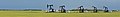
 Falher oil pumps in a corn field 1.jpg 6,000 × 4,000; 15 MB
-
 Falher oil pumps in a corn field 2.jpg 5,824 × 3,832; 13.12 MB
-
 Falher Wikivoyage banner.jpg 5,824 × 833; 2.71 MB
-
 False Creek and BC Place.jpg 4,000 × 6,000; 12.17 MB
-
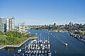 False Creek from Granville Street Bridge.jpg 6,000 × 4,000; 14.81 MB
-
 False Creek from the Science World.jpg 6,000 × 4,000; 11.58 MB
-
 Ferguson Block.jpg 4,000 × 6,000; 15.3 MB
-
 Ferns on the Wild Pacific Trail.jpg 4,000 × 6,000; 17.73 MB
-
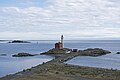
 Fisgard Lighthouse 1.jpg 3,738 × 5,700; 10.01 MB
-
 Fisgard Lighthouse 2.jpg 6,000 × 4,000; 12.55 MB
-
 Fisgard Lighthouse 3.jpg 6,000 × 4,000; 12.39 MB
-
 Fisgard Lighthouse 4.jpg 4,000 × 6,000; 12.26 MB
-
 Fisgard Lighthouse from the lower battery of Fort Rodd Hill.jpg 6,000 × 4,000; 11.86 MB
-
 Fisherman's Wharf Hay River.jpg 6,000 × 4,000; 12.55 MB
-
 Fjord in L'Anse de Tabatiere.jpg 3,648 × 2,736; 4.7 MB
-
 Fjord Saguenay in Anse Théophile.jpg 3,474 × 2,622; 4.11 MB
-
 Fontenelle from the bridge.jpg 2,736 × 3,648; 4.77 MB
-
 Forest in Mount Revelstoke NP 1.jpg 4,000 × 5,892; 16.85 MB
-
 Forest in Mount Revelstoke NP 2.jpg 6,000 × 4,000; 19.35 MB
-
 Forest on the Lupin Falls trail.jpg 4,000 × 6,000; 18.29 MB
-
 Forge Saint-Laurent.jpg 3,648 × 2,736; 4.37 MB
-
 Forillon National Park Cap Gaspé Southwest coast 1.jpg 2,736 × 3,648; 4.42 MB
-
 Forillon National Park Cape Gaspé End of the world sign.jpg 2,504 × 1,936; 2.91 MB
-
 Forillon National Park Gaspé Bay seen from the coast 1.jpg 2,964 × 2,116; 3.06 MB
-
 Forillon National Park Gaspé Bay seen from the coast 2.jpg 2,736 × 3,648; 5.05 MB
-
 Forillon National Park Gaspé Bay seen from the coast 3.jpg 3,474 × 2,592; 4.47 MB
-
 Forillon National Park Gaspé Bay seen from the coast 4.jpg 2,536 × 3,464; 4.91 MB
-
 Forillon National Park Phare de Cap Gaspé in a fog.jpg 2,736 × 3,648; 4.39 MB
-
 Forillon National Park Phare de Cap Gaspé seen from the west.jpg 2,568 × 3,480; 3.72 MB
-
 Fort Erie Holloway Memorial Chapel.jpg 2,736 × 3,648; 7.06 MB
-
 Fort Erie Old Fort Erie cannon shot demonstration.jpg 3,648 × 2,736; 7.37 MB
-
 Fort Henry entrance inside.jpg 2,736 × 3,648; 4.87 MB
-
 Fort Henry entrance.jpg 2,736 × 3,648; 4.26 MB
-
 Fort Henry Guard Marching.jpg 3,648 × 2,736; 4.46 MB
-
 Fort Henry Guard preparing a gun.jpg 2,736 × 3,648; 5.52 MB
-
 Fort Henry Guard preparing to pull a gun.jpg 2,736 × 3,648; 5.09 MB
-
 Fort Henry Guard with a goat.jpg 2,736 × 3,648; 5.07 MB
-
 Fort Henry gun carriages.jpg 3,648 × 2,736; 4.31 MB
-
 Fort Henry inside.jpg 3,648 × 2,736; 4.42 MB
-
 Fort Henry northern wall.jpg 2,256 × 3,456; 3.69 MB
-
 Fort Mississauga Niagara-on-the-Lake.jpg 3,648 × 2,736; 4.72 MB
-
 Fort Providence Airport 1.jpg 6,000 × 4,000; 16.79 MB
-
 Fort Providence Airport 2.jpg 6,000 × 4,000; 14.96 MB
-
 Fort Rodd Hill Belmont Battery 1.jpg 3,750 × 5,568; 12.18 MB
-
 Fort Rodd Hill Belmont Battery 2.jpg 5,840 × 3,832; 11.03 MB
-
 Fort Rodd Hill building next to the Officers House.jpg 6,000 × 4,000; 15.39 MB
-
 Fort Rodd Hill lower battery 1.jpg 6,000 × 4,000; 12.64 MB
-
 Fort Rodd Hill lower battery 2.jpg 6,000 × 4,000; 14.44 MB
-
 Fort Rodd Hill lower battery 3.jpg 6,000 × 4,000; 13.28 MB
-
 Fort Rodd Hill lower battery 4.jpg 6,000 × 4,000; 13.76 MB
-
 Fort Rodd Hill lower battery 5.jpg 4,000 × 6,000; 14.29 MB


.jpg)
.jpg)


.jpg)
.jpg)
.jpg)


