Category:Photographs by Stuart Logan
Jump to navigation
Jump to search

Media in category "Photographs by Stuart Logan"
The following 116 files are in this category, out of 116 total.
-
 0 MPH speed limit in Bighton (geograph 3159633).jpg 3,138 × 2,483; 2.42 MB
-
 A12 west of Milestone Farm (geograph 3601378).jpg 3,648 × 2,736; 1.32 MB
-
 A21 passes through Robinsgate Wood - geograph.org.uk - 3919542.jpg 3,175 × 2,411; 1.27 MB
-
 A26 Cuilfail Tunnel mouth (geograph 3009412).jpg 3,648 × 2,736; 3.44 MB
-
 A264 at the eastern edge of Rusthall Common - geograph.org.uk - 2993978.jpg 3,483 × 2,438; 1.78 MB
-
 A264 junction with A26 - geograph.org.uk - 2994003.jpg 3,648 × 2,736; 1.72 MB
-
 A264 junction with Hall's Hole Road - geograph.org.uk - 2994047.jpg 3,297 × 2,422; 1.59 MB
-
 A264 junction with Major York's Road - geograph.org.uk - 2993985.jpg 3,180 × 2,406; 1.64 MB
-
 A264 junction with Pembury Road - geograph.org.uk - 2994016.jpg 3,648 × 2,736; 1.41 MB
-
 A264 north of Oakley School - geograph.org.uk - 2994056.jpg 3,582 × 2,645; 1.93 MB
-
 A3025 junction with Victoria Road - geograph.org.uk - 2604258.jpg 3,648 × 2,456; 996 KB
-
 A342 enters Rushall - geograph.org.uk - 3454604.jpg 3,587 × 2,670; 1.54 MB
-
 A36 passes the Church of St Peter (geograph 3461400).jpg 3,252 × 2,588; 1.07 MB
-
 A379 passes the entrance to Sea Cliff in Strete, Devon-geograph-3998784-by-Stuart-Logan.jpg 3,175 × 2,267; 1.25 MB
-
 A417 passes Shell filling station - geograph.org.uk - 3935378.jpg 3,648 × 2,736; 3.56 MB
-
 A508 passes The White Hart Public House (geograph 3345421).jpg 3,526 × 2,449; 1.02 MB
-
 A832 bridge over Abhainn Ghlas (geograph 2473366).jpg 3,072 × 2,048; 3.93 MB
-
 Alton Towers historic gardens (geograph 3270902).jpg 1,792 × 1,270; 484 KB
-
 Amroth Castle (geograph 2668806).jpg 3,072 × 2,048; 1.75 MB
-
 Approaching The Red Lion in Little Missenden geograph-4107335-by-Stuart-Logan.jpg 3,883 × 2,474; 1.64 MB
-
 Ash Lane fords Clayhill Brook (geograph 3370281).jpg 3,648 × 2,736; 3.89 MB
-
 Atop the Greenway Viaduct looking southwest-geograph-3865478-by-Stuart-Logan.jpg 4,000 × 3,000; 2.87 MB
-
 B1054 passes The Old Bakery, Hempstead (geograph 3628391).jpg 3,462 × 2,555; 1.28 MB
-
 B2089 viaduct over B2244 (geograph 2598208).jpg 3,071 × 2,197; 1.25 MB
-
 B3048 passes the gates to Longparish House geograph-3337950-by-Stuart-Logan.jpg 3,648 × 2,736; 2 MB
-
 B3302 Mellanear Road junction with Trelissick Road - geograph.org.uk - 3189884.jpg 3,183 × 2,048; 1.09 MB
-
 Barn at Manor Farm, Ablington Geograph-3162824-by-Stuart-Logan.jpg 3,648 × 2,736; 2.06 MB
-
 Bawdsey Manor entrance-geograph-3554361-by-Stuart-Logan.jpg 3,648 × 2,736; 2.09 MB
-
 Bibury Court Hotel (geograph 3162769).jpg 3,648 × 2,736; 2.92 MB
-
 Bibury Court Hotel (geograph 3162773).jpg 3,648 × 2,736; 1.63 MB
-
 Black Isle Brewery shop (geograph 2457236).jpg 3,648 × 2,736; 2.06 MB
-
 Bow Brook passes under Vyne Road (geograph 3318247).jpg 3,648 × 2,736; 2.93 MB
-
 Bramdean House and garden (geograph 3019510).jpg 3,072 × 2,048; 2.01 MB
-
 Brocks Lane heads upstream (geograph 2331548).jpg 3,648 × 2,736; 1.12 MB
-
 Bullingstone Lane junction with Speldhurst Road - geograph.org.uk - 2993938.jpg 3,648 × 2,456; 2.17 MB
-
 Burchetts Green Road passes The Crown (geograph 3017133).jpg 3,648 × 2,736; 1.56 MB
-
 Catmore Farm and Church Geograph-2356335-by-Stuart-Logan.jpg 3,648 × 2,736; 1.81 MB
-
 Cave Entrance, West Wycombe Park-geograph.org.uk-4101078.jpg 2,804 × 3,133; 1.77 MB
-
 Chilston Park House.jpg 5,088 × 3,392; 10.38 MB
-
 Christ Church, Mount Pleasant (geograph 2511863).jpg 1,940 × 3,004; 890 KB
-
 Church of St Andrew, Coln St Dennis (geograph 3163857).jpg 3,648 × 2,736; 2.1 MB
-
 Church of St James (geograph 3163863).jpg 3,648 × 2,736; 2.44 MB
-
 Church of St Mary (geograph 2974070).jpg 3,648 × 2,736; 2.91 MB
-
 Church of St Mary the Virgin (geograph 3935531).jpg 3,648 × 2,736; 2.52 MB
-
 Church of St Mary the Virgin and Westwood Manor (geograph 4035898).jpg 3,557 × 2,619; 1.01 MB
-
 Church Street passes the old Sun Inn (geograph 3537251).jpg 3,072 × 2,048; 1.13 MB
-
 Clumps Ahoy! (geograph 3452145).jpg 3,598 × 2,698; 1.6 MB
-
 Coastal ladder near Bigbury (geograph 2304412).jpg 2,048 × 3,072; 1.5 MB
-
 Cranemoor Lake Englefield-geograph-2282892-by-Stuart-Logan.jpg 3,072 × 2,048; 3.71 MB
-
 Crooked Billet, Stoke Row (Geograph-2890038-by-Stuart-Logan).jpg 3,648 × 2,736; 1.82 MB
-
 Crossroads in Maidford (geograph 2932040).jpg 3,251 × 2,573; 1.39 MB
-
 Crowsley Park Receiving Station - geograph.org.uk - 2919386.jpg 3,648 × 2,736; 2.07 MB
-
 Dryburgh Abbey yew tree (geograph 2368968).jpg 2,048 × 3,072; 4.51 MB
-
 Ducking out of the ferry (geograph 3414552).jpg 3,648 × 2,736; 2.02 MB
-
 Dyrham Church (geograph 2283517).jpg 3,072 × 2,048; 2.09 MB
-
 Eight Bells Inn (geograph 3630517).jpg 3,648 × 2,736; 1.75 MB
-
 Eilean na Moine in Loch Eilt-geograph-2490101.jpg 3,072 × 2,048; 1.63 MB
-
 Entrance to Hatherop Castle School, Gloucestershire-geograph-3162536-by-Stuart-Logan.jpg 3,496 × 2,616; 1.94 MB
-
 Entrance to The John of Gaunt School (geograph 4035968).jpg 4,000 × 3,000; 1.91 MB
-
 Hambleden Place from Ferry Lane (geograph 3414762).jpg 3,574 × 2,710; 1.59 MB
-
 Hartley Court Geograph-3374093-by-Stuart-Logan.jpg 3,648 × 2,736; 1.73 MB
-
 Its not a shallow ford today (geograph 3240846).jpg 3,648 × 2,432; 1.57 MB
-
 Junction of Queensferry Street and Hope Street (geograph 2498316).jpg 3,648 × 2,736; 1.39 MB
-
 Kidmore End Road passes The White Horse - geograph.org.uk - 3659746.jpg 3,648 × 2,736; 1.73 MB
-
 King Edward VII Building, Newcastle University, 11 July 2007.jpg 2,736 × 3,648; 2.64 MB
-
 Lane beside Holland Bottom - geograph.org.uk - 2875225.jpg 3,546 × 2,656; 1.73 MB
-
 Lane in Marten, Wiltshire - geograph-2626026.jpg 3,648 × 2,736; 1.57 MB
-
 Lansdown Cemetery entrance porch (geograph 2616210).jpg 3,648 × 2,736; 3.57 MB
-
 Leggs Lane junction with Speldhurst Road - geograph.org.uk - 2992890.jpg 3,307 × 2,438; 1.88 MB
-
 Lucton School (geograph 3743625).jpg 4,000 × 3,000; 2.83 MB
-
 Lymington New Forest Hospital (geograph 2539386).jpg 3,648 × 2,736; 1.89 MB
-
 M4 crosses the River Loddon (geograph 3325508).jpg 3,572 × 2,499; 1.22 MB
-
 Moll Harriss Clump (geograph 3430880).jpg 3,648 × 2,736; 1.98 MB
-
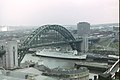 New Tyne Bridge (geograph 3297778).jpg 5,088 × 3,392; 2.56 MB
-
 King's Walk, Newcastle University, 11 July 2007.jpg 3,648 × 2,736; 1.58 MB
-
 Pack Horse Public House (geograph 3307902).jpg 3,648 × 2,736; 2.13 MB
-
 Passmore Edwards Free Library (geograph 3185234).jpg 3,081 × 2,524; 1.16 MB
-
 RHS Wisley Rock Garden reconstruction-geograph-3271041-by-Stuart-Logan.jpg 1,770 × 1,188; 677 KB
-
 River Coln southwest of Ablington Manor (geograph 3162838).jpg 3,648 × 2,736; 2.96 MB
-
 Sea cave near Thurlestone geograph-2304327-by-Stuart-Logan.jpg 2,048 × 3,072; 1.17 MB
-
 War memorial at Lower Shiplake (geograph 2819252).jpg 3,648 × 2,736; 1.49 MB
-
 Southern portal of the Sapperton Tunnel (geograph 2897064).jpg 3,578 × 2,536; 2.42 MB
-
 Southwestern corner of Netheravon Camp (geograph 3452798).jpg 3,648 × 2,736; 2.33 MB
-
 Sowley Pond (geograph 3235883).jpg 3,648 × 2,432; 2.51 MB
-
 St Margarets Church (geograph 2667596).jpg 3,648 × 2,736; 2.03 MB
-
 St Stephens Church (geograph 2497195).jpg 3,648 × 2,736; 1.69 MB
-
 St Thomas of Canterbury Church, Fairford by Stuart Logan Geograph 3938697.jpg 3,330 × 2,519; 1.41 MB
-
 Stables to Westbury House (geograph 3247818).jpg 3,648 × 2,432; 2.42 MB
-
 Station Road passes the erstwhile Holmsley Station (geograph 4076906).jpg 3,648 × 2,736; 1.49 MB
-
 Thatched cottages in Thruxton, Hampshire - geograph 4045024.jpg 3,648 × 2,736; 1.96 MB
-
 The Bell, Aldworth (geograph 2583695).jpg 3,648 × 2,736; 2.02 MB
-
 The Bull & Butcher and Dibleyville-geograph-3439982-by-Stuart-Logan.jpg 3,648 × 2,736; 1.3 MB
-
 The Bull and Butcher-geograph-2892753-by-Stuart-Logan.jpg 3,648 × 2,663; 1.6 MB
-
 The Cottage & Friars Pardon (geograph 3452698).jpg 3,578 × 2,590; 1.17 MB
-
 The Crown, Sydenham, Oxfordshire-geograph-2894236-by-Stuart-Logan.jpg 3,525 × 2,556; 1.6 MB
-
 The Duchess of Somersets Hospital (geograph 2416256).jpg 3,644 × 2,549; 1.54 MB
-
 The Foresters Arms, Brunswick Street (geograph 2818863).jpg 3,322 × 2,554; 1.46 MB
-
 The Frog, Skirmett, Buckinghamshire-geograph-3439917-by-Stuart-Logan.jpg 3,648 × 2,736; 1.41 MB
-
 The George Hotel (geograph 2558879).jpg 3,225 × 2,592; 1.22 MB
-
 The Giant's Spade. - geograph.org.uk - 2297940.jpg 2,048 × 3,072; 1.6 MB
-
 The Manor House, Little Missenden-geograph-4107497-by-Stuart-Logan.jpg 3,562 × 2,727; 1.52 MB
-
 The Seahorse Inn, previously known as the Sailor's Home Arms - Geograph-2675847.jpg 3,162 × 2,432; 857 KB
-
 The South Cottage (geograph 3918264).jpg 4,000 × 3,000; 3.05 MB
-
 The Three Horseshoes (geograph 3159650).jpg 3,648 × 2,736; 2.73 MB
-
 The Woolpack Inn Coggeshall Geograph-3546226-by-Stuart-Logan.jpg 3,648 × 2,736; 1.36 MB
-
 Thornford Road Ford (geograph 2544089).jpg 3,648 × 2,445; 2.82 MB
-
 Thurlestone Sands (geograph 2304258).jpg 3,072 × 2,048; 1.57 MB
-
 Tracy Park north facade - geograph.org.uk - 2614877.jpg 3,648 × 2,736; 1.88 MB
-
 Tracy Park south facade - geograph.org.uk - 2614751.jpg 3,648 × 2,736; 1.83 MB
-
 Trench Green crossroads (geograph 3307868).jpg 3,182 × 2,419; 1.74 MB
-
 Un-named lane leads to Colstrope Farm-geograph-3409961-by-Stuart-Logan.jpg 3,547 × 2,666; 1.89 MB
-
 Un-named road between King Street and Church Lane (geograph 2932054).jpg 3,648 × 2,736; 1.66 MB
-
 Valley Farmhouse (geograph 3537029).jpg 3,072 × 2,048; 1.57 MB
-
 Western facade of Trewithen House (geograph 2352051).jpg 2,971 × 1,993; 1.47 MB
-
 Wigmore Abbey entrance and gatehouse (geograph 3742652).jpg 4,000 × 3,000; 3.52 MB
-
 Ypres Tower (geograph 2382638).jpg 2,907 × 2,029; 1.07 MB
.jpg)
.jpg)

.jpg)


.jpg)


.jpg)
.jpg)
.jpg)
.jpg)

.jpg)

.jpg)
.jpg)


.jpg)
.jpg)
.jpg)
.jpg)
.jpg)
.jpg)

.jpg)


.jpg)
.jpg)
.jpg)
.jpg)
.jpg)
.jpg)
.jpg)
.jpg)
.jpg)

.jpg)
.jpg)

.jpg)
.jpg)
.jpg)
.jpg)


.jpg)
.jpg)

.jpg)
.jpg)


.jpg)

.jpg)
.jpg)
.jpg)
.jpg)
.jpg)

.jpg)
.jpg)

.jpg)

.jpg)
.jpg)
.jpg)
.jpg)
.jpg)
.jpg)

.jpg)
.jpg)

.jpg)


.jpg)

.jpg)
.jpg)

.jpg)


.jpg)
.jpg)

.jpg)
.jpg)


.jpg)

.jpg)
.jpg)
.jpg)
.jpg)
.jpg)