Category:Photographs by George A. Grant
Jump to navigation
Jump to search
| George A. Grant
(1891–1964) |
|||
|---|---|---|---|
 |
|||
| Alternative names |
George Alexander Grant | ||
| Description | American photographer and architectural photographer The first Chief Photographer for the U.S. National Park Service (NPS). | ||
| Date of birth/death |
1891 |
1964 | |
| Location of birth | Milton | ||
| Work period | 1929–1954 | ||
| Authority file | |||
Subcategories
This category has the following 6 subcategories, out of 6 total.
C
Media in category "Photographs by George A. Grant"
The following 200 files are in this category, out of 725 total.
(previous page) (next page)-
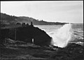 "SPOUTING HORN" AT DEPOE BAY - NARA - 520105.jpg 3,000 × 2,139; 1.36 MB
-
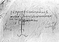 1605 "graffiti" on Inscription Rock, by Juan de Oñate.jpg 516 × 366; 21 KB
-
 1933 car&trailer.jpg 337 × 297; 61 KB
-
 1933 Chevrolet trucks.jpg 513 × 271; 23 KB
-
 HPC 001930 (27470721711).jpg 509 × 360; 68 KB
-
 20-mule-team wagons.jpg 516 × 361; 26 KB
-
 A CLOSE-UP OF THE EOLIAN (TOPIARY) GARDENS - NARA - 520119.jpg 3,000 × 2,100; 1.77 MB
-
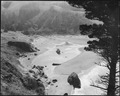
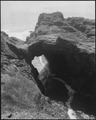
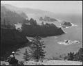
 A CREEK REACHES THE OCEAN - NARA - 520184.jpg 3,000 × 2,392; 1.7 MB
-
 A CREEK REACHES THE OCEAN - NARA - 520184.tif 3,000 × 2,392; 6.84 MB
-
-

-

-
 A PLACE TO FISH^ - NARA - 520189.jpg 2,404 × 3,000; 1.4 MB
-
 A PLACE TO FISH^ - NARA - 520189.tif 2,404 × 3,000; 6.88 MB
-
 A PORTION OF WOAHINK LAKE - NARA - 520130.jpg 3,000 × 2,100; 1.25 MB
-
 A PORTION OF WOAHINK LAKE - NARA - 520130.tif 3,000 × 2,100; 6.01 MB
-

-
 A SHELTERED BAY - CURRY COUNTY - NARA - 520180.jpg 3,000 × 2,345; 1.64 MB
-
 A SHELTERED BAY - CURRY COUNTY - NARA - 520180.tif 3,000 × 2,345; 6.71 MB
-
 A SPOUTING HORN AT DEPOE BAY - NARA - 520106.jpg 3,000 × 2,154; 1.45 MB
-
 A SPOUTING HORN AT DEPOE BAY - NARA - 520106.tif 2,959 × 2,100; 5.93 MB
-

-
 ABANDONED RANCH - NARA - 520164.jpg 3,000 × 2,133; 1.46 MB
-
 ABANDONED RANCH - NARA - 520164.tif 3,000 × 2,133; 6.1 MB
-

-
-

-
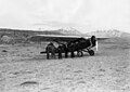 Airplane expedition - Travel Air 6000 in Moab, UT (26936642554).jpg 680 × 482; 79 KB
-
 AN ARM OF CLEOWAX LAKE - NARA - 520128.jpg 3,000 × 2,102; 1.3 MB
-
 AN ARM OF CLEOWAX LAKE - NARA - 520128.tif 3,000 × 2,102; 6.01 MB
-
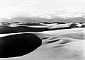
 AN OLD DUNE "ISLAND" WITHIN NEW DUNES - NARA - 520137.jpg 3,000 × 2,144; 1.33 MB
-
 AN OLD DUNE "ISLAND" WITHIN NEW DUNES - NARA - 520137.tif 3,000 × 2,144; 6.13 MB
-
 ANOTHER SPOUTING HORN - NARA - 520107.jpg 3,000 × 2,171; 1.3 MB
-
 ANOTHER SPOUTING HORN - NARA - 520107.tif 3,000 × 2,171; 6.21 MB
-
 ANOTHER VIEW OF THE EOLIAN, OR TOPIARY, GARDENS - NARA - 520116.jpg 3,000 × 2,100; 1.84 MB
-
 ANOTHER VIEW OF THE EOLIAN, OR TOPIARY, GARDENS - NARA - 520116.tif 3,000 × 2,100; 6.01 MB
-

-
 Arthur Demaray sitting in his office (99a23cb98fc74a8485d43904565b8350).jpg 8,005 × 5,306; 2.58 MB
-
-

-
 Bear dinner 1922.jpg 516 × 387; 33 KB
-
 BIBE 155 large (26936642944).jpg 720 × 529; 118 KB
-
 BIBE 1936 GAG 159 large (26936642804).jpg 720 × 525; 112 KB
-
 BIBE 1936 GAG 175x large (27447413982).jpg 720 × 538; 131 KB
-
 BIBE 1936 GAG 176 large (26936642504).jpg 720 × 532; 152 KB
-
 BIBE 1936 GAG 177a (26936642464).jpg 720 × 535; 115 KB
-
 BIBE 1936 GAG 177x (26936642894).jpg 720 × 537; 123 KB
-
 BIBE 1936 GAG 178 large (27447413872).jpg 720 × 539; 143 KB
-
 BIBE 1936 GAG 179a large (27447414312).jpg 720 × 548; 108 KB
-

-

-
 Blackfoot teepees.jpg 516 × 348; 27 KB
-
 BLASTED HOPES - NARA - 520159.jpg 3,000 × 2,201; 1.55 MB
-
 BLASTED HOPES - NARA - 520159.tif 3,000 × 2,201; 6.3 MB
-
 BROOKINGS SHORES - NARA - 520168.jpg 3,000 × 2,137; 1.27 MB
-
 BROOKINGS SHORES - NARA - 520168.tif 3,000 × 2,137; 6.11 MB
-
 Bryce Cabin circa 1881.jpg 585 × 415; 70 KB
-

-

-

-

-
-

-
 CAPE SEBASTIAN FROM SOUTH - NARA - 520162.jpg 3,000 × 2,148; 1.47 MB
-
 CAPE SEBASTIAN FROM SOUTH - NARA - 520162.tif 3,000 × 2,148; 6.15 MB
-
 Cascades and waterfalls along Mt. Carmel road during rainstorm. - NARA - 520404.jpg 2,142 × 3,000; 1.36 MB
-
 Cascades and waterfalls along Mt. Carmel road during rainstorm. - NARA - 520404.tif 2,142 × 3,000; 6.13 MB
-
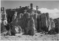
 Castellated formation, north side of road in Red Canyon. - NARA - 520213.jpg 3,000 × 2,114; 1.53 MB
-
 Castellated formation, north side of road in Red Canyon. - NARA - 520213.tif 3,000 × 2,114; 6.05 MB
-
 Castellated formation, north side of road in Red Canyon. - NARA - 520214.jpg 3,000 × 2,129; 1.7 MB
-

-

-

-

-
 CCC Camp -3, Jackson Lake, August 28, 1933 (27447442572).jpg 475 × 335; 87 KB
-
 CCC RMNP 1933.jpg 516 × 358; 27 KB
-

-
 CLEOWAX LAKE DUNES - NARA - 520129.jpg 3,000 × 2,084; 1.31 MB
-

-

-
 COOS BAY BRIDGE - NARA - 520141.jpg 3,000 × 2,159; 1.58 MB
-
 COOS BAY BRIDGE - NARA - 520141.tif 3,000 × 2,159; 6.18 MB
-

-
 CRLA - West Entrance Sign (27546419455).jpg 488 × 694; 149 KB
-

-

-
 CURRY COUNTY COASTLINE - NARA - 520177.jpg 3,000 × 2,378; 1.31 MB
-
 CURRY COUNTY COASTLINE - NARA - 520177.tif 3,000 × 2,378; 6.8 MB
-
 CURRY COUNTY FARM - NARA - 520172.jpg 3,000 × 2,475; 1.49 MB
-
 CURRY COUNTY FARM - NARA - 520172.tif 3,000 × 2,475; 7.08 MB
-
 CURRY COUNTY SEASCAPE - NARA - 520191.jpg 2,356 × 3,000; 1.7 MB
-
 CURRY COUNTY SEASCAPE - NARA - 520191.tif 2,356 × 3,000; 6.74 MB
-
 Daily trips CLNP.jpg 348 × 423; 32 KB
-

-
 DEPOE BAY VIEW WITH SPOUTING HORN THRU LAVA SHORE ROCKS - NARA - 520108.jpg 3,000 × 2,141; 1.34 MB
-
 DEPOE BAY VIEW WITH SPOUTING HORN THRU LAVA SHORE ROCKS - NARA - 520108.tif 3,000 × 2,141; 6.13 MB
-
 Deric Nusbaum (27447414182).jpg 327 × 464; 79 KB
-

-

-

-

-
-
 DUNES ENCROACH ON FOREST - NARA - 520133.jpg 3,000 × 2,089; 1.49 MB
-
 DUNES ENCROACH ON FOREST - NARA - 520133.tif 3,000 × 2,089; 5.98 MB
-
 DUNES ENCROACHING ON FOREST - NARA - 520138.jpg 3,000 × 2,168; 1.22 MB
-
 DUNES ENCROACHING ON FOREST - NARA - 520138.tif 3,000 × 2,168; 6.2 MB
-

-
-

-
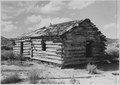
 Early home of Ebenezer Bryce. Additional data on 79-ZBC-BC19. - NARA - 520234.jpg 3,000 × 2,123; 1.94 MB
-
 Early home of Ebenezer Bryce. Additional data on 79-ZBC-BC19. - NARA - 520234.tif 3,000 × 2,123; 6.07 MB
-

-

-

-
 EMBATTLED EVERGREENS - NARA - 520145.jpg 2,170 × 3,000; 2.16 MB
-
 EMBATTLED EVERGREENS - NARA - 520145.tif 2,170 × 3,000; 6.21 MB
-
-
-
 Ezekiel 'Zeke' Johnson GAG (26936642414).jpg 457 × 626; 94 KB
-

-

-

-

-

-

-

-

-

-

-

-

-
 Flappers MVNP crop.jpg 301 × 299; 16 KB
-
 Flappers MVNP.jpg 348 × 501; 27 KB
-

-

-

-

-

-
-

-
-

-
 Ft. Matanzas 1937.jpg 348 × 514; 20 KB
-
 Gen. Grat tree,1936.jpg 313 × 412; 110 KB
-
 Geo W. Coe.jpg 348 × 492; 32 KB
-
 GEOLOGIC AND CLIMATIC STORY - NARA - 520140.jpg 3,000 × 2,151; 1.3 MB
-
 GEOLOGIC AND CLIMATIC STORY - NARA - 520140.tif 3,000 × 2,151; 6.15 MB
-
 GEOLOGY ON EXHIBITION - NARA - 520166.jpg 3,000 × 2,130; 1.38 MB
-
 GEOLOGY ON EXHIBITION - NARA - 520166.tif 3,000 × 2,130; 6.09 MB
-

-
 Girls at White Sands.jpg 516 × 362; 17 KB
-
 GLAC 729 (27511331896).jpg 714 × 1,008; 233 KB
-
 GLAC Going-to-the-Sun Highway 752 (27473661971).jpg 488 × 344; 71 KB
-
 GLAC Going-to-the-Sun Highway Dedication 770 (27270689280).jpg 658 × 463; 115 KB
-

-
 GLAC Swiss Costumed Waitresses (27270649050).jpg 469 × 321; 52 KB
-
 GLAC Swiss Costumed Waitresses (27475224901).jpg 682 × 469; 78 KB
-

-
 GOLD BEACH "MINE" - NARA - 520157.jpg 3,000 × 2,152; 1.39 MB
-
 GOLD BEACH "MINE" - NARA - 520157.tif 3,000 × 2,152; 6.16 MB
-
-
 GRAVEYARD OF FOREST - NARA - 520139.jpg 3,000 × 2,166; 1.22 MB
-
 GRAVEYARD OF FOREST - NARA - 520139.tif 3,000 × 2,166; 6.2 MB
-

-

-
 Ground Cherry - Japanese Lanterns. Physalis. - NARA - 520506.jpg 2,138 × 3,000; 1.18 MB
-
 Ground Cherry - Japanese Lanterns. Physalis. - NARA - 520506.tif 2,138 × 3,000; 6.12 MB
-

-
 GRSM 1931 Preliminary Survey Team (26936642384).jpg 485 × 691; 148 KB
-
 GRSM 1931 Preliminary Survey Team (26936642654).jpg 702 × 415; 107 KB
-
 GRSM 1931 Preliminary Survey Team (26936642684).jpg 695 × 483; 120 KB
-
 GRSM 1931 Preliminary Survey Team (27447414112).jpg 697 × 483; 154 KB
-
 GRSM 1931 Preliminary Survey Team (27447432292).jpg 687 × 420; 89 KB
-
 GRSM Captured Still (27447432282).jpg 438 × 288; 65 KB
-
 GRTE Teton Canyon (27511331866).jpg 717 × 504; 134 KB
-
 GRTE Teton Range (27511331836).jpg 720 × 494; 118 KB
-
 GRTE-360 (27473661921).jpg 679 × 473; 116 KB
-
 GRTE-361 (27511331806).jpg 679 × 473; 146 KB
-
 Guy E Edwards (27447432252).jpg 578 × 808; 123 KB
-
 Harold Bryant at office (27447432212).jpg 720 × 542; 75 KB
-
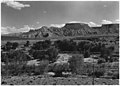
 Headed up Red Canyon toward Bryce. - NARA - 520216.jpg 3,000 × 2,123; 1.5 MB
-
 Headed up Red Canyon toward Bryce. - NARA - 520216.tif 3,000 × 2,123; 6.07 MB
-

-

-
 HECETA HEAD AND LIGHTHOUSE - NARA - 520121.jpg 3,000 × 2,087; 1.53 MB
-
 HECETA HEAD AND LIGHTHOUSE - NARA - 520121.tif 3,000 × 2,087; 5.97 MB
-
 HECETA HEAD LIGHTHOUSE - NARA - 520120.jpg 3,000 × 2,102; 1.33 MB
-
 HECETA HEAD LIGHTHOUSE - NARA - 520120.tif 3,000 × 2,102; 6.01 MB
-

-

-
-
 HIKER'S PARADISE - NARA - 520183.jpg 2,391 × 3,000; 1.47 MB
-
 HIKER'S PARADISE - NARA - 520183.tif 2,391 × 3,000; 6.84 MB
-
 HIKING THE COASTLINE - CURRY COUNTY - NARA - 520181.jpg 2,361 × 3,000; 1.61 MB
-
 HIKING THE COASTLINE - CURRY COUNTY - NARA - 520181.tif 2,361 × 3,000; 6.76 MB
-
 Hindu Temples from Peek-A-Boo Canyon. - NARA - 520274.jpg 3,000 × 2,141; 2.07 MB
-

-

-
 HOME OF SEA BIRDS - NARA - 520176.jpg 3,000 × 2,365; 1.72 MB
-
 HOME OF SEA BIRDS - NARA - 520176.tif 3,000 × 2,365; 6.77 MB


.jpg)

_GARDENS_-_NARA_-_520119.jpg)

.jpg)
.jpg)
.jpg)


.jpg)

.jpg)
_signs_along_the_main_street_of_West_Yellowstone,_Montana._Eagle%27s_Store_(rustic_structure)_at_(8c0988f558464a8cbc074fc7ee7c3229).jpg)
.jpg)
.jpg)


.jpg)
.jpg)
_Camp_No._2,_near_Apgar,_Montana,_at_the_foot_of_Lake_MacDonald_(639ede63e3ca49dfab147de5f05ea658).jpg)
._(cb5bc0b011da40618e031bb2412d581b).jpg)

.jpg)
.jpg)
.jpg)
.jpg)
.jpg)
.jpg)
.jpg)
.jpg)
.jpg)
.jpg)


.jpg)
.jpg)
_workers_ready_to_depart_from_camp_to_the_various_places_on_the_job_-_woods_(ad9082816d2a42698b7f4dd45717bc48).jpg)
.jpg)
.jpg)
_boys_sawing_down_dead_trees_in_burned_over_area_near_Belton,_Montana._Glacier_(90d2cb1cbd9b40689751f03f9bdfb2a0).jpg)


_Camp_and_the_woodpile_at_Rocky_Mountain_National_Park._(d885f329242b400e8d572f99ab191eab).jpg)
_camp_at_Lava_Beds_National_Monument._North_entrance_on_site_of_Gillenes_camp_looking_north_(7b787222f5b6412a864b524f9734d819).jpg)
_enrollees_carrying_on_erosion_control_operations_along_the_Graveyard_Road_in_front_of_Stockade_(4018a5d807a8439c882388f423373743).jpg)
_workers_at_lunch,_Cow_Creek,_Rocky_Mountain_National_Park._(a7af327c5e064da6955af178424118ed).jpg)
.jpg)

.jpg)

.jpg)
.jpg)

.jpg)
.jpg)


.jpg)

.jpg)
.jpg)
_in_Devils_Tower_National_(b8c9a8ed3fe2433e8650926449b06bc0).jpg)
.jpg)


.jpg)


.jpg)


.jpg)
,_showing_a_bastion,_the_moat_wall,_and_moat._Dry_Tortugas_National_Park_(formerly_Fort_Jefferson_(2a227be1751e4ff683bbb64b0d11c503).jpg)
_-illegible-_to_monument._Locality-_Papago_State_Park_(Not_in_Saguaro_National_Monument)._Negative_-_12_(823f4525899746abbb6d1690a14ba88e).jpg)
_-illegible-_to_monument._Papago_Saguaro._Locality-_Not_in_Saguaro_National_Monument._Negative_-_12-01_(1cea410022ea4dfcb9e097b09efd0c01).jpg)
.jpg)
.jpg)
.jpg)
.jpg)
.jpg)
.jpg)
.jpg)
_orders_has_no_effect_on_fire_traveling,_so_the_(daba79b4e4f3486db9719717ccbf0e97).jpg)
.jpg)


.jpg)


.jpg)

.jpg)


.jpg)
.jpg)
.jpg)
.jpg)
.jpg)
.jpg)
.jpg)

.jpg)

.jpg)
.jpg)

_Camp_at_Many_Glacier,_Glacier_National_Park,_made_up_mostly_of_boys_from_(f41417cc1145446a95fd0f091fe73be8).jpg)
.jpg)
.jpg)
.jpg)
.jpg)
.jpg)
.jpg)
.jpg)
.jpg)
.jpg)
.jpg)
.jpg)
.jpg)

_camp_no.3,_north_end_of_Jackson_Lake,_Grand_Teton_National_Park._(ceec16b71b004e4da8bd57c56caefdbf).jpg)
.jpg)


.jpg)
.jpg)
.jpg)


.jpg)
.jpg)

.jpg)
.jpg)