Category:Phillack
Jump to navigation
Jump to search
village in Cornwall, United Kingdom  | |||||
| Upload media | |||||
| Instance of |
| ||||
|---|---|---|---|---|---|
| Location | Hayle, Cornwall, South West England, England | ||||
 | |||||
English: Phillack is a settlement in the west of Cornwall, UK which since 1935 has fallen within the boundaries of the Hayle civil parish. The origin of the name Phillack was traced in the 17th century to the Irish Saint Felicitas, who is said to have founded Phillack church in the 6th century AD, but a 10th century Vatican codex mentions a Saint Felec of Cornwall, who may be the dedicatee and is believed to have lived about the same time.
Subcategories
This category has the following 3 subcategories, out of 3 total.
B
M
- Minerals of Wheal Alfred (11 F)
Media in category "Phillack"
The following 84 files are in this category, out of 84 total.
-
 A view across Lelant Saltings - geograph.org.uk - 394468.jpg 640 × 425; 77 KB
-
 Across the estuary to Phillack - geograph.org.uk - 2701823.jpg 640 × 427; 188 KB
-
 Beach below Phillack Towans (6541).jpg 4,288 × 2,848; 5.62 MB
-
 Beach below Phillack Towans (6544).jpg 4,288 × 2,848; 5.09 MB
-
 Beach below Phillack Towans (6546).jpg 4,288 × 2,848; 5.2 MB
-
 Beach below Phillack Towans (6547).jpg 4,288 × 2,848; 5.13 MB
-
 Beach below Phillack Towans (6548).jpg 4,288 × 2,848; 4.79 MB
-
 Beach near Black Cliff - geograph.org.uk - 107867.jpg 640 × 480; 77 KB
-
 Bungalows near Hayle - geograph.org.uk - 1856817.jpg 640 × 480; 86 KB
-
 Bus shelter in Phillack ... - geograph.org.uk - 3824307.jpg 1,152 × 1,536; 1.04 MB
-

-
 Caravan site on Phillack Towans (6537).jpg 4,288 × 2,848; 6.49 MB
-
 Caravan site on Phillack Towans (6538).jpg 4,288 × 2,848; 6.45 MB
-
 Caravans at Riviere Towans - geograph.org.uk - 1505648.jpg 640 × 480; 70 KB
-
 Churchtown Road Phillack - geograph.org.uk - 1505582.jpg 640 × 480; 119 KB
-
 Coast path in Phillack Towans - geograph.org.uk - 1856793.jpg 640 × 480; 84 KB
-

-
 Copperhouse Canal - geograph.org.uk - 577891.jpg 640 × 427; 108 KB
-

-
 Godrevy at sunset - geograph.org.uk - 369481.jpg 640 × 481; 69 KB
-
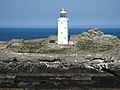 Godrevy Lighthouse, Godrevy Island - geograph.org.uk - 407138.jpg 640 × 480; 99 KB
-
 Hayle River estuary - geograph.org.uk - 107871.jpg 640 × 480; 117 KB
-
 Hayle Towans - geograph.org.uk - 318473.jpg 640 × 427; 86 KB
-
 Hayle Towans beach, looking toward Estuary from Godrevy.jpg 1,600 × 1,200; 348 KB
-
 Hayle, Loggans Mill - geograph.org.uk - 91932.jpg 640 × 437; 134 KB
-
 Kitesurfer off Phillack Towans (6540).jpg 4,288 × 2,848; 5.36 MB
-
 Lelant, Cornwall - geograph.org.uk - 465513.jpg 640 × 480; 70 KB
-
 Lethlean House.jpg 1,530 × 1,712; 1 MB
-
 Lethlean Towans (SSSI).jpg 966 × 1,232; 376 KB
-
 Mexico straight on. - panoramio.jpg 3,648 × 2,056; 4.93 MB
-
 Over the Black Bridge - geograph.org.uk - 578331.jpg 640 × 427; 117 KB
-
 Phillack , Brookway - geograph.org.uk - 6337747.jpg 6,000 × 4,000; 7.29 MB
-
 Phillack , Churchtown Road - geograph.org.uk - 6305227.jpg 6,000 × 4,000; 7.57 MB
-
 Phillack , Clifton Terrace - geograph.org.uk - 6305206.jpg 6,000 × 4,000; 7.21 MB
-
 Phillack , Copperhouse Pool - geograph.org.uk - 6305204.jpg 6,000 × 4,000; 6.97 MB
-
 Phillack , Copperhouse Pool - geograph.org.uk - 6305221.jpg 6,000 × 4,000; 7.83 MB
-
 Phillack , Copperhouse Pool - geograph.org.uk - 6305222.jpg 6,000 × 4,000; 5.7 MB
-
 Phillack , Crop Field - geograph.org.uk - 6305198.jpg 6,000 × 4,000; 7.82 MB
-
 Phillack , Footpath - geograph.org.uk - 6305207.jpg 6,000 × 4,000; 6.28 MB
-
 Phillack , Footpath - geograph.org.uk - 6305225.jpg 6,000 × 4,000; 7.53 MB
-
 Phillack , Footpath - geograph.org.uk - 6337746.jpg 6,000 × 4,000; 6.47 MB
-
 Phillack , Grassy Field - geograph.org.uk - 6304673.jpg 6,000 × 4,000; 6.13 MB
-
 Phillack , Grassy Field - geograph.org.uk - 6304676.jpg 6,000 × 4,000; 6.98 MB
-
 Phillack , Hayle Scenery - geograph.org.uk - 6305201.jpg 6,000 × 4,000; 6.35 MB
-
 Phillack , Lethlean Lane - geograph.org.uk - 6305232.jpg 6,000 × 4,000; 5.66 MB
-
 Phillack , Riviere Cottages - geograph.org.uk - 6305223.jpg 6,000 × 4,000; 7.56 MB
-
 Phillack , Riviere Sands Holiday Park - geograph.org.uk - 6304664.jpg 6,000 × 4,000; 6.75 MB
-
 Phillack , Riviere Towans - geograph.org.uk - 6304659.jpg 6,000 × 4,000; 5.64 MB
-
 Phillack , Riviere Towans - geograph.org.uk - 6304674.jpg 4,000 × 6,000; 6.6 MB
-
 Phillack , Riviere Towans - geograph.org.uk - 6305199.jpg 6,000 × 4,000; 5.84 MB
-
 Phillack , Riviere Towans Chalets - geograph.org.uk - 6304671.jpg 6,000 × 4,000; 5.88 MB
-
 Phillack , Road - geograph.org.uk - 6305202.jpg 6,000 × 4,000; 7.38 MB
-
 Phillack , Road - geograph.org.uk - 6305203.jpg 6,000 × 4,000; 5.92 MB
-
 Phillack , St Felicitas and St Piala's Church - geograph.org.uk - 6305226.jpg 6,000 × 4,000; 7.89 MB
-
 Phillack , St Felicitas and St Piala's Church - geograph.org.uk - 6305229.jpg 4,000 × 6,000; 6.49 MB
-
 Phillack , St Felicitas and St Piala's Church - geograph.org.uk - 6305231.jpg 6,000 × 4,000; 7.47 MB
-
 Phillack , St Felicitas and St Piala's Church - Graves - geograph.org.uk - 6305230.jpg 6,000 × 4,000; 6.8 MB
-
 Phillack , St Felicitas and St Piala's Church - Lych Gate - geograph.org.uk - 6305228.jpg 4,000 × 6,000; 6.26 MB
-
 Phillack , Track - geograph.org.uk - 6305200.jpg 6,000 × 4,000; 5.92 MB
-
 Phillack - Victorian Post Box.jpg 2,780 × 3,108; 3.38 MB
-
 Phillack cemetery - geograph.org.uk - 1505576.jpg 640 × 499; 103 KB
-
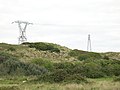 Power lines on Upton Towans - geograph.org.uk - 57430.jpg 640 × 480; 68 KB
-
 Riviere Cottage 2.jpg 2,608 × 2,031; 5.29 MB
-
 Riviere Cottage Plaque.jpg 2,486 × 2,314; 2.57 MB
-
 Riviere Cottage.jpg 3,359 × 3,261; 7.26 MB
-
 Stivesbaymap.gif 450 × 424; 13 KB
-
 The Black Bridge - geograph.org.uk - 578316.jpg 640 × 427; 98 KB
-
 The Bucket of Blood Inn Phillack - geograph.org.uk - 4065992.jpg 1,280 × 960; 790 KB
-
 The Bucket of Blood inn sign - geograph.org.uk - 4312122.jpg 531 × 800; 110 KB
-
 The Bucket of Blood, Phillick - geograph.org.uk - 4312117.jpg 800 × 531; 88 KB
-
 Upton Towans - geograph.org.uk - 345050.jpg 640 × 514; 141 KB
-
 Western Greyhound 555 at Hayle Towans on route 515 (8871873068).jpg 2,880 × 1,623; 2.32 MB
-
 Fore Street, Copperhouse - geograph.org.uk - 578038.jpg 640 × 427; 95 KB
-

-
 Godrevy Island - geograph.org.uk - 410883.jpg 640 × 332; 89 KB
-
 Grass covered dunes at Hayle Towans - geograph.org.uk - 758231.jpg 640 × 480; 53 KB
-
 Looking towards the wood - geograph.org.uk - 636138.jpg 640 × 480; 96 KB
-
 New affordable housing and a derelict Mill - geograph.org.uk - 57258.jpg 640 × 480; 108 KB
-
 Pampas Grass under the powerlines - geograph.org.uk - 58492.jpg 640 × 480; 97 KB
-
 Phillack - geograph.org.uk - 56806.jpg 640 × 480; 331 KB
-
 The Hayle turning on the A30 - geograph.org.uk - 169501.jpg 640 × 426; 58 KB
-
 The King George V Memorial Walk - geograph.org.uk - 578350.jpg 640 × 427; 142 KB
-

-
 The lane to North Treveneague farm - geograph.org.uk - 636142.jpg 640 × 480; 127 KB


.jpg)
.jpg)
.jpg)
.jpg)
.jpg)


.jpg)
.jpg)


.jpg)


.jpg)


.jpg)


