Category:Pfarrspeicher (Zuzgen)
Jump to navigation
Jump to search
| Object location | | View all coordinates using: OpenStreetMap |
|---|
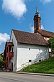
building in Zuzgen in the canton of Aargau, Switzerland  | |||||
| Upload media | |||||
| Instance of | |||||
|---|---|---|---|---|---|
| Part of | |||||
| Location | Zuzgen, Rheinfelden District, Aargau, Switzerland | ||||
| Street address |
| ||||
| Heritage designation | |||||
| Inception |
| ||||
 | |||||
Media in category "Pfarrspeicher (Zuzgen)"
The following 2 files are in this category, out of 2 total.
-
 2018-Zuzgen-Pfarrspeicher-II.jpg 1,280 × 1,920; 2.24 MB
-
 2018-Zuzgen-Pfarrspeicher.jpg 1,280 × 1,920; 2.12 MB
