Category:Pfarrkirche hl. Ägidius Ruppersthal
Jump to navigation
Jump to search
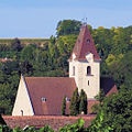
church building in Großweikersdorf, Austria  .JPG)  | |||||
| Upload media | |||||
| Instance of | |||||
|---|---|---|---|---|---|
| Location | Ruppersthal, Großweikersdorf, Tulln District, Lower Austria, Austria | ||||
| Heritage designation | |||||
 | |||||
Media in category "Pfarrkirche hl. Ägidius Ruppersthal"
The following 8 files are in this category, out of 8 total.
-
 Kirche 23654 Hauptaltar in A-3701 Ruppersthal.jpg 4,016 × 4,875; 2.93 MB
-
 Ruppersthal - Pfarrkirche hl. Ägidius - August 2012.JPG 1,054 × 1,052; 361 KB
-
 Ruppersthal - Pfarrkirche hl. Ägidius - November 2015 (1).jpg 4,251 × 3,130; 4.57 MB
-
 Ruppersthal - Pfarrkirche hl. Ägidius - Okt 2014 Nacht(1).JPG 2,324 × 1,923; 933 KB
-
 Ruppersthal - Pfarrkirche hl. Ägidius - Okt 2014 Nacht(2).JPG 2,229 × 1,768; 490 KB
-
 Ruppersthal - Pfarrkirche hl. Ägidius - Sept 2014 (1).JPG 3,218 × 2,224; 2.12 MB
-
 Ruppersthal - Pfarrkirche hl. Ägidius - Sept 2014 (2).JPG 3,960 × 3,117; 3.27 MB
-
 Ruppersthal Pfarrkirche.jpg 2,000 × 3,008; 4.09 MB

.jpg)
.JPG)
.JPG)
.JPG)