Category:Pfarrkirche Hautzendorf
Jump to navigation
Jump to search
| Object location | | View all coordinates using: OpenStreetMap |
|---|
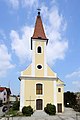
church building in Kreuttal, Austria   | |||||
| Upload media | |||||
| Instance of | |||||
|---|---|---|---|---|---|
| Named after | |||||
| Location | Kreuttal, Mistelbach District, Lower Austria, Austria | ||||
| Street address |
| ||||
| Heritage designation | |||||
 | |||||
Media in category "Pfarrkirche Hautzendorf"
The following 3 files are in this category, out of 3 total.
-
 Hautzendorf - Kirche.JPG 2,625 × 3,937; 6.65 MB
-
 Hautzendorf Filialkirche.jpg 1,920 × 1,280; 475 KB
-
 Kirche 19893 Hauptaltar in A-2123 Hautzendorf.jpg 4,000 × 5,086; 3.06 MB
