Category:Pfarrkirche Adnet
Jump to navigation
Jump to search
| Object location | | View all coordinates using: OpenStreetMap |
|---|
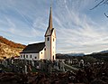
church building in Adnet, Austria  | |||||
| Upload media | |||||
| Instance of | |||||
|---|---|---|---|---|---|
| Named after | |||||
| Location | Adnet, Hallein District, Salzburg, Austria | ||||
| Heritage designation | |||||
 | |||||
Deutsch: Ansichten und Details der Pfarrkirche hll. Stephanus und Laurentius in Adnet, Bezirk Hallein, Land Salzburg
Subcategories
This category has the following 3 subcategories, out of 3 total.
F
- Friedhof Adnet (24 F)
P
- Pfarrhof Adnet (3 F)
Media in category "Pfarrkirche Adnet"
The following 17 files are in this category, out of 17 total.
-
 Adnet - Ort - Pfarrkirche - 2020 08 11-1.jpg 4,233 × 2,821; 2.36 MB
-
 Adnet - Ort - Pfarrkirche - 2020 08 11-2.jpg 3,303 × 4,954; 3.26 MB
-
 Adnet - Ort - Pfarrkirche - 2020 08 11-3.jpg 4,947 × 3,297; 2.54 MB
-
 Adnet - Pfarrkirche Adnet - Tür 2.jpg 4,877 × 3,251; 3.15 MB
-
 Adnet - Pfarrkirche Adnet - Tür 3.jpg 3,701 × 2,466; 1.75 MB
-
 Adnet - Pfarrkirche Adnet -Tür 1.jpg 3,456 × 5,184; 4.14 MB
-
 Adnet Friedhof 8157.jpg 3,446 × 2,786; 5.61 MB
-
 Adnet Friedhof 8172.jpg 3,480 × 2,688; 5.49 MB
-
 Adnet Kirche 8149.jpg 4,052 × 2,608; 6.7 MB
-
 Adnet Kirche 8154.jpg 3,526 × 2,750; 6.33 MB
-
 Adnet Kirche 8155.jpg 2,722 × 4,200; 7.18 MB
-
 Adnet kirche steinbruch.jpg 3,797 × 2,136; 6.06 MB
-
 Adnet kirche untersberg.jpg 2,989 × 2,242; 4.9 MB
-
 Adnet kirche.jpg 5,940 × 3,960; 8.86 MB
-
 Adnet salzburg.jpg 3,433 × 1,928; 4.98 MB
-
 Adnet von Waidach.JPG 2,560 × 1,920; 1.16 MB
-
 Friedhof Adnet.JPG 4,000 × 3,000; 4.85 MB


