Category:Pfarrhofgasse (Klagenfurt)
Jump to navigation
Jump to search
Media in category "Pfarrhofgasse (Klagenfurt)"
The following 17 files are in this category, out of 17 total.
-
 Klagenfurt Innere Stadt Pfarrhofgasse 2 Zum Augustin Luft-Ansicht 03082017 0289.jpg 7,360 × 4,912; 25.18 MB
-
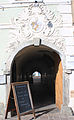
 Klagenfurt Innere Stadt Pfarrhofgasse 2 Zum Augustin Portal S-Ansicht 23082020 9783.jpg 4,452 × 7,175; 17.61 MB
-
 Klagenfurt Innere Stadt Pfarrhofgasse 2 Zum Augustin S-Fassade Fenster 23082020 9784.jpg 4,522 × 6,857; 13.83 MB
-
 Klagenfurt Innere Stadt Pfarrhofgasse 6 Vorstadthaus der von Seenuss O-Ansicht 23082020 9785.jpg 4,912 × 6,940; 16.84 MB
-
 Klagenfurt Innere Stadt Pfarrhofgasse 8 Vorstadthaus Ecke Eggergasse 18052020 9025.jpg 4,872 × 6,946; 15.48 MB
-
 Klagenfurt Innere Stadt Pfarrhofgasse 8 Vorstadthaus Ecke Eggergasse 23082020 9786.jpg 4,912 × 5,820; 14.95 MB
-
 Klagenfurt Innere Stadt Pfarrhofgasse W-Ansicht mit Stadtpfarrturm 23052020 9043.jpg 4,912 × 7,360; 15.43 MB
-
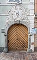
 Klagenfurt Pfarrhofgasse 2 Zum Augustin Portal 02082016 3385.jpg 4,476 × 6,707; 15.85 MB
-
 Klagenfurt Pfarrhofgasse 6 Vorstadthaus der von Seenuss O-Ansicht 23052020 9050.jpg 4,912 × 7,360; 18.27 MB
-
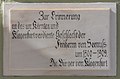 Klagenfurt Pfarrhofgasse 6 Vorstadthaus Gedenktafel Freiherrn von Seenuss 02082016 3368.jpg 7,014 × 4,641; 12.43 MB
-
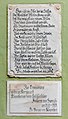
 Klagenfurt Pfarrhofgasse 6 Vorstadthaus Inschrift-Tafeln von Seenuss 02082016 3369.jpg 3,826 × 6,085; 12.14 MB
-
 Klagenfurt Pfarrhofgasse 6 Vorstadthaus Inschrift-Tafeln von Seenuss 23052020 9044.jpg 4,135 × 7,248; 17.92 MB
-
 Klagenfurt Pfarrhofgasse 8 Vorstadthaus Gallo Nero Portal 02082016 3363.jpg 4,912 × 7,360; 14.23 MB
-
 Klagenfurt, Pfarrhofgasse 2 (2).JPG 3,072 × 4,608; 5.18 MB
-
 Klagenfurt, Pfarrhofgasse 2 (7).JPG 2,437 × 3,541; 4.44 MB
-
 Klagenfurt, Pfarrhofgasse 2 - detail1.JPG 2,789 × 4,507; 7.16 MB
-
 Klagenfurt, Pfarrhofgasse 2 - detail2.JPG 5,184 × 3,456; 7.64 MB


.JPG)
.JPG)

