Category:Pfarrhaus Gröben (Ludwigsfelde)
Jump to navigation
Jump to search
| Object location | | View all coordinates using: OpenStreetMap |
|---|
This is the category of the Brandenburger Baudenkmal (cultural heritage monument) with the ID 09105935 (Wikidata)
|
 | |||||
| Upload media | |||||
| Instance of | |||||
|---|---|---|---|---|---|
| Location | Ludwigsfelde, Teltow-Fläming District, Brandenburg, Germany | ||||
| Heritage designation | |||||
 | |||||
Media in category "Pfarrhaus Gröben (Ludwigsfelde)"
The following 2 files are in this category, out of 2 total.
-
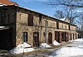 Pfarrhaus Gröben, Wirtschaftsgebäude.JPG 2,025 × 1,378; 980 KB
-
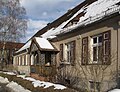 Pfarrhaus Gröben.JPG 2,322 × 1,782; 846 KB
