Category:Perris maps of Manhattan published in 1855
Jump to navigation
Jump to search
Maps from: Perris, William. Maps of the City of New-York. 1st, 2nd, 3rd, & 4th Ward. Vol. 1. (1855), comprising 21 section maps (double-page plates) plus volume index and title page with explanation (both single-page plates).
Source: The New York Public Library Digital Collections website, Maps of the city of New York [1855].
Subcategories
This category has only the following subcategory.
Media in category "Perris maps of Manhattan published in 1855"
The following 25 files are in this category, out of 25 total.
-
 Perris Manhattan V. 1 title page with explanation publ. 1855.jpg 4,272 × 6,788; 4.7 MB
-
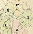 Perris Manhattan V. 1 volume index publ. 1855 (cropped).jpg 1,066 × 1,091; 295 KB
-
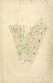 Perris Manhattan V. 1 volume index publ. 1855.jpg 4,409 × 6,785; 5.15 MB
-
 Perris Manhattan V. 1 volume index (small) publ. 1855.jpg 1,040 × 1,600; 379 KB
-
 Perris Manhattan V. 1 Plate 01 publ. 1855.jpg 6,360 × 4,812; 4.86 MB
-
 Perris Manhattan V. 1 Plate 02 publ. 1855.jpg 6,228 × 4,849; 4.02 MB
-
 Perris Manhattan V. 1 Plate 03 publ. 1855.jpg 6,198 × 4,764; 3.67 MB
-
 Perris Manhattan V. 1 Plate 04 publ. 1855.jpg 6,186 × 4,758; 4.09 MB
-
 Perris Manhattan V. 1 Plate 05 publ. 1855.jpg 6,216 × 4,794; 4.12 MB
-
 Perris Manhattan V. 1 Plate 06 publ. 1855.jpg 6,210 × 4,758; 3.7 MB
-
 Perris Manhattan V. 1 Plate 07 publ. 1855.jpg 6,239 × 4,860; 4.46 MB
-
 Perris Manhattan V. 1 Plate 08 publ. 1855.jpg 6,252 × 4,794; 4.08 MB
-
 Perris Manhattan V. 1 Plate 09 publ. 1855.jpg 6,174 × 4,704; 3.29 MB
-
 Perris Manhattan V. 1 Plate 10 publ. 1855.jpg 6,228 × 4,842; 3.9 MB
-
 Perris Manhattan V. 1 Plate 11 publ. 1855.jpg 6,228 × 4,758; 4.05 MB
-
 Perris Manhattan V. 1 Plate 12 publ. 1855.jpg 6,270 × 4,770; 3.67 MB
-
 Perris Manhattan V. 1 Plate A publ. 1855.jpg 6,291 × 4,829; 4.24 MB
-
 Perris Manhattan V. 1 Plate B publ. 1855.jpg 6,326 × 4,789; 3.91 MB
-
 Perris Manhattan V. 1 Plate C publ. 1855.jpg 6,342 × 4,854; 4.5 MB
-
 Perris Manhattan V. 1 Plate D publ. 1855.jpg 6,288 × 4,752; 4.2 MB
-
 Perris Manhattan V. 1 Plate E publ. 1855.jpg 6,326 × 4,703; 4 MB
-
 Perris Manhattan V. 1 Plate F publ. 1855.jpg 6,294 × 4,842; 4.35 MB
-
 Perris Manhattan V. 1 Plate G publ. 1855.jpg 6,306 × 4,803; 4.77 MB
-
 Perris Manhattan V. 1 Plate H publ. 1855.jpg 6,296 × 4,763; 3.88 MB
-
 Perris Manhattan V. 1 Plate I publ. 1855.jpg 6,234 × 4,824; 4.13 MB

.jpg)

_publ._1855.jpg)


