Category:Penyrheol, Trecenydd and Energlyn
Jump to navigation
Jump to search
community in Caerphilly, Wales  | |||||
| Upload media | |||||
| Instance of | |||||
|---|---|---|---|---|---|
| Location | Caerphilly County Borough, Wales | ||||
| Population |
| ||||
| Area |
| ||||
 | |||||
Subcategories
This category has the following 4 subcategories, out of 4 total.
Media in category "Penyrheol, Trecenydd and Energlyn"
The following 172 files are in this category, out of 172 total.
-

-

-

-

-
 A468 between the roundabouts - geograph.org.uk - 3125905.jpg 640 × 456; 75 KB
-
 A468 footbridge, Caerphilly - geograph.org.uk - 2696085.jpg 640 × 342; 66 KB
-
 A468 near Trecenydd - geograph.org.uk - 3787493.jpg 640 × 481; 55 KB
-
 A469 at Trecenydd - geograph.org.uk - 3787494.jpg 640 × 481; 64 KB
-

-
 Aber Cycleway at Station Terrace, Penyrheol - geograph.org.uk - 5739405.jpg 5,179 × 3,451; 4.18 MB
-

-

-
 B4263 layby near Abertridwr - geograph.org.uk - 2931404.jpg 640 × 504; 95 KB
-
 Birthplace of Tommy Cooper, Caerphilly - geograph.org.uk - 3817078.jpg 769 × 800; 135 KB
-
 Bowles Close, Caerphilly - geograph.org.uk - 2525264.jpg 640 × 480; 104 KB
-

-
 Bowls Lane, Penyrheol - geograph.org.uk - 5574541.jpg 4,608 × 3,456; 3.84 MB
-
 Bryn Ifor, Caerphilly - geograph.org.uk - 2928886.jpg 640 × 480; 63 KB
-
 Bryn Siriol, Caerphilly - geograph.org.uk - 2931307.jpg 640 × 418; 63 KB
-
 Building work in progress, Gypsy Lane - geograph.org.uk - 2065204.jpg 4,000 × 3,000; 3.21 MB
-

-
 Byway above Llanbradach - geograph.org.uk - 3345379.jpg 640 × 480; 46 KB
-
 Caerphilly Family Centre - geograph.org.uk - 2928841.jpg 640 × 503; 76 KB
-

-
 Cattle grid near Pen yr Heol Las Farm - geograph.org.uk - 4498931.jpg 3,918 × 2,938; 3.58 MB
-
 Cattle grid where Heol Las runs on to Eglwysilan Common - geograph.org.uk - 5574562.jpg 4,608 × 3,456; 3.71 MB
-

-
 Class 37 at Energlyn ^ Churchill Park - geograph.org.uk - 6208795.jpg 4,554 × 3,415; 4.92 MB
-
 Coed Leddyn, Pwllypant - geograph.org.uk - 5574578.jpg 4,608 × 3,456; 3.76 MB
-
 Corner gate, Rhymney Valley Ridgeway Walk - geograph.org.uk - 5772803.jpg 5,179 × 3,451; 3.93 MB
-

-

-

-

-

-
 Cottages, Groes-wen - geograph.org.uk - 2070462.jpg 3,296 × 2,472; 1.87 MB
-
 Court Road, Energlyn, Caerphilly - geograph.org.uk - 3934860.jpg 800 × 599; 127 KB
-
 Craig yr Allt - geograph.org.uk - 1990162.jpg 2,896 × 1,944; 2.27 MB
-
 Cylchdro Penyrheol Roundabout - geograph.org.uk - 3908659.jpg 640 × 480; 77 KB
-

-
 Electricity pylon near Groes-wen - geograph.org.uk - 2070366.jpg 2,472 × 3,296; 1.71 MB
-
 Energlyn Stores, Caerphilly - geograph.org.uk - 3817064.jpg 800 × 635; 155 KB
-

-

-
 Entrance to Energlyn Sidings, Caerphilly - geograph.org.uk - 3934841.jpg 800 × 600; 204 KB
-

-
 Farmland and track above Llanbradach - geograph.org.uk - 4498924.jpg 4,000 × 2,400; 2.19 MB
-

-
 Field footpath to Gwaun-gledyr-uchaf - geograph.org.uk - 5771152.jpg 5,179 × 3,451; 5.81 MB
-
 Footbridge over A468 at Energlyn - geograph.org.uk - 3125918.jpg 640 × 442; 103 KB
-
 Footbridge over the A468, Trecenydd - geograph.org.uk - 1849164.jpg 3,296 × 2,472; 1.87 MB
-
 Footpath above Groeswen Road - geograph.org.uk - 5772631.jpg 5,184 × 3,456; 5.96 MB
-
 Footpath across the A468 in Energlyn - geograph.org.uk - 4498948.jpg 3,832 × 2,874; 3.63 MB
-
 Footpath down to Groeswen - geograph.org.uk - 5772610.jpg 5,179 × 3,451; 5.99 MB
-
 Footpath stile, Gypsy Lane, Nantgarw - geograph.org.uk - 2065190.jpg 3,000 × 4,000; 3.76 MB
-
 Footpath through the trees in Penyrheol - geograph.org.uk - 4498943.jpg 4,000 × 3,000; 3.3 MB
-
 Footpath to Groeswen Road - geograph.org.uk - 5772349.jpg 5,179 × 3,451; 4.96 MB
-
 Former Bowls Inn to let, Caerphilly - geograph.org.uk - 2928696.jpg 640 × 401; 57 KB
-
 Gate on path to Groeswen - geograph.org.uk - 5772322.jpg 5,179 × 3,451; 6.59 MB
-
 Grange Close, Trecenydd, Caerphilly - geograph.org.uk - 2695793.jpg 640 × 431; 52 KB
-
 Groeswen Drive, Caerphilly - geograph.org.uk - 2569905.jpg 640 × 480; 77 KB
-
 Gypsy Lane - geograph.org.uk - 6175002.jpg 2,048 × 1,536; 1.41 MB
-
 Hank Marvin, Caerphilly - geograph.org.uk - 2928727.jpg 640 × 517; 80 KB
-
 Hendre Infants School, Caerphilly - geograph.org.uk - 2703494.jpg 640 × 432; 74 KB
-
 Hendre Junior School, Caerphilly - geograph.org.uk - 2703532.jpg 640 × 272; 44 KB
-

-

-
 Hendredenny Drive, looking towards St Cenydd Rd - geograph.org.uk - 1849349.jpg 3,296 × 2,472; 1.86 MB
-
 Heol Aneurin, Penyrheol, Caerphilly - geograph.org.uk - 2928782.jpg 640 × 454; 65 KB
-
 Heol Brynawel Road - geograph.org.uk - 3909189.jpg 640 × 480; 59 KB
-
 Heol Groeswen Drive - geograph.org.uk - 3908639.jpg 640 × 480; 79 KB
-

-
 Junction of Groeswen Drive and Hendredenny Drive - geograph.org.uk - 1849286.jpg 3,296 × 2,472; 1.81 MB
-
 Junction of Gypsy Lane and Old Nantgarw Rd, Caerphilly - geograph.org.uk - 2065175.jpg 4,000 × 3,000; 3.43 MB
-
 Junction of Heol Las with Heol Cwarrel Clarke - geograph.org.uk - 5574573.jpg 4,608 × 3,456; 3.96 MB
-
 Junction on Old Nantgarw Rd - geograph.org.uk - 2070360.jpg 3,296 × 2,472; 1.88 MB
-
 Kissing gate near reservoir - geograph.org.uk - 5772660.jpg 5,179 × 3,451; 5.62 MB
-

-
 Litter-strewn lane, Heol Las, Penyrheol - geograph.org.uk - 5574571.jpg 4,608 × 3,456; 3.85 MB
-

-

-
 Looking NE from Old Nantgarw Rd, Caerphilly - geograph.org.uk - 2190926.jpg 4,000 × 3,000; 2.25 MB
-
 Loose ends in Caerphilly - geograph.org.uk - 3817068.jpg 800 × 490; 87 KB
-
 Mango Express, Penyrheol,Caerphilly - geograph.org.uk - 2929304.jpg 640 × 526; 66 KB
-
 Mill House, Old Nantgarw Road - geograph.org.uk - 5771127.jpg 5,184 × 3,456; 7.54 MB
-
 Moel Fryn, Penyrheol,Caerphilly - geograph.org.uk - 2928877.jpg 640 × 425; 62 KB
-
 Mysterious mound beside Gypsy Lane, Nantgarw - geograph.org.uk - 2065185.jpg 4,000 × 3,000; 3.9 MB
-

-

-

-
 New school under construction - geograph.org.uk - 3050874.jpg 640 × 480; 64 KB
-
 New Street, Pwllypant, Caerphilly - geograph.org.uk - 2416678.jpg 640 × 467; 68 KB
-

-

-

-
 Ordnance Survey Cut Mark - geograph.org.uk - 5848641.jpg 1,024 × 886; 329 KB
-
 Ordnance Survey Cut Mark - geograph.org.uk - 5848644.jpg 1,024 × 715; 192 KB
-
 Ordnance Survey Rivet - geograph.org.uk - 5848636.jpg 521 × 1,024; 216 KB
-
 Ordnance Survey Rivet - geograph.org.uk - 5848649.jpg 750 × 1,024; 220 KB
-

-
 Pen-y-dre,Penyrheol - geograph.org.uk - 5574575.jpg 4,608 × 3,456; 3.68 MB
-
 Pen-yr-Heol Las Farm - geograph.org.uk - 5574565.jpg 4,608 × 3,456; 3.81 MB
-
 Pen-yr-Heol Las Farm - geograph.org.uk - 5574568.jpg 4,608 × 3,456; 3.84 MB
-
 Penyrheol ACF hall, Caerphilly - geograph.org.uk - 2931290.jpg 640 × 388; 78 KB
-
 Penyrheol Cemetery entrance - geograph.org.uk - 2070681.jpg 3,296 × 2,472; 1.81 MB
-
 Penyrheol News,Caerphilly - geograph.org.uk - 2929507.jpg 640 × 573; 77 KB
-
 Platform ends at Energlyn ^ Churchill Park station - geograph.org.uk - 4499789.jpg 4,000 × 3,000; 3.64 MB
-
 Pwllypant railway bridge - geograph.org.uk - 2416806.jpg 640 × 498; 103 KB
-

-
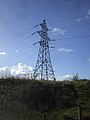
 Pylon in field, Gwaun-gledyr-uchaf - geograph.org.uk - 5772294.jpg 5,184 × 3,456; 7.13 MB
-
 Railway bridge over Heol Pwllypant, Pwllypant - geograph.org.uk - 5574579.jpg 4,608 × 3,456; 4.05 MB
-

-

-

-
 Rhiw Fach, Penyrheol,Caerphilly - geograph.org.uk - 2929237.jpg 640 × 457; 59 KB
-
 Rhymney Valley Ridgeway Walk by edge of field - geograph.org.uk - 5772683.jpg 5,179 × 3,451; 4.6 MB
-
 Road into Groeswen - geograph.org.uk - 5772411.jpg 5,179 × 3,451; 4.24 MB
-
 Road to Llanbradach from the A469 - geograph.org.uk - 2416893.jpg 640 × 480; 93 KB
-
 Roundabout outside St Cenydd School - geograph.org.uk - 3125913.jpg 640 × 393; 44 KB
-

-

-
 Ruined building near Groes-wen - geograph.org.uk - 2070376.jpg 3,296 × 2,472; 1.91 MB
-

-

-

-
 School House, Trecenydd, Caerphilly - geograph.org.uk - 2703550.jpg 640 × 385; 59 KB
-

-
 Second Avenue, Trecenydd - geograph.org.uk - 1849383.jpg 3,296 × 2,472; 1.8 MB
-
 Sheep and lambs near Llanbradach - geograph.org.uk - 4498920.jpg 4,000 × 3,000; 4.68 MB
-

-
 Sign for road junction - geograph.org.uk - 6175003.jpg 1,536 × 2,048; 732 KB
-

-
 Southeast end of St Cenydd Road, Caerphilly - geograph.org.uk - 6025843.jpg 1,024 × 870; 166 KB
-
 Spar store, Trecenydd, Caerphilly - geograph.org.uk - 2696024.jpg 640 × 501; 71 KB
-
 St Cenydd Leisure Centre, Caerphilly - geograph.org.uk - 2703544.jpg 640 × 480; 66 KB
-
 St Cenydd Rd Presbyterian Church, Trecenydd - geograph.org.uk - 1849126.jpg 3,296 × 2,472; 1.9 MB
-
 St Cenydd Rd, Trecenydd - geograph.org.uk - 1849142.jpg 3,296 × 2,472; 1.84 MB
-

-

-

-
 Station Terrace, B4263, Penyrheol - geograph.org.uk - 5739507.jpg 5,184 × 3,456; 7.25 MB
-

-

-

-
 Sylvia's Tuck Shop, Trecenydd - geograph.org.uk - 1849182.jpg 3,296 × 2,472; 1.86 MB
-

-

-
 The A468 at Trecenydd - geograph.org.uk - 1849367.jpg 3,296 × 2,472; 1.87 MB
-
 The Angel, Caerphilly - geograph.org.uk - 2569822.jpg 640 × 480; 69 KB
-
 The Angel, Whitecross Lane, Hendredenny - geograph.org.uk - 1849272.jpg 3,296 × 2,472; 1.79 MB
-
 The Bowls Inn Pub Caerphilly - geograph.org.uk - 2758537.jpg 1,024 × 684; 127 KB
-
 The Crescent, Trecenydd - geograph.org.uk - 1849153.jpg 3,296 × 2,472; 1.81 MB
-
 The Hay Loft, Gwaun-gledyr-uchaf - geograph.org.uk - 5771463.jpg 5,179 × 3,451; 5.36 MB
-
 The northern end of Gypsy Lane, near Hendredenny Park - geograph.org.uk - 2065197.jpg 4,000 × 3,000; 3.62 MB
-
 The White Cross, Groes-wen - geograph.org.uk - 2070450.jpg 3,296 × 2,472; 1.78 MB
-

-
 Towards Groeswen - geograph.org.uk - 5772336.jpg 5,184 × 3,456; 7.48 MB
-
 Track from Pen yr Heol Las Farm towards Caerphilly - geograph.org.uk - 4498937.jpg 4,000 × 3,000; 3.73 MB
-

-

-
 Traffic jam on A468, Caerphilly - geograph.org.uk - 2696252.jpg 640 × 386; 74 KB
-
 Trecenydd Surgery, Caerphilly - geograph.org.uk - 2696045.jpg 640 × 480; 75 KB
-

-

-

-

-
 Ty-isaf Bungalows, Caerphilly - geograph.org.uk - 2928760.jpg 640 × 405; 54 KB
-
 Ty-llwyd, Groeswen - geograph.org.uk - 5772646.jpg 5,179 × 3,451; 4.46 MB
-

-
 View near Groes-wen - geograph.org.uk - 2070385.jpg 3,296 × 2,472; 1.95 MB
-
 Weir on Nant Aber - geograph.org.uk - 5738678.jpg 5,179 × 3,451; 5.4 MB
-
 White Cross Inn, Groeswen - geograph.org.uk - 5772597.jpg 5,179 × 3,451; 4.58 MB


