Category:Penygadair
Jump to navigation
Jump to search

Penygadair is the highest peak of Cadair Idris, Wales.
Media in category "Penygadair"
The following 43 files are in this category, out of 43 total.
-
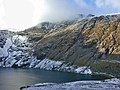 A wintry Cwm Cau - geograph.org.uk - 1615782.jpg 800 × 600; 618 KB
-
 Cadair Idris - Penygadair, Dolgellau.1.jpg 6,000 × 4,000; 15.75 MB
-
 Cadair Idris - Penygadair, Dolgellau.2.jpg 5,437 × 3,625; 10.18 MB
-
 Cadair Idris - Penygadair, Dolgellau.3.jpg 6,000 × 4,000; 19.46 MB
-
 Cadair Idris view of ridge east of summit.jpg 2,288 × 1,712; 879 KB
-
 East from Pen y Gadair - geograph.org.uk - 520457.jpg 800 × 600; 241 KB
-
 From Penygadair - geograph.org.uk - 329275.jpg 640 × 480; 64 KB
-
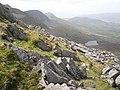
 Llethrau Pen y Gadair - Slopes of Pen y Gadair - geograph.org.uk - 3968931.jpg 3,264 × 2,448; 3.91 MB
-
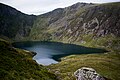
 Llyn y Gadair - geograph.org.uk - 135848.jpg 640 × 480; 119 KB
-

-
 Looking along the Penygadair ridge - geograph.org.uk - 1650992.jpg 640 × 480; 98 KB
-
 Looking towards the Peak^^ - geograph.org.uk - 418761.jpg 640 × 480; 62 KB
-

-
 Pen y Gadair - geograph.org.uk - 3969501.jpg 1,600 × 1,200; 749 KB
-
 Pen y Gadair from the top of Craig Cau - geograph.org.uk - 520453.jpg 800 × 600; 243 KB
-
 Penygadair - Cadair Idris Summit - geograph.org.uk - 52724.jpg 640 × 286; 79 KB
-
 Penygadair - geograph.org.uk - 1426938.jpg 640 × 425; 64 KB
-

-
 Penygadair summit ridge - geograph.org.uk - 1314885.jpg 640 × 480; 101 KB
-
 Penygadair summit ridge - geograph.org.uk - 1314887.jpg 640 × 480; 76 KB
-
 Penygadair, summit of Cadair Idris.jpg 2,288 × 1,712; 769 KB
-
 Penygadair, the summit of Cader Idris - geograph.org.uk - 370956.jpg 640 × 480; 59 KB
-
 Penygadair. from Pony pathJPG.jpg 1,296 × 972; 263 KB
-
 Summit of Cadair Idris - geograph.org.uk - 6001292.jpg 640 × 480; 88 KB
-
 Summit Shelter Cadair Idris - Penygadair - geograph.org.uk - 3356009.jpg 1,600 × 1,200; 845 KB
-

-
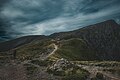
 The final ascent - geograph.org.uk - 1618339.jpg 640 × 428; 71 KB
-
 The northern crags of Cadair Idris - geograph.org.uk - 1764378.jpg 3,504 × 2,336; 3.89 MB
-

-
 The steep road to Arthog at Cregennan - geograph.org.uk - 2560310.jpg 1,600 × 1,200; 340 KB
-
 The Stone Shoot - geograph.org.uk - 371007.jpg 640 × 579; 89 KB
-
 The summit of Cader Idris - geograph.org.uk - 4465164.jpg 640 × 480; 74 KB
-
 The summit ridge of Penygadair - geograph.org.uk - 370964.jpg 640 × 480; 60 KB
-
 The summit shelter on Penygader - geograph.org.uk - 3559266.jpg 640 × 480; 49 KB
-

-

-

-
 Trig point on Penygadair summit of Cadair Idris, view WNW - geograph.org.uk - 2509934.jpg 2,816 × 2,112; 1.83 MB
-

-
 View north from Pen y Gadair - geograph.org.uk - 520455.jpg 800 × 600; 211 KB
-
 View north west from Pen y Gadair - geograph.org.uk - 1615754.jpg 640 × 448; 82 KB
-
-
 Winter vantage - geograph.org.uk - 1188305.jpg 640 × 427; 69 KB


