Category:Pentireglaze Haven
Jump to navigation
Jump to search
Media in category "Pentireglaze Haven"
The following 33 files are in this category, out of 33 total.
-
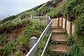
 Coastpath crossing Pentireglaze Haven - geograph.org.uk - 1468406.jpg 640 × 426; 143 KB
-

-
-
 East of Pentireglaze Haven - geograph.org.uk - 1468377.jpg 640 × 426; 90 KB
-

-

-
 Low cliffs north of Pentireglaze Haven - geograph.org.uk - 1468414.jpg 640 × 413; 116 KB
-
 Near Pentireglaze, Cornwall - geograph.org.uk - 1091344.jpg 640 × 575; 146 KB
-
 New Polzeath from Pentireglaze Haven - geograph.org.uk - 1468390.jpg 640 × 423; 117 KB
-

-

-
 North of Pentireglaze Haven (1) - geograph.org.uk - 1468381.jpg 640 × 422; 123 KB
-
 North of Pentireglaze Haven (2) - geograph.org.uk - 1468384.jpg 640 × 426; 141 KB
-
 North of Pentireglaze Haven (3) - geograph.org.uk - 1468386.jpg 640 × 426; 135 KB
-
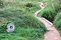 NT sign at head of Pentireglaze Haven - geograph.org.uk - 1468363.jpg 640 × 421; 187 KB
-
 Pentireglaze Haven - geograph.org.uk - 1172881.jpg 640 × 480; 77 KB
-
 Pentireglaze Haven - geograph.org.uk - 1526766.jpg 640 × 480; 101 KB
-
 Pentireglaze Haven - geograph.org.uk - 1526768.jpg 640 × 480; 99 KB
-
 Pentireglaze Haven and Padstow Bay - geograph.org.uk - 1526767.jpg 640 × 480; 89 KB
-
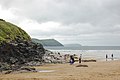
 Pentireglaze Haven beach - geograph.org.uk - 1468400.jpg 640 × 417; 68 KB
-
 Pentireglaze Haven from the north - geograph.org.uk - 1468359.jpg 640 × 430; 104 KB
-
 Pentireglaze Haven, headlands view - geograph.org.uk - 1468398.jpg 640 × 426; 68 KB
-
 Rock fissure at Pentireglaze Haven - geograph.org.uk - 1468411.jpg 426 × 640; 140 KB
-
 Rock strata near Pentireglaze Haven - geograph.org.uk - 1468415.jpg 640 × 426; 139 KB
-

-

-
 Rocky inlet north of Pentireglaze Haven - geograph.org.uk - 1468426.jpg 538 × 640; 114 KB
-
 Sand and sea at Pentireglaze Haven - geograph.org.uk - 1468367.jpg 640 × 423; 83 KB
-

-

-

-

-
 Bungalow at Pentireglaze Haven - geograph.org.uk - 1468395.jpg 640 × 429; 100 KB


_-_geograph.org.uk_-_1468381.jpg)
_-_geograph.org.uk_-_1468384.jpg)
_-_geograph.org.uk_-_1468386.jpg)


_-_geograph.org.uk_-_1468422.jpg)


