Category:Pentewan
Jump to navigation
Jump to search
English: Pentewan is a small coastal village and former port in south Cornwall, United Kingdom. It lies at the mouth of the St Austell River in the civil parish of Pentewan Valley and the ecclesiastical parish of St Austell. The nearest town is St Austell three miles (4.5 km) to the north.
village in United Kingdom  | |||||
| Upload media | |||||
| Instance of | |||||
|---|---|---|---|---|---|
| Location | Pentewan Valley, Cornwall, South West England, England | ||||
| Elevation above sea level |
| ||||
 | |||||
Subcategories
This category has the following 3 subcategories, out of 3 total.
C
P
- Pentewan harbour (15 F)
- Pentewan Sands (12 F)
Media in category "Pentewan"
The following 28 files are in this category, out of 28 total.
-
 All Saints' Church, Pentewan, Cornwall.jpg 4,697 × 3,541; 6.03 MB
-
 Amphibious Assault Demonstration at Pentewan Beach, Cornwall MOD 45149888.jpg 2,500 × 2,000; 665 KB
-
 Caravan and camping park, Pentewan - geograph.org.uk - 1389545.jpg 640 × 480; 106 KB
-

-
 Dive center near Meragissey SAL DIVING 01726 844640 - panoramio.jpg 2,048 × 1,536; 1.04 MB
-
 Entrance Channel at Pentewan - geograph.org.uk - 64509.jpg 640 × 480; 110 KB
-
 Garden Gateways (222003607).jpeg 2,048 × 1,464; 1.28 MB
-
 Hallane House - geograph.org.uk - 1148384.jpg 480 × 640; 78 KB
-
 Pentewan Beach - geograph.org.uk - 5495750.jpg 640 × 480; 165 KB
-
 Pentewan Harbour and village - geograph.org.uk - 289214.jpg 640 × 439; 69 KB
-
 Pentewan Railway plaque.jpg 400 × 332; 50 KB
-
 Pentewan Railway shed.jpg 750 × 473; 67 KB
-
 Pentewan Sands Sailing Club - geograph.org.uk - 1215618.jpg 640 × 426; 47 KB
-
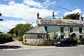
 Pentewan Village Square - geograph.org.uk - 31459.jpg 640 × 424; 116 KB
-
 Portgiskey and Sconhoe Beach - geograph.org.uk - 2139101.jpg 1,024 × 768; 130 KB
-
 RalphMcTellWithDavidSuffCornwall2006.jpg 1,071 × 1,638; 808 KB
-
 Road bridge over cycleway nr. Heligan - geograph.org.uk - 493327.jpg 640 × 480; 153 KB
-
 Sconhoe Beach - geograph.org.uk - 2422231.jpg 640 × 480; 265 KB
-
 St Austell River, Pentewan (geograph 2420407).jpg 640 × 480; 294 KB
-
 St Austell, Pentewan Harbour - geograph.org.uk - 138242.jpg 640 × 427; 111 KB
-
 Trimming Tools (219483271).jpeg 2,048 × 1,735; 670 KB
-
 Wooden Footpath Bridge - geograph.org.uk - 295837.jpg 640 × 480; 153 KB
-
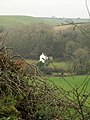
 Across Farmland - geograph.org.uk - 240738.jpg 640 × 427; 99 KB
-
 Coastline north of Pentewan - geograph.org.uk - 295832.jpg 640 × 480; 91 KB
-
 Hallane Beach and cliffs - geograph.org.uk - 494432.jpg 640 × 427; 140 KB
-
 Levalsa Farm Holiday Cottage - geograph.org.uk - 560264.jpg 640 × 480; 109 KB
-
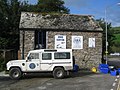
 Lobb's Shop - geograph.org.uk - 494417.jpg 640 × 427; 107 KB
-
 The boundary wall to the King's Woods - geograph.org.uk - 496517.jpg 640 × 427; 139 KB


.jpeg)


.jpg)

.jpeg)


