Category:Pennyvenie
Jump to navigation
Jump to search

A former mining village near Dalmellington, East Ayrshire, now given over to opencast mining.Link
Media in category "Pennyvenie"
The following 21 files are in this category, out of 21 total.
-
 Auldnaw - geograph.org.uk - 468768.jpg 640 × 480; 64 KB
-
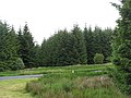 B741 and lots of trees - geograph.org.uk - 468778.jpg 640 × 480; 86 KB
-
 Benbeoch basaltic columns - geograph.org.uk - 771828.jpg 640 × 480; 104 KB
-
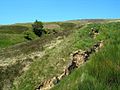
 Beoch Lane - geograph.org.uk - 468771.jpg 640 × 480; 93 KB
-

-
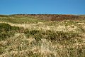
 Hill Country Near Dalmellington - geograph.org.uk - 1332192.jpg 640 × 457; 92 KB
-
 Hill Land Near Pennyvenie - geograph.org.uk - 1346003.jpg 640 × 480; 104 KB
-
 Near Pennyvenie - geograph.org.uk - 1346025.jpg 640 × 426; 95 KB
-
 Old spoil tip - geograph.org.uk - 183475.jpg 640 × 480; 45 KB
-
 Pennyvenie - geograph.org.uk - 185429.jpg 640 × 480; 87 KB
-
 Pennyvenie Hillside View - geograph.org.uk - 1346033.jpg 640 × 426; 111 KB
-
 Pennyvenie opencast coal site - geograph.org.uk - 183472.jpg 640 × 480; 44 KB
-
 Pennyvenie Pit Bing, Dalmellington, East Ayrshire.jpg 4,145 × 1,834; 1.31 MB
-
 Pennyvenie View - geograph.org.uk - 1332171.jpg 640 × 480; 104 KB
-
 Prickeny Road - geograph.org.uk - 469364.jpg 480 × 640; 110 KB
-
 The Old Pennyvenie Coal Pit Bing, Dalmellington, East Ayrshire.jpg 4,896 × 2,752; 2.37 MB
-
 The Pennyvenie Pit Bing, Dalmellington, East Ayrshire.jpg 4,896 × 2,752; 2.47 MB
-
 Towards Pennyvenie - geograph.org.uk - 1346012.jpg 640 × 426; 103 KB
-
 Towards Pennyvenie Open Cast Mine - geograph.org.uk - 1346029.jpg 640 × 426; 111 KB
-
 Towards Pennyvenie Open Cast Workings - geograph.org.uk - 1346037.jpg 640 × 426; 104 KB
-
 What happened here^ - geograph.org.uk - 1581586.jpg 640 × 480; 101 KB


