Category:Pembridge
Jump to navigation
Jump to search
village in Herefordshire, UK  | |||||
| Upload media | |||||
| Instance of | |||||
|---|---|---|---|---|---|
| Location | Herefordshire, West Midlands, England | ||||
| Population |
| ||||
| official website | |||||
 | |||||
English: Pembridge is a village and civil parish located just south of the River Arrow on the A44 between Leominster and Kington in Herefordshire, England. Pembridge is believed to have originally been called Pen y Bont (Welsh origin) before it was anglicised to the current spelling.
Nederlands: Pembridge is een plaats en civil parish in het bestuurlijke gebied Herefordshire, in het Engelse graafschap Herefordshire met 1000 inwoners.
Polski: Pembridge – wieś w Anglii, w hrabstwie Herefordshire. Leży 22 km na północny zachód od miasta Hereford i 206 km na północny zachód od Londynu. Miejscowość liczy 1000 mieszkańców.

Subcategories
This category has the following 13 subcategories, out of 13 total.
B
- Bearwood, Herefordshire (14 F)
- Pembridge Bridge (9 F)
C
- Court of Noke (22 F)
L
- Lower Bearwood (13 F)
- Lower Broxwood (3 F)
M
- Pembridge Market Hall (24 F)
- Marston, Herefordshire (11 F)
- Moorcourt, Herefordshire (6 F)
P
- Pembridge War Memorial (4 F)
T
- Pembridge telephone box (8 F)
W
Media in category "Pembridge"
The following 200 files are in this category, out of 284 total.
(previous page) (next page)-

-
 A Brand New Orchard - geograph.org.uk - 4048319.jpg 1,600 × 1,199; 508 KB
-
 A house down a lane - geograph.org.uk - 4048362.jpg 1,600 × 1,200; 423 KB
-
 A Potato Field - geograph.org.uk - 4048299.jpg 1,600 × 1,200; 768 KB
-

-

-
 A44 at the access for Moseley Farm - geograph.org.uk - 2587956.jpg 640 × 480; 63 KB
-
 A44 at the access for Pitfield Farm - geograph.org.uk - 2587953.jpg 640 × 480; 63 KB
-
 A44 at the access to Westonbury Farm - geograph.org.uk - 2587959.jpg 640 × 480; 70 KB
-
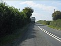
 A44 between Kington and Pembridge - geograph.org.uk - 6076238.jpg 1,024 × 768; 385 KB
-
 A44 entering Pembridge from the east - geograph.org.uk - 2587944.jpg 640 × 480; 71 KB
-
 A44 near Weston - geograph.org.uk - 2587964.jpg 640 × 480; 44 KB
-
 A44 south of Marston - geograph.org.uk - 2587960.jpg 640 × 480; 52 KB
-
 A44 through Pembridge - geograph.org.uk - 2144916.jpg 600 × 800; 75 KB
-
 A44 west of Pembridge - geograph.org.uk - 2587951.jpg 640 × 480; 67 KB
-
 AA Sign at Pembridge - geograph.org.uk - 5853062.jpg 2,048 × 1,536; 1.48 MB
-
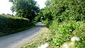
 An ancient lane - geograph.org.uk - 5674226.jpg 1,024 × 768; 333 KB
-
 An ancient motte - geograph.org.uk - 2366885.jpg 2,048 × 1,536; 641 KB
-
 Anaerobic Digester plant, Shobdon - geograph.org.uk - 4256720.jpg 854 × 640; 345 KB
-
 Anaerobic digester, The Leven - geograph.org.uk - 6076373.jpg 1,024 × 768; 278 KB
-
 Ancient and modern - geograph.org.uk - 2935212.jpg 1,024 × 612; 297 KB
-
 Another tight bend on the A44 - geograph.org.uk - 2587958.jpg 640 × 480; 46 KB
-
 Approaching Lower Green - geograph.org.uk - 4995439.jpg 1,600 × 901; 725 KB
-
 Approaching Meer Common - geograph.org.uk - 4995423.jpg 1,600 × 901; 664 KB
-
 Approaching The Forge - geograph.org.uk - 2621484.jpg 640 × 480; 87 KB
-
 Approaching the turning to Cabal - geograph.org.uk - 2620732.jpg 2,592 × 1,944; 2.89 MB
-
 Armorial Bearings of the BRACE family of Noke Court, Pembridge, Herefordshire.png 1,200 × 1,200; 479 KB
-
 Armorial Bearings of the TYLER family of Pembridge, Herefordshire.png 1,200 × 1,200; 819 KB
-
 Arrow flood plain - geograph.org.uk - 388745.jpg 640 × 480; 75 KB
-
 Back to the main road - geograph.org.uk - 2152375.jpg 600 × 800; 95 KB
-
 Bearwood Lane (Pembridge) - geograph.org.uk - 6522217.jpg 3,648 × 2,432; 3.73 MB
-
 Bearwood Lane (Pembridge) - geograph.org.uk - 6522889.jpg 2,560 × 1,440; 1.59 MB
-
 Bearwood Lane and the Market Hall, Pembridge - geograph.org.uk - 6719609.jpg 2,000 × 1,338; 907 KB
-
 Behind the Parish Hall - geograph.org.uk - 4060212.jpg 4,000 × 3,000; 2.93 MB
-
 Bench by the River Arrow (Pembridge) - geograph.org.uk - 6522180.jpg 3,648 × 2,736; 3.82 MB
-
 Bench, Pembridge - geograph.org.uk - 6073045.jpg 640 × 480; 119 KB
-
 Bend into Pembridge - geograph.org.uk - 1354439.jpg 640 × 480; 70 KB
-
 Beside the Curl Brook, Marsden - geograph.org.uk - 6076230.jpg 1,024 × 768; 349 KB
-
 Boardwalk, Pembridge - geograph.org.uk - 6073043.jpg 1,024 × 768; 520 KB
-
 Bridge over the old Leominster and Kington Railway route - geograph.org.uk - 6508926.jpg 3,264 × 1,844; 3.88 MB
-
 Brockaly ^ The Riddox - geograph.org.uk - 4048389.jpg 1,600 × 1,200; 433 KB
-
 Brook beside Noke Lane - geograph.org.uk - 6076352.jpg 1,024 × 768; 571 KB
-
 Broxwood Road - geograph.org.uk - 4995434.jpg 1,600 × 901; 695 KB
-
 Broxwood Road - geograph.org.uk - 4995437.jpg 1,600 × 901; 688 KB
-
 Bug hotel - geograph.org.uk - 6073071.jpg 1,024 × 768; 565 KB
-
 Bull in the Orchard - geograph.org.uk - 4048329.jpg 1,600 × 1,118; 522 KB
-
 Burcher to Staunton road - geograph.org.uk - 5515224.jpg 1,024 × 683; 420 KB
-
 Byletts - geograph.org.uk - 6073053.jpg 1,024 × 768; 418 KB
-
 Byway, leading to Bearwood - geograph.org.uk - 1971303.jpg 1,024 × 768; 267 KB
-
 Cabal Lane - geograph.org.uk - 5674259.jpg 1,024 × 768; 336 KB
-
 Cabal Lane - geograph.org.uk - 6076294.jpg 1,024 × 768; 453 KB
-
 Carpenter's Wood - geograph.org.uk - 3855233.jpg 640 × 480; 360 KB
-
 Carpenter's Wood - geograph.org.uk - 3855239.jpg 640 × 480; 374 KB
-
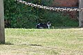 Cat at Pembridge Primary School - geograph.org.uk - 5853194.jpg 2,048 × 1,360; 1.36 MB
-
 Cat by Pembridge Village Hall - geograph.org.uk - 6522964.jpg 2,048 × 1,536; 1.39 MB
-
 Christmas decorations at Pembridge Market Hall - geograph.org.uk - 6710559.jpg 4,032 × 3,024; 3.39 MB
-
 Christmas decorations at West End Farm (Pembridge) - geograph.org.uk - 6710623.jpg 4,032 × 3,024; 3.63 MB
-
 Christmas tree at Pump House (Pembridge) - geograph.org.uk - 6710611.jpg 4,032 × 3,024; 2.77 MB
-
 Christmas tree beside Oak House (Pembridge) - geograph.org.uk - 6710639.jpg 4,032 × 3,024; 3.23 MB
-
 Christmas tree beside Oak House (Pembridge) - geograph.org.uk - 6710640.jpg 4,032 × 3,024; 2.78 MB
-
 Christmas tree inside Pembridge Market Hall - geograph.org.uk - 6710585.jpg 4,032 × 3,024; 4.19 MB
-
 Christmas trees at St. Mary's church (Porch ^ Pembridge) - geograph.org.uk - 6710598.jpg 4,032 × 3,024; 3.64 MB
-
 Christmas trees at the Kings House (Pembridge) - geograph.org.uk - 6710635.jpg 4,032 × 2,268; 2.67 MB
-
 Christmas trees at West End (Pembridge) - geograph.org.uk - 6710618.jpg 4,032 × 3,024; 3.46 MB
-
 Christmas trees in Pembridge - geograph.org.uk - 6710540.jpg 4,032 × 3,024; 3.77 MB
-
 Christmas trees in Pembridge - geograph.org.uk - 6710604.jpg 4,032 × 3,024; 3.89 MB
-
 Christmas trees in Pembridge - geograph.org.uk - 6710626.jpg 4,032 × 3,024; 3.22 MB
-
 Cider orchard at Lower Green - geograph.org.uk - 4995438.jpg 1,600 × 901; 769 KB
-
 Cotmore - geograph.org.uk - 6076267.jpg 1,024 × 768; 287 KB
-
 Country lane at Nutfield - geograph.org.uk - 440541.jpg 640 × 426; 113 KB
-
 Country road approaching Sherrington Manor - geograph.org.uk - 5695524.jpg 680 × 1,024; 292 KB
-
 Country road at Broxwood - geograph.org.uk - 5695402.jpg 680 × 1,024; 314 KB
-
 Court of Noke Farm - geograph.org.uk - 6716822.jpg 800 × 533; 131 KB
-
 Crates by the gate - geograph.org.uk - 4057085.jpg 1,600 × 1,200; 322 KB
-
 Decommissioned gate - geograph.org.uk - 3855229.jpg 640 × 480; 312 KB
-
 Disused machinery - geograph.org.uk - 914519.jpg 640 × 480; 62 KB
-
 Diverging lanes near Bearwood - geograph.org.uk - 4995446.jpg 1,600 × 901; 718 KB
-
 East Street, Pembridge - geograph.org.uk - 6158024.jpg 1,844 × 1,154; 1.33 MB
-
 Engineers code, Cabal Lane - geograph.org.uk - 6076295.jpg 1,024 × 768; 395 KB
-
 Entering Pembridge - geograph.org.uk - 6210896.jpg 1,024 × 683; 188 KB
-
 Entrance to Pembridge Primary School - geograph.org.uk - 6522947.jpg 3,648 × 2,736; 3.6 MB
-
 Fallen oak, Upper Marston - geograph.org.uk - 6059258.jpg 1,024 × 1,024; 424 KB
-
 Farm bridge crossing the River Arrow - geograph.org.uk - 5692142.jpg 1,024 × 680; 327 KB
-
 Farm outbuildings, Luntley Court Farm - geograph.org.uk - 1969561.jpg 1,024 × 768; 202 KB
-
 Farm shop on edge of Pembridge - geograph.org.uk - 5891749.jpg 1,600 × 958; 668 KB
-
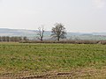
 Farmland above the River Arrow - geograph.org.uk - 5673137.jpg 1,024 × 683; 256 KB
-
 Farmland at Pembridge - geograph.org.uk - 5670417.jpg 1,024 × 768; 295 KB
-
 Farmland at Staunton-on-Arrow - geograph.org.uk - 5671075.jpg 1,024 × 683; 209 KB
-
 Farmland near Lower Green - geograph.org.uk - 5695520.jpg 1,024 × 680; 234 KB
-
 Farmland near Luntley - geograph.org.uk - 5670808.jpg 1,024 × 768; 243 KB
-
 Farmland near Upper Marston - geograph.org.uk - 5674253.jpg 1,024 × 768; 271 KB
-
 Farmland north of Pembridge - geograph.org.uk - 5671066.jpg 1,024 × 683; 221 KB
-
 Farmland track beside the River Arrow - geograph.org.uk - 5692129.jpg 1,024 × 680; 244 KB
-
 Farmyard, at Luntley - geograph.org.uk - 1969588.jpg 1,600 × 1,200; 592 KB
-
 Fence and field boundary - geograph.org.uk - 5674812.jpg 1,024 × 768; 308 KB
-
 Field access, The Forge - geograph.org.uk - 6076316.jpg 1,024 × 768; 417 KB
-
 Field beside a dismantled railway - geograph.org.uk - 5671071.jpg 1,024 × 683; 270 KB
-
 Field boundaries - geograph.org.uk - 4995443.jpg 1,600 × 901; 744 KB
-
 Field entrance, Upper Marston - geograph.org.uk - 6076293.jpg 1,024 × 768; 477 KB
-
 Field near Little Sherrington - geograph.org.uk - 5695566.jpg 1,024 × 680; 307 KB
-
 Field of golden wheat, near Luntley - geograph.org.uk - 1969617.jpg 1,600 × 1,200; 626 KB
-
 Field, Sherrington - geograph.org.uk - 6076387.jpg 1,024 × 768; 291 KB
-
 Field, Tibhall - geograph.org.uk - 3853939.jpg 640 × 480; 244 KB
-
 Fields near Luntley - geograph.org.uk - 4053501.jpg 1,600 × 1,067; 452 KB
-

-
 Fingerpost, Lower Broxwood - geograph.org.uk - 3854929.jpg 640 × 480; 364 KB
-
 Footpath off the road to Shobdon - geograph.org.uk - 2621865.jpg 626 × 450; 187 KB
-
 Ford at The Forge - geograph.org.uk - 4294424.jpg 3,872 × 2,592; 4.8 MB
-
 Gateway and farm track - geograph.org.uk - 5692140.jpg 1,024 × 680; 275 KB
-
 Glacial deposition terrain - geograph.org.uk - 6076331.jpg 1,024 × 768; 290 KB
-
 Gorsty to Weston lane - geograph.org.uk - 4995444.jpg 1,600 × 901; 745 KB
-
 Grove Wood - geograph.org.uk - 6076348.jpg 1,024 × 768; 570 KB
-
 Gunnera manicata - geograph.org.uk - 4995508.jpg 1,600 × 1,200; 1,014 KB
-

-
 Gunnera manicata, detail - geograph.org.uk - 4995512.jpg 1,600 × 1,200; 1.13 MB
-
 Herefordshire grassland - geograph.org.uk - 4995442.jpg 1,600 × 901; 665 KB
-
 Holmcroft - geograph.org.uk - 6059265.jpg 1,024 × 626; 140 KB
-
 House at Meer Common - geograph.org.uk - 4995420.jpg 1,600 × 901; 718 KB
-
 House entrance on West Street, Pembridge - geograph.org.uk - 6158021.jpg 1,920 × 1,280; 1.1 MB
-
 House in Nokelane Head - geograph.org.uk - 2621489.jpg 640 × 480; 105 KB
-
 Lane at the entrance to Lowe Farm - geograph.org.uk - 2621463.jpg 640 × 480; 49 KB
-
 Lane east of Noke Bridge - geograph.org.uk - 2621458.jpg 640 × 480; 79 KB
-

-
 Lane north of Luntley - geograph.org.uk - 1814675.jpg 640 × 480; 157 KB
-
 Lane scene at The Leen - geograph.org.uk - 2621457.jpg 640 × 480; 79 KB
-
 Lane to Nokelane Head - geograph.org.uk - 2621486.jpg 640 × 480; 109 KB
-
 Lane to Twyford - geograph.org.uk - 1814695.jpg 640 × 480; 182 KB
-
 Lane west of Strangworth Farm - geograph.org.uk - 2621482.jpg 640 × 480; 63 KB
-
 Lane, Broxwood - geograph.org.uk - 3874070.jpg 640 × 480; 241 KB
-
 Lane, Cabal - geograph.org.uk - 6076302.jpg 1,024 × 768; 521 KB
-
 Large model turkey - geograph.org.uk - 6158025.jpg 1,920 × 1,280; 1.57 MB
-
 Log pile - geograph.org.uk - 2488836.jpg 2,592 × 1,944; 2.06 MB
-
 Lonely cottage on the A44 - geograph.org.uk - 2587986.jpg 640 × 480; 77 KB
-
 Longwood, near Luntley - geograph.org.uk - 1971362.jpg 1,024 × 768; 206 KB
-
 Luntley Court Farm - geograph.org.uk - 4995538.jpg 1,600 × 901; 630 KB
-
 Luntley, Herefordshire - geograph.org.uk - 4995534.jpg 1,600 × 901; 691 KB
-
 Manley Crescent, Pembridge - geograph.org.uk - 5670766.jpg 1,024 × 768; 268 KB
-
 Mature tree in a field at Broxwood - geograph.org.uk - 5695394.jpg 1,024 × 680; 248 KB
-
 Meadow beside Tippet's Brook - geograph.org.uk - 4053606.jpg 1,600 × 1,175; 583 KB
-

-
 Minor road to Bearwood - geograph.org.uk - 1971317.jpg 768 × 1,024; 211 KB
-
 Mixen near Broxwood - geograph.org.uk - 3854933.jpg 640 × 480; 244 KB
-
 Moorcot to Weston road - geograph.org.uk - 3855121.jpg 640 × 480; 293 KB
-
 More fields near Luntley - geograph.org.uk - 4058278.jpg 2,048 × 1,536; 988 KB
-
 Moseley Common - geograph.org.uk - 6075504.jpg 1,024 × 689; 317 KB
-
 Motte, Staunton on Arrow - geograph.org.uk - 6076355.jpg 1,024 × 768; 369 KB
-
 No through road to Lower and Upper Wetton - geograph.org.uk - 5695515.jpg 1,024 × 680; 333 KB
-
 Noke Bridge crossroads - geograph.org.uk - 2621459.jpg 640 × 480; 98 KB
-
 Noke Bridge looking north - geograph.org.uk - 2621491.jpg 640 × 480; 80 KB
-
 Noke Bridge looking south - geograph.org.uk - 2621461.jpg 640 × 480; 97 KB
-
 Noke Lane - geograph.org.uk - 2621490.jpg 640 × 480; 84 KB
-
 Noke Lane - geograph.org.uk - 5674217.jpg 1,024 × 683; 302 KB
-
 Noke Lane - geograph.org.uk - 6076335.jpg 1,024 × 768; 364 KB
-
 Noke Lane - geograph.org.uk - 6076351.jpg 1,024 × 768; 450 KB
-
 Noke Lane nearing Nokelane Head - geograph.org.uk - 2621488.jpg 640 × 480; 95 KB
-

-
 Orchard at Broxwood - geograph.org.uk - 5694795.jpg 1,024 × 680; 361 KB
-
 Orchard by Westonbury Mill Gardens - geograph.org.uk - 6432594.jpg 1,920 × 1,080; 1,022 KB
-
 Orchard near Pembridge - geograph.org.uk - 4058209.jpg 1,600 × 1,135; 732 KB
-
 Orchard, Moseley - geograph.org.uk - 6073070.jpg 1,024 × 768; 529 KB
-
 Orchard, Whetton - geograph.org.uk - 3854923.jpg 640 × 480; 348 KB
-
 Pastoral scene, Broxwood - geograph.org.uk - 4995431.jpg 1,600 × 901; 652 KB
-
 Path by Bridge Street (Pembridge) - geograph.org.uk - 6521625.jpg 3,648 × 2,736; 4.77 MB
-
 Path closure notice - geograph.org.uk - 6073069.jpg 768 × 1,024; 467 KB
-
 Path to Pembridge Village Green Conservation Area - geograph.org.uk - 6522174.jpg 3,128 × 2,346; 2.78 MB
-
 Path to Pembridge Village Green Conservation Area - geograph.org.uk - 6522194.jpg 2,942 × 2,202; 1.64 MB
-
 Pembridge (1294718).jpg 1,000 × 702; 96 KB
-
 Pembridge - Millennium Playing Field - geograph.org.uk - 1539197.jpg 640 × 480; 190 KB
-
 Pembridge - West Street, looking west - geograph.org.uk - 1814683.jpg 640 × 480; 139 KB
-
 Pembridge Car Park - geograph.org.uk - 5841046.jpg 3,648 × 2,736; 4.88 MB
-
 Pembridge Car Park - geograph.org.uk - 5852979.jpg 3,648 × 2,736; 5.02 MB
-
 Pembridge, Playground - geograph.org.uk - 5752863.jpg 6,590 × 4,399; 5.82 MB
-
 Picnic site beside the River Arrow - geograph.org.uk - 5671042.jpg 1,024 × 683; 323 KB
-
 Pipeline marker - geograph.org.uk - 5695400.jpg 1,024 × 680; 334 KB
-
 Playground at Pembridge Village Hall - geograph.org.uk - 6522956.jpg 2,560 × 1,440; 1.75 MB
-
 Pond, Cabal - geograph.org.uk - 6076299.jpg 1,024 × 768; 465 KB
-
 Pool beside The Leen - geograph.org.uk - 5692133.jpg 1,024 × 680; 390 KB
-
 Postbox, Pembridge, Herefordshire - geograph.org.uk - 4093110.jpg 768 × 1,024; 1.06 MB
-
 Presteign Branch trackbed, Forge Crossing - geograph.org.uk - 6076320.jpg 1,024 × 768; 539 KB
-
 Public footpath by River Arrow, Pembridge - geograph.org.uk - 2490543.jpg 1,024 × 683; 318 KB
-
 RAF Hercules over Shobdon airfield - geograph.org.uk - 4876210.jpg 2,048 × 889; 676 KB
-
 Red Campion, Silene dioica - geograph.org.uk - 4995430.jpg 1,600 × 1,203; 1,013 KB
-
 Reindeers at the Old Wheelwrights (Pembridge) - geograph.org.uk - 6710642.jpg 4,032 × 3,024; 2.38 MB
-
 River Arrow - geograph.org.uk - 1159346.jpg 640 × 480; 313 KB
-
 River Arrow, Court of Noke - geograph.org.uk - 6076353.jpg 1,024 × 768; 408 KB
-
 River Arrow, Pembridge - geograph.org.uk - 6073049.jpg 1,024 × 768; 476 KB
-
 Riverside boardwalk, Pembridge - geograph.org.uk - 3940672.jpg 3,200 × 4,813; 6.63 MB
-
 Road junction, Sherrington - geograph.org.uk - 6076386.jpg 1,024 × 768; 411 KB
-
 Road to Shobdon north of Milton Cross - geograph.org.uk - 2621861.jpg 628 × 446; 151 KB
-
 Rolling farmland - geograph.org.uk - 5674220.jpg 800 × 450; 78 KB
-
 Sharp bend on the A44 - geograph.org.uk - 2587943.jpg 640 × 480; 81 KB
-
 Sheep in a field at Pembridge - geograph.org.uk - 5670422.jpg 1,024 × 768; 359 KB
-
 Sign at Pembridge Car Park - geograph.org.uk - 5852972.jpg 3,648 × 2,736; 4.82 MB
-
 Sign at Pembridge Car Park - geograph.org.uk - 5852975.jpg 3,648 × 2,736; 4.57 MB
-
 Sign at Pembridge Village Green Conservation Area - geograph.org.uk - 6522139.jpg 3,648 × 2,736; 4.47 MB
-
 Sign at Pembridge Village Green Conservation Area - geograph.org.uk - 6522147.jpg 3,648 × 2,736; 4.07 MB
-
 Sign for the New Inn - geograph.org.uk - 6073063.jpg 1,024 × 685; 394 KB
-
 Signpost at Luntley - geograph.org.uk - 773517.jpg 640 × 480; 105 KB
-
 Signs at Pembridge Car Park - geograph.org.uk - 5852969.jpg 3,648 × 2,736; 5.11 MB
-
 Signs at Pembridge Car Park - geograph.org.uk - 6520424.jpg 2,560 × 1,440; 1.79 MB


_-_geograph.org.uk_-_6522217.jpg)
_-_geograph.org.uk_-_6522889.jpg)


_-_geograph.org.uk_-_6710623.jpg)
_-_geograph.org.uk_-_6710611.jpg)
_-_geograph.org.uk_-_6710639.jpg)
_-_geograph.org.uk_-_6710640.jpg)

_-_geograph.org.uk_-_6710598.jpg)
_-_geograph.org.uk_-_6710635.jpg)
_-_geograph.org.uk_-_6710618.jpg)


_-_geograph.org.uk_-_6521625.jpg)


.jpg)


_-_geograph.org.uk_-_6710642.jpg)


_-_geograph.org.uk_-_6522180.jpg)