Category:Pebmarsh
Jump to navigation
Jump to search
English: Pebmarsh is a small village in Essex, England. It is situated to the north east of Halstead close to the A131.
village in Essex, England, UK  | |||||
| Upload media | |||||
| Instance of | |||||
|---|---|---|---|---|---|
| Location | Braintree, Essex, East of England, England | ||||
| Population |
| ||||
| official website | |||||
 | |||||
Subcategories
This category has the following 4 subcategories, out of 4 total.
Media in category "Pebmarsh"
The following 87 files are in this category, out of 87 total.
-
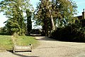
 Bench With A View - geograph.org.uk - 5291999.jpg 1,024 × 768; 267 KB
-
 Bend On The A131 - geograph.org.uk - 5292069.jpg 1,024 × 768; 203 KB
-
 Cricks Farm, near Pebmarsh, Essex - geograph.org.uk - 244490.jpg 640 × 413; 57 KB
-

-
 Defibrillator in phone box, Pebmarsh - geograph.org.uk - 5113626.jpg 2,683 × 2,683; 3.04 MB
-
 Entrance and driveway to Stanley Hall - geograph.org.uk - 300950.jpg 640 × 480; 93 KB
-
 Entrance to Pebmarsh - geograph.org.uk - 3299144.jpg 640 × 480; 53 KB
-
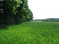 Field Boundary - geograph.org.uk - 3001931.jpg 1,024 × 768; 269 KB
-
 Field near Spoon's Hall - geograph.org.uk - 4961015.jpg 640 × 480; 113 KB
-
 Field of hay at Manning's Farm - geograph.org.uk - 244499.jpg 640 × 391; 88 KB
-
 Fishing Lake - geograph.org.uk - 5291982.jpg 1,024 × 769; 163 KB
-
 Flint and brick faced cottages, Pebmarsh - geograph.org.uk - 5113618.jpg 3,412 × 2,109; 3.17 MB
-
 Footbridge - geograph.org.uk - 5291995.jpg 768 × 1,024; 283 KB
-
 Footpath - geograph.org.uk - 4651234.jpg 1,024 × 768; 181 KB
-
 Footpath - geograph.org.uk - 4651293.jpg 1,024 × 768; 270 KB
-
 Footpath And Bridge - geograph.org.uk - 5292007.jpg 1,024 × 768; 308 KB
-
 Footpath Junction - geograph.org.uk - 4651271.jpg 768 × 1,024; 294 KB
-
 Footpath on track, near Hill House, Pebmarsh - geograph.org.uk - 5113600.jpg 2,655 × 1,641; 1.59 MB
-
 Footpath Sign Post - geograph.org.uk - 3001774.jpg 1,024 × 768; 369 KB
-
 Footpath Through Oak Farm - geograph.org.uk - 4651262.jpg 1,024 × 768; 250 KB
-

-

-

-

-

-

-

-
 Inside St John the Baptist, Pebmarsh (h) - geograph.org.uk - 6281548.jpg 640 × 480; 104 KB
-

-
 Marked Footpath - geograph.org.uk - 4651252.jpg 768 × 1,024; 274 KB
-
 Marked Footpath - geograph.org.uk - 5291990.jpg 768 × 1,024; 327 KB
-
 Pebmarsh and church of St John the Baptist - geograph.org.uk - 5890319.jpg 4,220 × 3,102; 4.55 MB
-
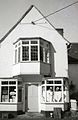 Pebmarsh Post Office,Halstead,Essex ,with Oriel Window,1978 - Flickr - sludgegulper.jpg 1,742 × 2,684; 574 KB
-
 Pebmarsh Road - geograph.org.uk - 4961007.jpg 640 × 480; 178 KB
-
 Pebmarsh Road near Byndes Farm - geograph.org.uk - 4943127.jpg 4,608 × 3,456; 3.95 MB
-
 Pebmarsh Road running past Worlds End Farm - geograph.org.uk - 5113553.jpg 3,648 × 2,255; 3.38 MB
-
 Pebmarsh war memorial - geograph.org.uk - 4961024.jpg 640 × 480; 117 KB
-
 Recently harvested arable land, near Le Mote Farm, Pebmarsh - geograph.org.uk - 5113639.jpg 3,045 × 1,882; 2.57 MB
-
 Recently tilled field near Birchleys, Pebmarsh - geograph.org.uk - 5113673.jpg 3,648 × 2,255; 2.61 MB
-
 Recently tilled land near Collin's Farm, Pebmarsh - geograph.org.uk - 5113670.jpg 3,648 × 2,736; 4.66 MB
-
 Repairs - geograph.org.uk - 3001932.jpg 768 × 1,024; 264 KB
-
 Road Junction - geograph.org.uk - 4651278.jpg 1,024 × 768; 266 KB
-
 Rush hour in Pebmarsh - geograph.org.uk - 6281484.jpg 640 × 480; 87 KB
-
 St John the Baptist, Pebmarsh, altar - geograph.org.uk - 6281568.jpg 640 × 480; 66 KB
-

-

-

-

-

-

-
 St John the Baptist, Pebmarsh, entrance - geograph.org.uk - 6281479.jpg 640 × 480; 116 KB
-
 St John the Baptist, Pebmarsh, font - geograph.org.uk - 6281521.jpg 480 × 640; 53 KB
-

-

-

-

-
 St John the Baptist, Pebmarsh, nave - geograph.org.uk - 6281565.jpg 640 × 480; 66 KB
-
 St John the Baptist, Pebmarsh, organ - geograph.org.uk - 6281522.jpg 480 × 640; 58 KB
-

-

-

-

-

-

-

-

-
 Start of footpath - geograph.org.uk - 4961031.jpg 640 × 480; 167 KB
-
 Traffic jam in Pebmarsh - geograph.org.uk - 6281477.jpg 640 × 480; 67 KB
-
 Very Green - geograph.org.uk - 3001929.jpg 1,024 × 768; 266 KB
-
 View from Pebmarsh Road - geograph.org.uk - 4941992.jpg 4,608 × 3,456; 3.93 MB
-
 Water pump, near the Brambles, Twinstead - geograph.org.uk - 5113653.jpg 1,280 × 1,600; 1.06 MB
-
 Wheat crop near Cricks Farm, Pebmarsh - geograph.org.uk - 5021455.jpg 3,648 × 2,432; 4.17 MB
-
 Wheat crop near Hoblets, Pebmarsh - geograph.org.uk - 5021443.jpg 3,648 × 2,432; 2.93 MB
-

-
 Entrance to Oak Farm, Pebmarsh, Essex - geograph.org.uk - 244474.jpg 640 × 429; 113 KB
-
 Farmhouse at Abbott's farm - geograph.org.uk - 300902.jpg 640 × 480; 70 KB
-

-
 Footpath by Marvel's Garden - geograph.org.uk - 416620.jpg 640 × 480; 112 KB
-
 Hunt's Hall Farm - geograph.org.uk - 300900.jpg 640 × 480; 79 KB
-
 Junction at the A.131 - geograph.org.uk - 300909.jpg 640 × 480; 80 KB
-

-

-
 Lorkin's Lane - geograph.org.uk - 373058.jpg 640 × 430; 55 KB
-
 Lorkins Farm - geograph.org.uk - 294203.jpg 640 × 480; 79 KB
-

-
 Signpost along Pebmarsh Road, Essex - geograph.org.uk - 244461.jpg 640 × 480; 97 KB
-
 The farmhouse at Mosses Farm - geograph.org.uk - 416623.jpg 640 × 480; 108 KB


_-_geograph.org.uk_-_6281531.jpg)
_-_geograph.org.uk_-_6281533.jpg)
_-_geograph.org.uk_-_6281534.jpg)
_-_geograph.org.uk_-_6281539.jpg)
_-_geograph.org.uk_-_6281540.jpg)
_-_geograph.org.uk_-_6281544.jpg)
_-_geograph.org.uk_-_6281546.jpg)
_-_geograph.org.uk_-_6281548.jpg)
_-_geograph.org.uk_-_6281551.jpg)


_-_geograph.org.uk_-_6281488.jpg)
_-_geograph.org.uk_-_6281493.jpg)
_-_geograph.org.uk_-_6281495.jpg)
_-_geograph.org.uk_-_6281497.jpg)
_-_geograph.org.uk_-_6281498.jpg)
_-_geograph.org.uk_-_6281499.jpg)


_-_geograph.org.uk_-_6281525.jpg)
_-_geograph.org.uk_-_6281528.jpg)
_-_geograph.org.uk_-_6281529.jpg)


_-_geograph.org.uk_-_6281553.jpg)
_-_geograph.org.uk_-_6281554.jpg)
_-_geograph.org.uk_-_6281556.jpg)
_-_geograph.org.uk_-_6281558.jpg)
_-_geograph.org.uk_-_6281561.jpg)
_-_geograph.org.uk_-_6281562.jpg)


