Category:Pawnee maps
Jump to navigation
Jump to search
Media in category "Pawnee maps"
The following 13 files are in this category, out of 13 total.
-
 Bulletin (1936) (19801732824).jpg 4,274 × 1,628; 642 KB
-
 Cheyenne and Arapaho territory (1851) and Pawnee territory with main settlements.png 1,468 × 904; 3.18 MB
-

-
-

-
 Pawnee Indian cessions (2). (Pawnee country after 1833).png 2,256 × 1,462; 5.83 MB
-
 Pawnee Indian cessions (3). Pawnee country after 1848).png 2,256 × 1,462; 5.83 MB
-
 Pawnee Indian cessions (4). (Pawnee country after 1857).png 2,256 × 1,462; 5.84 MB
-
 Pawnee Indian cessions (5). (Pawnee country in Nebraska after 1876).png 2,256 × 1,462; 7.09 MB
-
 Pawnee lang.png 501 × 321; 30 KB
-
 Pawnee01.png 1,270 × 1,476; 2.7 MB
-
 The area where the Pawnee captured the Sacred Arrows of the Cheyenne.jpg 2,041 × 999; 969 KB
-
 Wichita native areas and some archaeological sites in Kansas, Oklahoma and Texas.png 1,295 × 1,399; 126 KB
_and_Pawnee_territory_with_main_settlements.png)
).png)
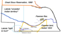
,_Nebraska._Pawnee_reservation_and_relevant_Indian_territories.png)
._(Pawnee_country_before_1833_as_recognized_by_the_United_States).png)
._(Pawnee_country_after_1833).png)
._Pawnee_country_after_1848).png)
._(Pawnee_country_after_1857).png)
._(Pawnee_country_in_Nebraska_after_1876).png)


_(19801732824).jpg)