Category:Pavlovskoe (Istrinsky District)
Jump to navigation
Jump to search
| Object location | | View all coordinates using: OpenStreetMap |
|---|
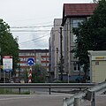
human settlement in Istrinsky District, Moscow Oblast, Russia  Вид на деревню Павловское с ЦКАД | |||||
| Upload media | |||||
| Instance of | |||||
|---|---|---|---|---|---|
| Location |
| ||||
| Population |
| ||||
 | |||||
Media in category "Pavlovskoe (Istrinsky District)"
The following 38 files are in this category, out of 38 total.
-
 Istra urban settlement Pavlovskoe 2024-06 1718544586.JPG 3,872 × 2,592; 3.05 MB
-
 Istra urban settlement Pavlovskoe 2024-06 1718544588.JPG 3,872 × 2,592; 2.86 MB
-
 Istra urban settlement Pavlovskoe 2024-06 1718544842.JPG 3,872 × 2,592; 2.92 MB
-
 Istra urban settlement Pavlovskoe 2024-06 1718544916.JPG 1,511 × 1,511; 1.02 MB
-
 Istra urban settlement Pavlovskoe 2024-06 1718544944.JPG 3,872 × 2,592; 2.38 MB
-
 Istra urban settlement Pavlovskoe 2024-06 1718545120.JPG 3,872 × 2,592; 2.42 MB
-
 Istra urban settlement Pavlovskoe 2024-06 1718546104.JPG 3,872 × 2,592; 2.86 MB
-
 Istra urban settlement Pavlovskoe 2024-06 1718546139.JPG 3,872 × 2,592; 2.49 MB
-
 Istra urban settlement Pavlovskoe 2024-06 1718546142.JPG 3,872 × 2,592; 2.78 MB
-
 Istra urban settlement Pavlovskoe 2024-06 1718546171.JPG 3,872 × 2,592; 2.34 MB
-
 Istra urban settlement Pavlovskoe 2024-06 1718546184.JPG 3,872 × 2,592; 2.98 MB
-
 Istra urban settlement Pavlovskoe 2024-06 1718546221.JPG 3,872 × 2,592; 3.18 MB
-
 Istra urban settlement Pavlovskoe 2024-06 1718546229.JPG 3,872 × 2,592; 3.07 MB
-
 Istra urban settlement Pavlovskoe 2024-06 1718546268.tiff 7,952 × 3,667; 31.86 MB
-
 Istra urban settlement Pavlovskoe 2024-06 1718546346.JPG 3,872 × 2,592; 2.89 MB
-
 Istra urban settlement Pavlovskoe 2024-06 1718546356.JPG 3,872 × 2,592; 2.84 MB
-
 Istra urban settlement Pavlovskoe 2024-06 1718546361.JPG 3,872 × 2,592; 2.65 MB
-
 Istra urban settlement Pavlovskoe 2024-06 1718546362.JPG 3,872 × 2,592; 2.46 MB
-
 Istra urban settlement Pavlovskoe 2024-06 1718546374.JPG 3,872 × 2,592; 2.99 MB
-
 Istra urban settlement Pavlovskoe 2024-06 1718546470.JPG 3,872 × 2,592; 2.97 MB
-
 Istra urban settlement Pavlovskoe 2024-06 1718546485.JPG 3,872 × 2,592; 2.68 MB
-
 Istra urban settlement Pavlovskoe 2024-06 1718546533.JPG 3,872 × 2,592; 2.7 MB
-
 Istra urban settlement Pavlovskoe 2024-06 1718546535.JPG 3,872 × 2,592; 2.64 MB
-
 Istra urban settlement Pavlovskoe 2024-06 1718546567.JPG 3,872 × 2,592; 2.38 MB
-
 Istra urban settlement Pavlovskoe 2024-06 1718546569.JPG 3,872 × 2,592; 3 MB
-
 Istra urban settlement Pavlovskoe 2024-06 1718546656.JPG 3,872 × 2,592; 3.6 MB
-
 Istra urban settlement Pavlovskoe 2024-06 1718546665.JPG 3,872 × 2,592; 2.81 MB
-
 Istra urban settlement Pavlovskoe 2024-06 1718546690.JPG 3,872 × 2,592; 3.31 MB
-
 Istra urban settlement Pavlovskoe 2024-06 1718546789.JPG 1,186 × 1,187; 370 KB
-
 Istra urban settlement Pavlovskoe 2024-06 1718546794.JPG 3,872 × 2,592; 3.2 MB
-
 Istra urban settlement Pavlovskoe 2024-06 1718546885.JPG 3,872 × 2,592; 2.41 MB
-
 Istra urban settlement Pavlovskoe 2024-06 1718546888.JPG 3,872 × 2,592; 2.24 MB
-
 Istra urban settlement Pavlovskoe 2024-06 1718546934.JPG 3,872 × 2,592; 2.55 MB
-
 Pavlovskoe1.jpg 1,280 × 960; 258 KB
-
 Pavlovskoe2.jpg 1,280 × 960; 205 KB
-
 Pavlovskoe3.jpg 1,280 × 960; 216 KB
-
 Pavlovskoe4.jpg 1,280 × 960; 286 KB
-
 Pavlovskoe5.jpg 1,280 × 960; 243 KB


