Category:Patrixbourne
Jump to navigation
Jump to search
English: Patrixbourne is a small settlement within the civil parish of Bekesbourne-with-Patrixbourne in the Canterbury District of Kent, England. It is located approximately one mile (1.6km) south of Bekesbourne, on the River Nailbourne, a tributary of the River Little Stour.
village in Kent, United Kingdom  | |||||
| Upload media | |||||
| Instance of |
| ||||
|---|---|---|---|---|---|
| Location | Bekesbourne-with-Patrixbourne, Canterbury, Kent, South East England, England | ||||
 | |||||
Subcategories
This category has the following 3 subcategories, out of 3 total.
B
M
O
Media in category "Patrixbourne"
The following 43 files are in this category, out of 43 total.
-
 Bifrons House Patrixbourne Kent Circa 1900-650x373.jpg 520 × 298; 50 KB
-
 Footbridge and ford, Patrixbourne - geograph.org.uk - 2868723.jpg 640 × 430; 90 KB
-
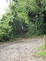
 Footpath near Patrixbourne - geograph.org.uk - 2871756.jpg 640 × 430; 46 KB
-
 Gué asséché (ford drained), Patrixbourne, Kent, UK - panoramio.jpg 1,024 × 768; 288 KB
-
 Hode Barn - geograph.org.uk - 1776290.jpg 3,072 × 2,304; 1.48 MB
-

-
 North Downs Way towards Hode Farm - geograph.org.uk - 1776301.jpg 3,072 × 2,304; 1.57 MB
-
 Oast Cottage, Patrixbourne - geograph.org.uk - 1776394.jpg 3,072 × 2,304; 1.64 MB
-
 Patrixbourne Lodge - geograph.org.uk - 2871818.jpg 640 × 430; 52 KB
-
 Patrixbourne, United Kingdom (Unsplash WbQkl1d6aIA).jpg 5,184 × 3,456; 992 KB
-
 Private road to Hode Farm - geograph.org.uk - 641111.jpg 640 × 480; 349 KB
-
 Roundabout in Patrixbourne - geograph.org.uk - 1776343.jpg 3,072 × 2,304; 2.02 MB
-
 The Nailbourne in flood, Patrixbourne - geograph.org.uk - 409832.jpg 640 × 480; 37 KB
-
 The Nailbourne Stream - looking up stream - geograph.org.uk - 1776461.jpg 2,304 × 3,072; 2.41 MB
-
 Timber framed Cottage in Patrixbourne - geograph.org.uk - 1776358.jpg 3,072 × 2,304; 641 KB
-
 War Memorial, Patrixbourne - geograph.org.uk - 2871781.jpg 640 × 430; 126 KB
-
 Bekesbourne Hill and the Unicorn pub - geograph.org.uk - 571807.jpg 480 × 640; 63 KB
-
 Bifrons Road, Bekesbourne. - geograph.org.uk - 317977.jpg 640 × 480; 228 KB
-
-

-
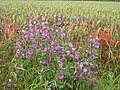
 Fields in Autumn - geograph.org.uk - 573070.jpg 640 × 480; 54 KB
-
 Floods of 2000 - geograph.org.uk - 636906.jpg 640 × 480; 107 KB
-
 Footpath and farm track to Hode Farm - geograph.org.uk - 340354.jpg 640 × 480; 237 KB
-

-
 Footpath leading SW from Keepers Hill - geograph.org.uk - 571847.jpg 640 × 480; 110 KB
-
 Houses on Adisham Road in the snow - geograph.org.uk - 409862.jpg 640 × 480; 21 KB
-
 Keepers Hill, Patrixbourne - geograph.org.uk - 571842.jpg 640 × 480; 80 KB
-
 Looking NW along Bekesbourne Lane. - geograph.org.uk - 311538.jpg 640 × 480; 151 KB
-
 Looking S along track to Hode Farm - geograph.org.uk - 341492.jpg 640 × 480; 125 KB
-
 Looking SE along Bekesbourne Lane. - geograph.org.uk - 311534.jpg 640 × 480; 179 KB
-
 Looking SE along Shepherds Close Road - geograph.org.uk - 573076.jpg 640 × 480; 60 KB
-

-
-
 Nailbourne in flood - geograph.org.uk - 409845.jpg 640 × 480; 77 KB
-
 Pond in the woods, near Hode Farm - geograph.org.uk - 341500.jpg 640 × 480; 214 KB
-
 Shepherd's Close Road - geograph.org.uk - 577614.jpg 640 × 480; 66 KB
-

-

-

-
 View along Old Palace Road - geograph.org.uk - 476431.jpg 640 × 480; 87 KB
-

-
 View along Shepherds Close Road - geograph.org.uk - 476498.jpg 640 × 480; 40 KB
-
 View along The Street, Patrixbourne - geograph.org.uk - 476386.jpg 640 × 480; 76 KB


,_Patrixbourne,_Kent,_UK_-_panoramio.jpg)

_along_the_railway,_Bekesbourne_-_geograph.org.uk_-_341481.jpg)


.jpg)


