Category:Pathhead, Midlothian
Jump to navigation
Jump to search
village in Midlothian, Scotland, UK  | |||||
| Upload media | |||||
| Instance of | |||||
|---|---|---|---|---|---|
| Location |
| ||||
 | |||||
Subcategories
This category has the following 5 subcategories, out of 5 total.
Media in category "Pathhead, Midlothian"
The following 40 files are in this category, out of 40 total.
-
 A wooded hill - geograph.org.uk - 540729.jpg 640 × 499; 74 KB
-
 A68 leaving Pathhead - geograph.org.uk - 829866.jpg 640 × 457; 60 KB
-
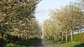
 Cherry trees, Whitburgh - geograph.org.uk - 540005.jpg 640 × 480; 86 KB
-
 Cherry trees, Whitburgh - geograph.org.uk - 801839.jpg 640 × 359; 102 KB
-
 Collecting round bales - geograph.org.uk - 1482961.jpg 640 × 480; 95 KB
-
 Combine trouble. - geograph.org.uk - 49099.jpg 640 × 480; 77 KB
-
 Doocot, Salters Road nr Pathhead - geograph.org.uk - 75220.jpg 480 × 640; 70 KB
-
 Drystane dyke, Burnside - geograph.org.uk - 1482945.jpg 640 × 480; 163 KB
-
 Dumped chair - geograph.org.uk - 537207.jpg 640 × 480; 108 KB
-
 Expanding Pathhead - geograph.org.uk - 38054.jpg 640 × 480; 76 KB
-
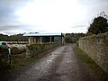 Farm buildings near the Turniedykes. - geograph.org.uk - 1029546.jpg 640 × 480; 64 KB
-
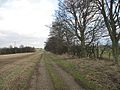
 Farm Track - geograph.org.uk - 82119.jpg 480 × 640; 417 KB
-
 Farmland by Pathhead - geograph.org.uk - 537223.jpg 640 × 480; 101 KB
-
 Field gate near Preston Hall - geograph.org.uk - 1470475.jpg 640 × 480; 139 KB
-
 Gate, Preston Hall - geograph.org.uk - 537216.jpg 640 × 480; 82 KB
-
 Harvested field, Pathhead - geograph.org.uk - 1482941.jpg 640 × 377; 71 KB
-
 Harvested field, Pathhead - geograph.org.uk - 1482949.jpg 640 × 480; 111 KB
-
 Hay Field - geograph.org.uk - 82128.jpg 640 × 480; 317 KB
-
 Hay Field - geograph.org.uk - 82130.jpg 640 × 480; 315 KB
-
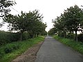
 Heading in to Pathhead from Crichton - geograph.org.uk - 1177596.jpg 640 × 563; 86 KB
-

-
 Loanhead Farmhouse - geograph.org.uk - 82112.jpg 640 × 480; 269 KB
-

-
 Moor Road - geograph.org.uk - 681648.jpg 640 × 480; 100 KB
-
 Moor Road - geograph.org.uk - 681656.jpg 640 × 480; 93 KB
-
 Old farm buildings, Whitburgh - geograph.org.uk - 681645.jpg 640 × 480; 83 KB
-
 Old strip, Loanhead - geograph.org.uk - 582006.jpg 640 × 480; 121 KB
-
 Pathhead main street.jpg 8,000 × 6,000; 13.66 MB
-
 Ploughed field, Pathhead - geograph.org.uk - 602383.jpg 640 × 480; 74 KB
-
 Preston Dene - geograph.org.uk - 75219.jpg 640 × 480; 104 KB
-

-

-

-
 The Temple, Preston Hall (geograph 2437518).jpg 800 × 530; 102 KB
-
 Turniedykes - geograph.org.uk - 582538.jpg 640 × 480; 72 KB
-
 Tynebank Farm - geograph.org.uk - 1177574.jpg 640 × 480; 49 KB
-
 Unplanted strip - geograph.org.uk - 582013.jpg 640 × 480; 76 KB
-
 Wheatfield, Whitburgh - geograph.org.uk - 540009.jpg 640 × 480; 74 KB
-
 Whippielaw - geograph.org.uk - 538628.jpg 640 × 480; 56 KB
-
 Woodland, Hope - geograph.org.uk - 538682.jpg 640 × 480; 118 KB


.jpg)


._(14582738825).jpg)