Category:Pastorenturm (Taborfriedhof)
Jump to navigation
Jump to search
| Object location | | View all coordinates using: OpenStreetMap |
|---|
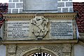
Deutsch: Der sogenannte Pastorenturm, ist der Torturm des Steyrer Taborfriedhofs.
Media in category "Pastorenturm (Taborfriedhof)"
The following 7 files are in this category, out of 7 total.
-
 Franz Kulstrunk - Taborfriedhof.jpg 873 × 1,045; 313 KB
-
 Hauptportal (Taborfriedhof).jpg 2,592 × 3,888; 4.38 MB
-
 Spruchinschrift (Taborfriedhof).jpg 3,888 × 2,592; 5.69 MB
-
 Steyr Arkadenfriedhof Hauptportal-1870-2.jpg 5,187 × 3,458; 13.43 MB
-
 Taborfriedhof (Torturm).jpg 2,522 × 3,849; 3.79 MB
-
 Taborfriedhof Torturm 1.jpg 2,514 × 3,834; 5.82 MB
-
 Torturm des Steyrer Taborfriedhofs 16-07-2015.jpg 2,592 × 3,888; 5.56 MB

.jpg)
.jpg)

.jpg)

