Category:Pascoag, Rhode Island
Jump to navigation
Jump to search
census-designated place in Providence County, Rhode Island, United States   | |||||
| Upload media | |||||
| Instance of | |||||
|---|---|---|---|---|---|
| Location | Providence County, Rhode Island | ||||
| Population |
| ||||
| Area |
| ||||
| Elevation above sea level |
| ||||
 | |||||
English: Media related to Pascoag, Rhode Island, a census-designated place and village in Providence County, Rhode Island. It is one of eight villages that make up the town of Burrillville.
Subcategories
This category has the following 2 subcategories, out of 2 total.
Media in category "Pascoag, Rhode Island"
The following 12 files are in this category, out of 12 total.
-
 Connecticut-Massachusetts-Rhode Island tripoint marker, circa 2005.JPG 1,024 × 768; 126 KB
-
 Connecticut-Massachusetts-Rhode Island tripoint marker, October 2018.jpg 5,184 × 3,888; 5.68 MB
-
 Former P&S abutment in Pascoag (1), June 2021.jpg 4,032 × 3,024; 5.47 MB
-
 Former P&S abutment in Pascoag (2), June 2021.jpg 4,032 × 3,024; 5.39 MB
-
 Pascoag and vicinity, Rhode Island, 1895. LOC 2008624341.jpg 11,508 × 7,723; 18.02 MB
-
 Pascoag Rhode Island 1906 Postcard.jpg 598 × 341; 72 KB
-
 Pascoag station postcard (2).jpg 999 × 646; 202 KB
-
 Pascoag station postcard.jpg 1,600 × 1,052; 662 KB
-
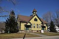 PascoagRI BridgetonSchool.jpg 1,024 × 680; 209 KB
-
 PascoagRI PascoagGrammarSchool.jpg 1,024 × 680; 220 KB
-

-
 Wallum Lake station 1909 postcard.jpg 1,457 × 735; 235 KB


,_June_2021.jpg)
,_June_2021.jpg)


.jpg)


