Category:Parracombe
Jump to navigation
Jump to search
English: Parracombe is a very small village near Lynton, in Devon, England. It is situated in the Heddon Valley, a fold of Exmoor, which rises to 1,575 ft. at the South East end of the parish.
village and civil parish in Devon, United Kingdom  | |||||
| Upload media | |||||
| Instance of | |||||
|---|---|---|---|---|---|
| Location | North Devon, Devon, South West England, England | ||||
| Population |
| ||||
 | |||||
Subcategories
This category has the following 3 subcategories, out of 3 total.
B
P
- Christ Church, Parracombe (7 F)
Media in category "Parracombe"
The following 200 files are in this category, out of 276 total.
(previous page) (next page)-
 A bend on the A39 near Parracombe - geograph.org.uk - 5846346.jpg 1,600 × 1,067; 434 KB
-
 A road traffic accident on the A39 near Parracombe - geograph.org.uk - 5526191.jpg 3,832 × 2,737; 4.87 MB
-
 A Rolba Snow Blower on the A39 - geograph.org.uk - 3305485.jpg 1,600 × 1,200; 367 KB
-
 A Rolba Snow Blower on the A39 - geograph.org.uk - 3305488.jpg 1,600 × 1,200; 433 KB
-
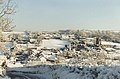 A Winter landscape of Parracombe - geograph.org.uk - 221642.jpg 640 × 421; 123 KB
-
 A39 bend on Rowley Down - geograph.org.uk - 5686605.jpg 1,600 × 1,200; 821 KB
-
 A39 crossing the valley above St Thomas' Well - geograph.org.uk - 3648479.jpg 1,536 × 1,151; 1.02 MB
-
 A39 in Holwell Wood - geograph.org.uk - 5687165.jpg 1,281 × 1,600; 637 KB
-
 Access road to Rowley Barton - geograph.org.uk - 5687157.jpg 1,600 × 1,200; 538 KB
-
 Approaching Blackmoor Gate from the east - geograph.org.uk - 3649563.jpg 1,536 × 1,024; 858 KB
-
 Archaeological survey, Chapman Barrows - geograph.org.uk - 4151674.jpg 1,024 × 768; 110 KB
-
 Barn at Stunhill Farm - geograph.org.uk - 4043244.jpg 1,024 × 768; 199 KB
-
 Bodley Lane - geograph.org.uk - 3987371.jpg 1,024 × 768; 181 KB
-
 Bridge over the River Heddon - geograph.org.uk - 917793.jpg 640 × 480; 122 KB
-

-
 Chapman Barrows, Challacombe Common - geograph.org.uk - 5536815.jpg 1,600 × 1,200; 565 KB
-
 Chapman Barrows, Challacombe Common - geograph.org.uk - 5536833.jpg 1,600 × 1,200; 645 KB
-
 Chapman Barrows, Challacombe Common - geograph.org.uk - 5537118.jpg 1,600 × 1,205; 526 KB
-
 Christ Church - geograph.org.uk - 4682285.jpg 800 × 600; 103 KB
-
 Christ Church at Parracombe - geograph.org.uk - 3702504.jpg 4,000 × 3,000; 2.81 MB
-
 Christ Church, Parracombe - geograph.org.uk - 3987929.jpg 1,024 × 768; 187 KB
-
 Christ Church, Parracombe - geograph.org.uk - 4156982.jpg 1,600 × 1,200; 796 KB
-
 Christ Church, Parracombe - geograph.org.uk - 5469684.jpg 6,000 × 4,000; 5.96 MB
-
 Christ Church, Parracombe, altar - geograph.org.uk - 4565159.jpg 640 × 480; 64 KB
-

-

-

-

-

-

-

-
 Christ Church, Parracombe, font - geograph.org.uk - 4565128.jpg 640 × 480; 72 KB
-

-

-
 Christ Church, Parracombe, lectern - geograph.org.uk - 4565143.jpg 480 × 640; 40 KB
-

-

-

-

-

-
 Christ Church, Parracombe, organ - geograph.org.uk - 4565151.jpg 480 × 640; 51 KB
-
 Christ Church, Parracombe, porch - geograph.org.uk - 4565104.jpg 480 × 640; 90 KB
-

-
 Christ Church, Parracombe, pulpit - geograph.org.uk - 4565146.jpg 480 × 640; 49 KB
-

-

-

-

-

-

-
 Churchtown - geograph.org.uk - 4747234.jpg 1,200 × 799; 211 KB
-
 Clearing a hedge near Brakebrook - geograph.org.uk - 5687176.jpg 1,600 × 1,200; 726 KB
-
 Combe head - geograph.org.uk - 737957.jpg 640 × 480; 62 KB
-
 Converted railway trackbed, Churchtown - geograph.org.uk - 3987942.jpg 1,024 × 768; 271 KB
-
 Corrugated iron shed, near Rowley Cross - geograph.org.uk - 4828059.jpg 1,024 × 829; 257 KB
-
 Cottage at Churchtown - geograph.org.uk - 3987975.jpg 1,024 × 768; 225 KB
-
 Cottage at Stunhill Farm - geograph.org.uk - 4043234.jpg 1,024 × 768; 270 KB
-
 Cowley Wood, Exmoor - geograph.org.uk - 5607038.jpg 640 × 344; 37 KB
-
 Crossroads, Parracombe - geograph.org.uk - 3987395.jpg 1,024 × 768; 183 KB
-
 Dick Smythe - geograph.org.uk - 221647.jpg 640 × 484; 67 KB
-
 Distant view of Parracombe from the east - geograph.org.uk - 6297252.jpg 1,024 × 683; 156 KB
-
 Electric Gate^ - geograph.org.uk - 452532.jpg 640 × 426; 147 KB
-

-
 Farm South of Martinhoe Cross - geograph.org.uk - 5537937.jpg 1,600 × 1,200; 636 KB
-
 Farmyard at Lower East Middleton - geograph.org.uk - 4043253.jpg 1,024 × 768; 235 KB
-
 Field access on Challacombe Common - geograph.org.uk - 5536802.jpg 1,600 × 1,203; 870 KB
-
 Field access on Parracombe Common - geograph.org.uk - 5535820.jpg 1,600 × 1,200; 954 KB
-
 Field access on Parracombe Common - geograph.org.uk - 5535840.jpg 1,600 × 1,204; 1,019 KB
-
 Field boundary at Chapman Barrows, Challacombe Down - geograph.org.uk - 5536818.jpg 1,600 × 1,200; 649 KB
-
 Field boundary at Chapman Barrows, Challacombe Down - geograph.org.uk - 5536836.jpg 1,600 × 1,200; 692 KB
-
 Field boundary at Chapman Barrows, Challacombe Down - geograph.org.uk - 5536850.jpg 1,600 × 1,200; 604 KB
-
 Field, east of Wheatly Lane - geograph.org.uk - 4084495.jpg 1,024 × 768; 255 KB
-
 Fields South of Martinhoe Cross - geograph.org.uk - 5537935.jpg 1,600 × 1,200; 615 KB
-
 Fields South of Martinhoe Cross, North Devon - geograph.org.uk - 5535799.jpg 1,600 × 1,204; 934 KB
-
 Footbridge over stream near Rowley Cross - geograph.org.uk - 3702496.jpg 4,000 × 3,000; 4.31 MB
-
 Footpath junction - geograph.org.uk - 452074.jpg 426 × 640; 167 KB
-
 Former Wesleyan Chapel, Parracombe - geograph.org.uk - 3987400.jpg 1,024 × 768; 200 KB
-
 Grass Cutting - geograph.org.uk - 452415.jpg 640 × 426; 96 KB
-
 Grass Cutting left - geograph.org.uk - 452418.jpg 640 × 426; 109 KB
-
 Grazed moorland near Chapman Barrows - geograph.org.uk - 5817865.jpg 6,000 × 4,000; 4.65 MB
-
 Heale Farm - geograph.org.uk - 4085043.jpg 1,024 × 768; 257 KB
-
 Highley and Holworthy, Parracombe Common, North Devon - geograph.org.uk - 5535861.jpg 1,600 × 1,200; 961 KB
-
 Highley Farm - geograph.org.uk - 731631.jpg 640 × 426; 93 KB
-
 Hillside above Higher Holworthy - geograph.org.uk - 5815442.jpg 6,000 × 4,000; 3.99 MB
-
 Hillside above Holworthy - geograph.org.uk - 5815455.jpg 6,000 × 4,000; 5.07 MB
-
 Holwell Barrow - geograph.org.uk - 737933.jpg 640 × 480; 45 KB
-
 Holwell Castle from Christ Church churchyard - geograph.org.uk - 5469692.jpg 6,000 × 4,000; 5.64 MB
-
 Holwell Castle, aerial 2018 (1) - geograph.org.uk - 5958844.jpg 800 × 533; 117 KB
-
 Holwell Castle, aerial 2018 (2) - geograph.org.uk - 5958847.jpg 800 × 533; 97 KB
-
 House at West Bodley - geograph.org.uk - 3987381.jpg 1,024 × 768; 191 KB
-
 Inside Christ Church, Parracombe (I) - geograph.org.uk - 4565114.jpg 640 × 480; 83 KB
-

-

-

-
 Interior, The church of St Petrock at Churchtown - geograph.org.uk - 5716962.jpg 1,024 × 768; 144 KB
-
 Invention Wood - geograph.org.uk - 4542329.jpg 1,024 × 808; 160 KB
-
 Killington Lane railway station, Devon - geograph.org.uk - 6156675.jpg 1,600 × 1,200; 492 KB
-
 Lay-by and picnic area by A39 near Rowley Cross - geograph.org.uk - 5687162.jpg 1,600 × 1,200; 753 KB
-
 Ley's Lane from Rowley Cross - geograph.org.uk - 5687158.jpg 1,600 × 1,200; 804 KB
-
-
 Lone tree by entrance to Holworthy - geograph.org.uk - 5687168.jpg 1,600 × 1,200; 716 KB
-
 Looking down Parracombe Lane towards the village - geograph.org.uk - 6297233.jpg 775 × 1,024; 306 KB
-

-
 Lynton and Barnstaple Railway - Disused trackbed - geograph.org.uk - 5448797.jpg 3,648 × 2,736; 4.87 MB
-

-

-

-

-
 Lynton and Barnstaple Railway Bridge 57 - geograph.org.uk - 5448783.jpg 3,648 × 2,736; 4.63 MB
-
 Lynton and Barnstaple Railway Bridge 61 - geograph.org.uk - 5711393.jpg 3,264 × 2,448; 2.5 MB
-
 Lynton and Barnstaple Railway Bridge 63 - geograph.org.uk - 5448809.jpg 3,648 × 2,736; 4.91 MB
-
 Lynton and Barnstaple Railway – Disused Trackbed - geograph.org.uk - 5956658.jpg 4,032 × 3,024; 3.37 MB
-
 Lynton and Barnstaple Railway – Disused Trackbed - geograph.org.uk - 5956663.jpg 4,032 × 3,024; 3.77 MB
-
 Lynton and Barnstaple Railway – Disused Trackbed - geograph.org.uk - 5956670.jpg 4,032 × 3,024; 3.95 MB
-
 Lynton and Barnstaple Railway – Disused Trackbed - geograph.org.uk - 5957033.jpg 4,032 × 3,024; 5.23 MB
-
 Lynton and Barnstaple Railway – Platelayers Hut - geograph.org.uk - 5957030.jpg 4,032 × 3,024; 5.52 MB
-
 Lynton and Barnstaple Railway – Platelayers Hut - geograph.org.uk - 6101959.jpg 3,648 × 2,056; 3.91 MB
-
 Lynton ^ Barnstaple Railway, course - geograph.org.uk - 4047237.jpg 1,600 × 1,082; 771 KB
-
 Lynton ^ Barnstaple Railway, embankment - geograph.org.uk - 4047232.jpg 1,600 × 1,079; 756 KB
-
 Lynton ^ Barnstaple Railway, Fair View entrance - geograph.org.uk - 4047210.jpg 1,600 × 1,088; 601 KB
-
 Lynton ^ Barnstaple Railway, formation at Parracombe - geograph.org.uk - 4047220.jpg 1,083 × 1,600; 526 KB
-
 Lynton ^ Barnstaple Railway, former course - geograph.org.uk - 4047235.jpg 1,600 × 1,085; 568 KB
-
 Lynton ^ Barnstaple Railway, towards Fair View - geograph.org.uk - 4047201.jpg 1,080 × 1,600; 599 KB
-
 Main road, Heale - geograph.org.uk - 4085036.jpg 1,024 × 768; 255 KB
-
 Millennium standing stone - geograph.org.uk - 403176.jpg 640 × 480; 113 KB
-
 Minniemoor Cross - geograph.org.uk - 4043262.jpg 1,024 × 768; 268 KB
-
 Minniemoor Lane - geograph.org.uk - 4043266.jpg 1,024 × 768; 255 KB
-
 Minniemoor View - geograph.org.uk - 451694.jpg 640 × 190; 43 KB
-
 Minor road junction on Parracombe Common - geograph.org.uk - 5535817.jpg 1,600 × 1,200; 865 KB
-
 Minor road junction on Parracombe Common - geograph.org.uk - 5535833.jpg 1,600 × 1,200; 1.21 MB
-
 Minor road on Parracombe Common - geograph.org.uk - 3988503.jpg 1,024 × 768; 184 KB
-
 Minor road on Parracombe Common - geograph.org.uk - 5535823.jpg 1,600 × 1,200; 1.12 MB
-
 Minor road on Parracombe Common - geograph.org.uk - 5535834.jpg 1,600 × 1,200; 848 KB
-
 Minor road on Parracombe Common - geograph.org.uk - 5535843.jpg 1,600 × 1,200; 636 KB
-
 Minor road South of Martinhoe Cross - geograph.org.uk - 5535805.jpg 1,600 × 1,200; 830 KB
-
 Minor road South of Martinhoe Cross - geograph.org.uk - 5535813.jpg 1,600 × 1,200; 1.02 MB
-
 Moorland field near Chapman Burrows - geograph.org.uk - 5815464.jpg 6,000 × 4,000; 7.22 MB
-
 Narrow lane on Parracombe Common - geograph.org.uk - 3988491.jpg 1,024 × 768; 241 KB
-
 Nearly hidden Country Phone Box - geograph.org.uk - 4156969.jpg 1,600 × 1,200; 1.18 MB
-
 Newground Lane - geograph.org.uk - 3988475.jpg 1,024 × 768; 250 KB
-
 North Devon , Jose's Lane - geograph.org.uk - 6025029.jpg 6,000 × 4,000; 7.15 MB
-
 North Devon , River Heddon - geograph.org.uk - 6025035.jpg 4,000 × 6,000; 5.68 MB
-
 Ordnance Survey Cut Mark - geograph.org.uk - 3724700.jpg 4,000 × 3,000; 4.64 MB
-
 Ordnance Survey Cut Mark - geograph.org.uk - 4649642.jpg 480 × 640; 119 KB
-
 Ordnance Survey Cut Mark - geograph.org.uk - 5984763.jpg 773 × 1,024; 251 KB
-

-
 Ordnance Survey Flush Bracket (G4858) - geograph.org.uk - 4649645.jpg 480 × 640; 121 KB
-
 Ordnance Survey Flush Bracket G4858 - geograph.org.uk - 3724722.jpg 4,000 × 3,000; 4.76 MB
-
 Outbuilding, Heale Farm - geograph.org.uk - 4084516.jpg 1,024 × 768; 260 KB
-
 Paracombe primary school. - geograph.org.uk - 1366414.jpg 640 × 480; 97 KB
-

-

-
 Parracombe Lane - geograph.org.uk - 3987389.jpg 1,024 × 785; 199 KB
-
 Parracombe Lane - geograph.org.uk - 5469679.jpg 6,000 × 4,000; 4.4 MB
-
 Parracombe primary school - geograph.org.uk - 739527.jpg 640 × 480; 90 KB
-
 Parracombe, approaching Christ Church churchyard - geograph.org.uk - 5846326.jpg 1,200 × 1,600; 699 KB
-
 Parracombe, at Rowley Gate - geograph.org.uk - 176921.jpg 640 × 427; 199 KB
-
 Parracombe, below Rowley Down - geograph.org.uk - 176916.jpg 640 × 427; 209 KB
-
 Parracombe, bridge over railway at Churchtown - geograph.org.uk - 5846348.jpg 683 × 1,024; 341 KB
-
 Parracombe, bridleway to Lady's Well - geograph.org.uk - 504555.jpg 640 × 427; 228 KB
-
 Parracombe, by the Fox and Goose inn - geograph.org.uk - 5846307.jpg 1,200 × 1,600; 495 KB
-
 Parracombe, course of the Lynton and Barnstaple Railway - geograph.org.uk - 5846350.jpg 1,600 × 1,067; 688 KB
-
 Parracombe, gravestone - geograph.org.uk - 5846367.jpg 1,067 × 1,600; 829 KB
-
 Parracombe, Heddon Hall - geograph.org.uk - 176910.jpg 640 × 427; 270 KB
-
 Parracombe, lane by bridge over railway - geograph.org.uk - 5846353.jpg 1,024 × 683; 237 KB
-
 Parracombe, main street - geograph.org.uk - 5846314.jpg 1,323 × 1,600; 591 KB
-
 Parracombe, narrow street - geograph.org.uk - 5846319.jpg 1,200 × 1,600; 669 KB
-
 Parracombe, near Bumsley Mill - geograph.org.uk - 86263.jpg 640 × 428; 161 KB
-
 Parracombe, on Parracombe Common - geograph.org.uk - 504543.jpg 640 × 423; 161 KB
-
 Parracombe, Parracombe Common - geograph.org.uk - 504549.jpg 640 × 427; 235 KB
-
 Parracombe, St Petrock's - towards the chancel - geograph.org.uk - 5846360.jpg 1,067 × 1,600; 312 KB
-
 Parracombe, St Petrock's church - geograph.org.uk - 5846356.jpg 1,067 × 1,600; 620 KB
-
 Parracombe, St. Petrock's Church - geograph.org.uk - 5742296.jpg 5,412 × 3,611; 5.18 MB
-
 Parracombe, St. Petrock's Church - geograph.org.uk - 5758845.jpg 6,703 × 4,473; 7.26 MB
-
 Parracombe, St. Petrock's Church - geograph.org.uk - 5758850.jpg 6,973 × 4,653; 6.55 MB
-

-

-

-

-

-
 Parracombe, St. Petrock's Church, Nave capital 1 - geograph.org.uk - 5758925.jpg 6,322 × 4,220; 4.09 MB
-
 Parracombe, St. Petrock's Church, Nave capital 2 - geograph.org.uk - 5758929.jpg 7,360 × 4,912; 5.9 MB
-

-

-

-

-

-
 Parracombe, St. Petrock's Church, Samuel Flamant memorial - geograph.org.uk - 5758868.jpg 6,610 × 4,413; 4.31 MB
-
 Parracombe, St. Petrock's Church, Southern aspect - geograph.org.uk - 5742298.jpg 7,360 × 4,912; 7.37 MB
-
 Parracombe, St. Petrock's Church, Tester above the pulpit - geograph.org.uk - 5758919.jpg 7,360 × 4,912; 6.02 MB
-
 Parracombe, St. Petrock's Church, The font - geograph.org.uk - 5758863.jpg 4,709 × 7,055; 6.49 MB
-

-
 Parracombe, St. Petrock's Church, The Word of Reformation - geograph.org.uk - 5742297.jpg 7,360 × 4,912; 7.25 MB
-

-

-

-

-
 Parracombe, the Common - geograph.org.uk - 504552.jpg 640 × 427; 164 KB
-
 Parracombe, the Common - geograph.org.uk - 504553.jpg 640 × 427; 173 KB
-
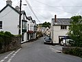
 Parracombe, The Fox and Goose Inn - geograph.org.uk - 165863.jpg 640 × 427; 136 KB


_-_geograph.org.uk_-_4565077.jpg)
_-_geograph.org.uk_-_4565099.jpg)
_-_geograph.org.uk_-_4565101.jpg)
_-_geograph.org.uk_-_4565103.jpg)
_-_geograph.org.uk_-_4565108.jpg)
_-_geograph.org.uk_-_4565109.jpg)
_-_geograph.org.uk_-_4565111.jpg)


_-_geograph.org.uk_-_4565135.jpg)
_-_geograph.org.uk_-_4565137.jpg)
_-_geograph.org.uk_-_4565138.jpg)
_-_geograph.org.uk_-_4565139.jpg)
_-_geograph.org.uk_-_4565142.jpg)


_-_geograph.org.uk_-_4565152.jpg)
_-_geograph.org.uk_-_4565154.jpg)
_-_geograph.org.uk_-_4565155.jpg)
_-_geograph.org.uk_-_4565158.jpg)


_-_geograph.org.uk_-_5958844.jpg)
_-_geograph.org.uk_-_5958847.jpg)

_-_geograph.org.uk_-_4565114.jpg)
_-_geograph.org.uk_-_4565115.jpg)
_-_geograph.org.uk_-_4565118.jpg)
_-_geograph.org.uk_-_4565121.jpg)


_on_Berry%27s_Ground_Lane,_Martinhoe_-_geograph.org.uk_-_6299160.jpg)


_-_geograph.org.uk_-_4708211.jpg)
_-_geograph.org.uk_-_4649645.jpg)


