Category:Parliament Street, Liverpool
Jump to navigation
Jump to search
| Object location | | View all coordinates using: OpenStreetMap |
|---|

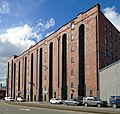
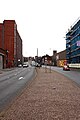
Said to be named after the Earl of Sefton obtaining, in 1771, an Act of Parliament to develop the land in this area of Liverpool. Part of the A562 main road into Liverpool from the east, it leads from Upper Parliament Street down to Chaloner Street on the dock road.
Media in category "Parliament Street, Liverpool"
The following 10 files are in this category, out of 10 total.
-
 45 - 51 Greenland Street 1.jpg 3,648 × 3,466; 5.92 MB
-
 Cains brewery, Liverpool (1).jpg 4,000 × 3,000; 2.69 MB
-
 Liverpool, UK - panoramio - IIya Kuzhekin (55).jpg 4,000 × 2,250; 1.37 MB
-
 Parliament Street (109162928).jpg 2,012 × 1,480; 1.19 MB
-
 Parliament Street Liverpool E1.jpg 3,456 × 5,184; 6.22 MB
-
 Parliament Street Liverpool E2.jpg 3,456 × 5,184; 8.2 MB
-
 Parliament Street Liverpool E3.jpg 3,456 × 5,184; 6.62 MB
-
 Parliament Street Liverpool W1.jpg 5,184 × 3,456; 9.56 MB
-
 Parliament Street Liverpool W2.jpg 5,007 × 3,340; 9.76 MB
-
 Parliament Street onto Chaloner Street (109162739).jpg 2,011 × 787; 694 KB

.jpg)
.jpg)
.jpg)


.jpg)